Good info. Thanks for the photos and comments.
Wonder how many wells / leases are feeding this battery?
Did you notice any signage along those lines?
j richard said:
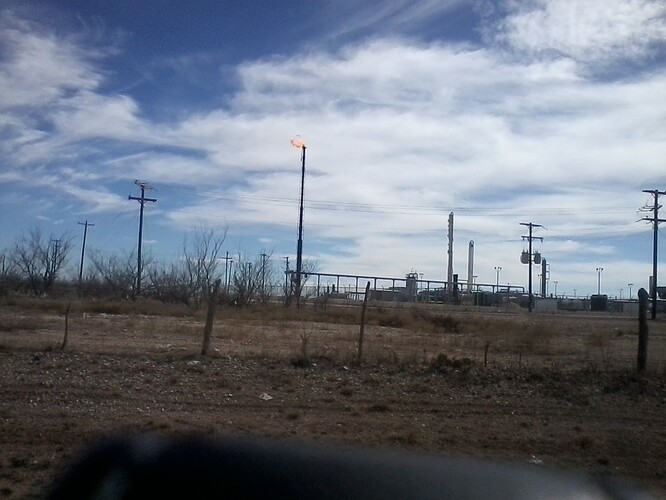
This is Pioneer in Crockett near the Crockett-Reagan line. I have never seen a tank battery this large before. Sinochem will be very pleased with their joint venture.
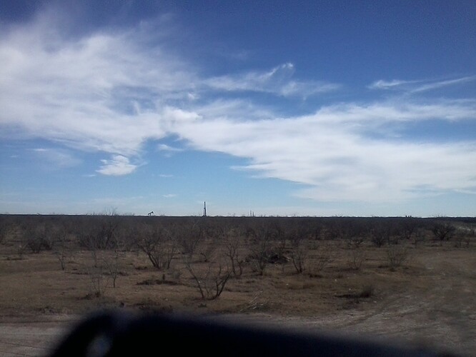
A camera phone doesn't do this justice. The drilling rig in the fore ground is a horizontal and the other two are vertical. This is in Glasscock Co. near the Reagan line. I think the HZ is the Lane Trust I discussed with AJ. Cline for sure.
j richard said:
Deadwood is flaring gas. Even with expansion there is too much gas (and Liquids).
I will write about the field trip more later. I hope the forum members enjoyed the pictures. Actually being in the field and around the leases is a real eye opener.
j richard said:
More great shots. The small flare may only be minor gas tied to the processing effort - not all gas is captured into pipelines.
From my own experiences, it is common to see some sort of small flare on these types of facilities
j richard said:
It is Pioneer. I think 4-5 Hz's are feeding this battery. Four to five miles north 2 rigs were running which would be Reagan County. I am glad you liked the pictures (some didn't come out). I am going to write field trip notes later. I hope you like that also.
Rock Man said:
Wonder how many wells / leases are feeding this battery?
Did you notice any signage along those lines?
j richard said:
This is Pioneer in Crockett near the Crockett-Reagan line. I have never seen a tank battery this large before. Sinochem will be very pleased with their joint venture.
Interesting Cline Shale presentation from late 2012.
May raise more questions than answers, but it does address the subsurface complexity of the Cline Shale
2220-29day1keithskaarelementpetroleumpt2.pdf (3.24 MB)Interesting Wolfberry presentation from late 2012 / companion to the Cline Shale presentation posted a few minutes ago..
More info on the overall subsurface complexity of this Midland Basin system
2219-28day1keithskaarelementpetroleum.pdf (2.88 MB)Well, I enjoyed all of this, thank you!
Rockman-
On the Wolfberry presentation one of the questions was: "When and why do you decide whether to horizontal in a vertical play?" A." Geology and economics."
Would you please explain this in your way where we can understand it? Also how about vertical in a horizontal play? That was a good report: Thank you.
Rock Man said:
Interesting Wolfberry presentation from late 2012 / companion to the Cline Shale presentation posted a few minutes ago..
More info on the overall subsurface complexity of this Midland Basin system
Interesting presentation. The Cline one has a type log for Fisher County, which I would like to understand.
What do the red and green colored sections in the type log mean? Are those the shale beds?
Ken
Ken,
The red on the Fisher County type log are the unconventional, organic rick layers of the Cline - or what one could call "net pay".
Don't see any green on the FIsher Co log, the green on the Scurry County log examples are conventional pay stringers (mostly sands / silts) that have good P&P.
Ken McKInney said:
Interesting presentation. The Cline one has a type log for Fisher County, which I would like to understand.
What do the red and green colored sections in the type log mean? Are those the shale beds?
Ken
A horizontal vs vertical approach to any play is all about economics.
The Wolfberry vertical play works because one can economically combine mulitple intervals for relatively low cost in a single well bore (the stacked Astrodome concept).
Many of these individual zones in the a vertical Wolfberry completion would not carry the costs economically of drilling a single target horizontal for that interval.
On the flip side, some plays will only work with horizontal drilling. The Cline and Eagle Ford are great examples. Vertical wells with 1-2 fracs in these formations will give you some decent rates initially but there will be very very steep decline and the results will be uneconomic. One needs to go horizontal and tap as much formation as possible to make these plays economics.
It all comes down to the reservoir and related engineering issues to determine which method is best. And oftentimes trial and error is needed to get to the "bottom line"
j richard said:
Rockman-
On the Wolfberry presentation one of the questions was: "When and why do you decide whether to horizontal in a vertical play?" A." Geology and economics."
Would you please explain this in your way where we can understand it? Also how about vertical in a horizontal play? That was a good report: Thank you.
Rock Man said:Interesting Wolfberry presentation from late 2012 / companion to the Cline Shale presentation posted a few minutes ago..
More info on the overall subsurface complexity of this Midland Basin system
As usual Rock Man, thank you very much!
I hate to ask because I don't offer much, but would you consider a favor if it was easily found on your data base? I could go to Austin and find the well but still wouldn't have your opinion. I think you and the board would find the well interesting with what I know plus comment.
I forgot to mention when I went to Ozona this weekend that Dawson Geophysical was working in Reagan Co. They were north of Big Lake and south of Laredo's Sugg Lease (which has Cline). Perhaps what Apache was talking about in their conference call. Dawson was also present in far north Howard County.
Fire away with your question and I will see what I can dig up.
j richard said:
As usual Rock Man, thank you very much!
I hate to ask because I don't offer much, but would you consider a favor if it was easily found on your data base? I could go to Austin and find the well but still wouldn't have your opinion. I think you and the board would find the well interesting with what I know plus comment.
I forgot to mention when I went to Ozona this weekend that Dawson Geophysical was working in Reagan Co. They were north of Big Lake and south of Laredo's Sugg Lease (which has Cline). Perhaps what Apache was talking about in their conference call. Dawson was also present in far north Howard County.
Ok, thank you!
County ;Crockett
Operator: Amoco
Well Name: Davidson (drilled 1975- Woflcamp discovery flowed 174 bbls- top of pay 8728)
Remarks: Discovery well for J.T.D. Field (Wolfcamp) Well in Sec. 6 (survey unknown 10mi. S.E. of Ozona) produced sparsley plugged 1978. Offset drilled in Sec. 7 also called Davidson was a dry hole in 1975.
Where I was going with this is do old wells tell us something that technology has unlocked or will unlock. In Crockett Co. both Anadarko and Whiting are permitted 6-7 mi. SE of this location. Probably wrong but wonder if Wolfcamp in 1975 in this well was so good that even though tight could produce where as now might be significant.
As an example in Glasscock in 1967, Texaco drilled a well named Currie. It was a Strawn discovery flowing 102 bbls. It's offset was a dry hole. In 2014 this well is in the middle of excellent Wolfberry and is 5-7 mi. from Laredo's Cox-Bundy on of the best Glasscock Cline leases. In 1967 did any one differentiate Strawn from Cline.
j richard said:
Ok, thank you!
County ;Crockett
Operator: Amoco
Well Name: Davidson (drilled 1975- Woflcamp discovery flowed 174 bbls- top of pay 8728)
Remarks: Discovery well for J.T.D. Field (Wolfcamp) Well in Sec. 6 (survey unknown 10mi. S.E. of Ozona) produced sparsley plugged 1978. Offset drilled in Sec. 7 also called Davidson was a dry hole in 1975.
Last. North(3-4 mi.) of the Davidson is the Baggett Strawn Field. I understand right above the Strawn is "Black Shale" which correlates with "Black starved shale" found much further north in the Midland Basin. You would know what "Black starved shale" is, I really don't. It wasn't lost on me Apache's 4th Quarter Operations Report (linked for AJ) the Wolfcamp is drawn much further south, even south of the Ozona Arch.
Had to post this way because the internet Gremlins ate my post before!
j richard said:
Where I was going with this is do old wells tell us something that technology has unlocked or will unlock. In Crockett Co. both Anadarko and Whiting are permitted 6-7 mi. SE of this location. Probably wrong but wonder if Wolfcamp in 1975 in this well was so good that even though tight could produce where as now might be significant.
As an example in Glasscock in 1967, Texaco drilled a well named Currie. It was a Strawn discovery flowing 102 bbls. It's offset was a dry hole. In 2014 this well is in the middle of excellent Wolfberry and is 5-7 mi. from Laredo's Cox-Bundy on of the best Glasscock Cline leases. In 1967 did any one differentiate Strawn from Cline.
j richard said:Ok, thank you!
County ;Crockett
Operator: Amoco
Well Name: Davidson (drilled 1975- Woflcamp discovery flowed 174 bbls- top of pay 8728)
Remarks: Discovery well for J.T.D. Field (Wolfcamp) Well in Sec. 6 (survey unknown 10mi. S.E. of Ozona) produced sparsley plugged 1978. Offset drilled in Sec. 7 also called Davidson was a dry hole in 1975.

