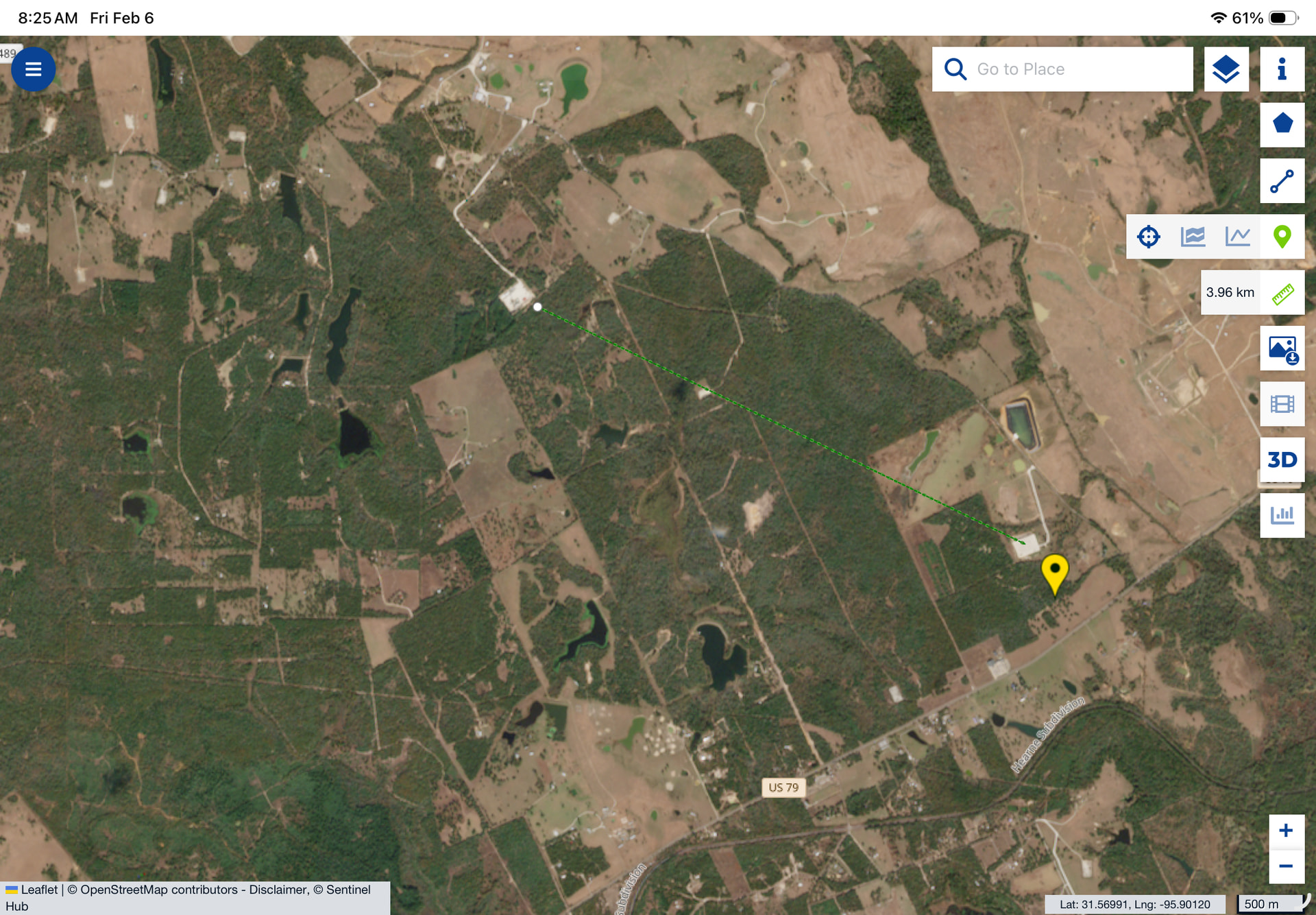
Mitsui has now filed directional surveys for these two wells: Lipsey 1H and Lipsey A 2H. This provides interesting info about the design of these two wells:
Both laterals are relatively short, about 6,400 feet.
The two laterals are close together; horizontal separation is only 840 feet.
The Lipsey 1H lateral is about 900 feet deeper than the Lipsey A 2H, so two different landing zones (perhaps Lower Bossier and Haynesville?).
Both laterals are relatively flat (but slightly toe up), only about 100 feet of structural change in each.
Any experienced oil/gas people have thoughts about this design and what Mitsui wants to accomplish? It seems very possible that the fractures could commingle.
Alan, I have interests in 2 wells just north of these wells in A-680, 16134873 and 16134874. These wells are totally opposite each other and the second one extends SE with a bottom hole pretty near the bottom holes of the Lipsey wells. My unit is just west of the Olajuwon well and SE of that long lateral Comstock well you posted about last week. Looks like I am getting surrounded!
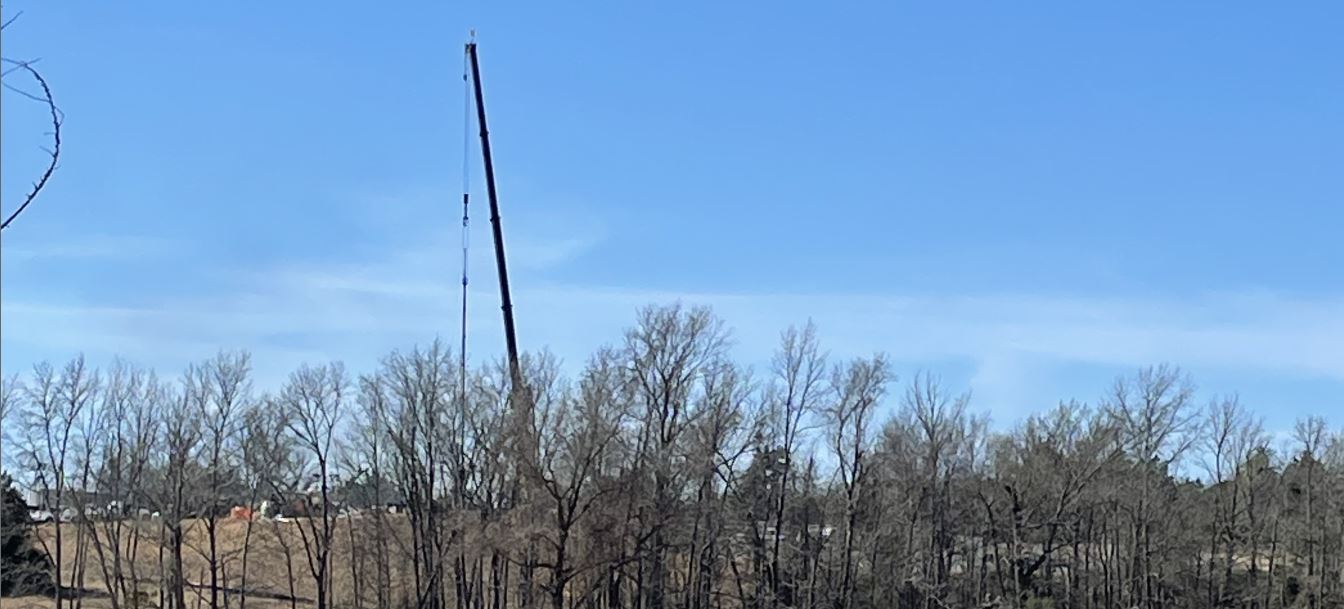
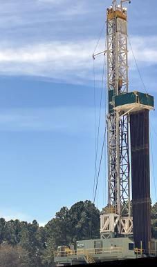
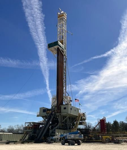
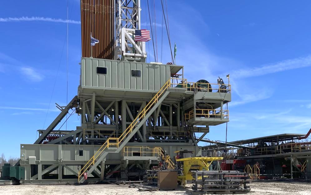
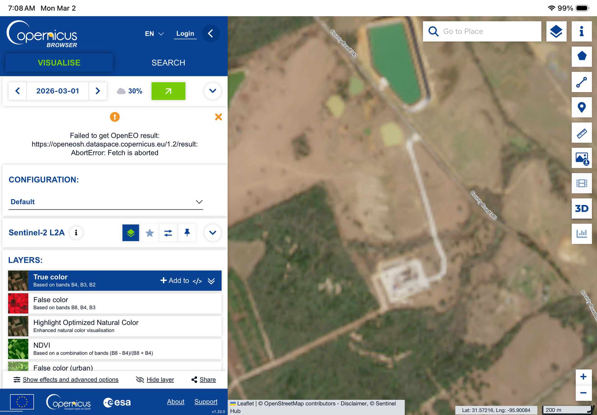
The rig Cactus 147 has been on site since late October but I am unable to get a more recent Copernicus satellite view than 1/15/26, so I do not know the current status of either well. Have you any insight?
As a mineral owner, I eagerly await production from Mitsui. It seems that some of the Comstock wells go into production a month after frac. In the case of Mitsui, I suppose they are still working on pipeline connection or perhaps the treatment plan in Anderson County will need to be completed.
They are new to the area, so the infrastructure they will use may not be as established. Or perhaps the intent to export leads to a longer time to transport from the well to a LNG facility. I understand Whitaker 1H may very well have been frac’d last month. No division order as of yet.
Lipsey A2H Listed as Cotton Valley. Horizontal length 6482’
Toe up helps with drainage. Mitsui is aiming for optimal drainage on both wells. Some slight intermingling of fractures can be helpful, but probably not much at that distance.
Alan–I have a lease with Comstock in Freestone County. The acreage (40 acres covering 3 surveys) is not in Haynesville. I have been receiving unsolicited offers to purchase, each higher than the last. Any insights as to what is going on? I can provide info on surveys. Thanks.
Thank you for your input, but can you give a little more detail on your statement that one is Haynesville and the other Bossier? A Copernicus view from yesterday still shows Cactus 147 still rigged up and onsite so I am assuming PBH is nearing but not yet drilled. There is a new filing shown on Welldatabase that shows that PP is completed as of 1/29/26, but that is all I have been able to see. Is it common practice to land two 180-degree opposite wells from the same pad in two different zones?
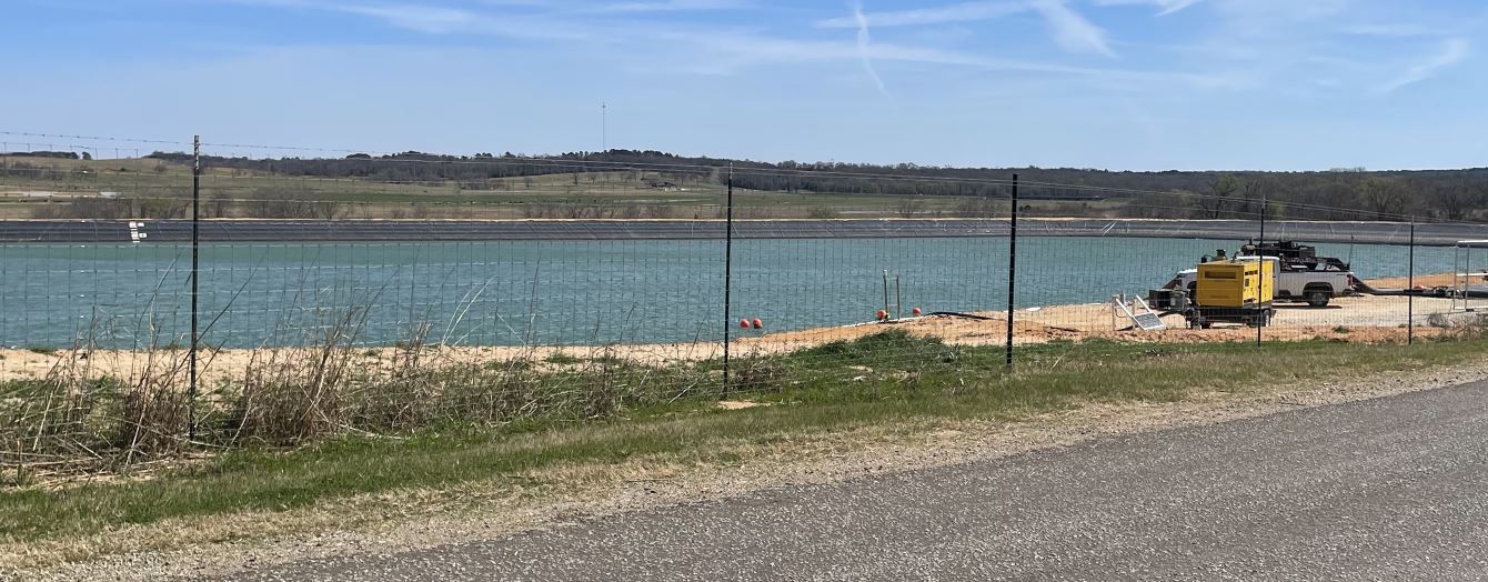
Thanks for that, the Lipsey wells are just south of the Kretzschmar PBH 1H lateral so I am watching their completion closely as hopefully my 2 will be next in line for fracking. That Lipsey frac pond is just down the road about 2 miles so I am wondering if it will be refilled and sold to Comstock after Lipsey is completed.
Visited the Kretzschmar wells down the road also and found out like Lipsey they are each going into a different layer. The PP is almost finished with its lateral and then they are going to skid to PBH to complete its lateral. Got to see the Cactus Rig 147 close up this time.
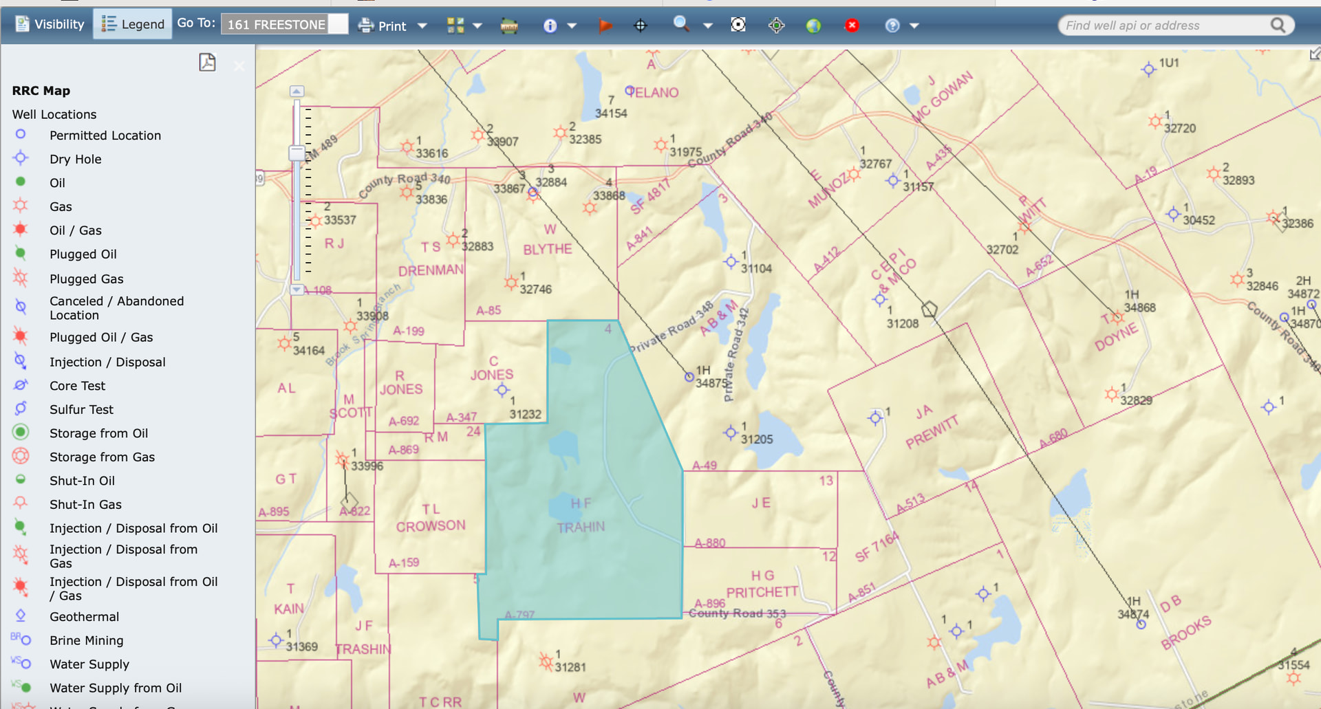
Newbie here. Been following several postings in Leon and Freestone Counties for a little bit just to familiarize myself with the processes. Several map images show a larger tract in the area (“HF Trahin”) with activity all around the tract. Is that tract just not leased or deemed not “drillable”? It only has a private road showing on maps. Maybe not accessible?
What I can say in our lease in Leon is some of our acreage was “restricted” and not leased. My understanding is this means the land is on an easement, is a natural preserve or watershed perhaps. Something of that nature. An area that has been designated as not to be drilled on.
There is a rig drilling a current permit that starts in A-337 and heads through A-605 into A-85 and into A-49. The well is very long, so whether it makes it into A-49 remains to be seen. Comstock-Dolly Jones RP 1H (34875). H F Trahin is the abstract just to the SW of A-49 (Blue). They may have not gotten to the section yet. It does have two lakes on it, but they can certainly drill under them and will be a suitable depth to protect them. Might be another underlying reason.