In the last 9 months we’ve received 6 offers to purchase our mineral rights. The offers have been all over the map - very low to $9,000 an acre. We will never sell. We inherited everything and we’re relatively young enough to wait and see, plus we have kids.
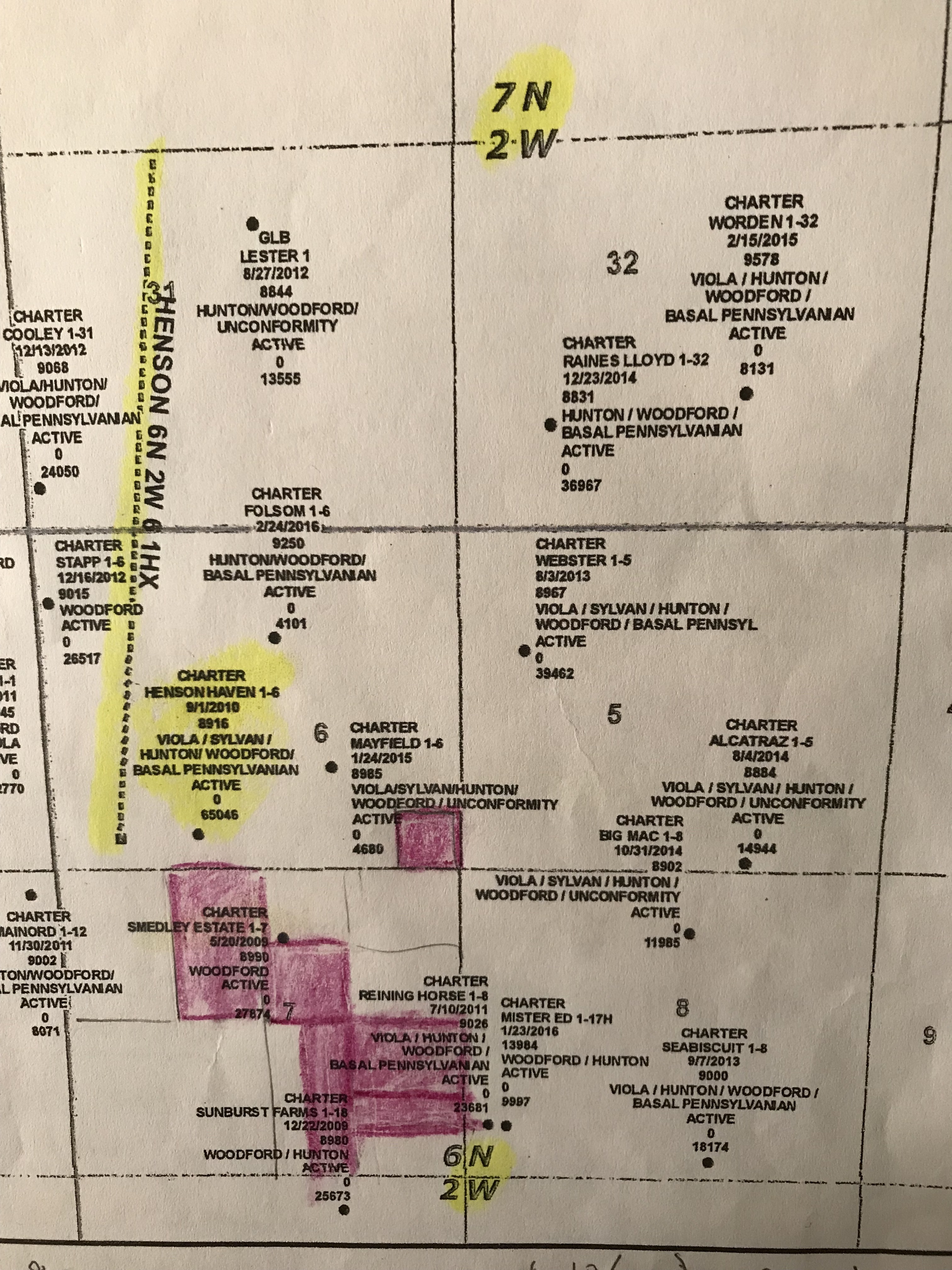
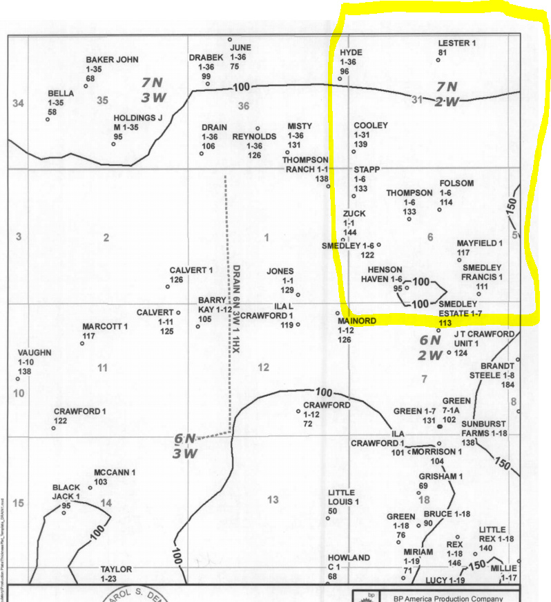
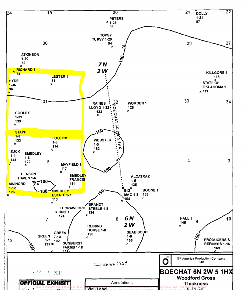
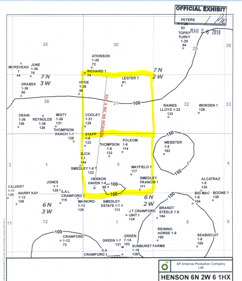
BP has contacted us and there’s a horizontal well starting in one section of what we own. We have contacted the attorney with BP and there have been many court docs sent to us. We’ve leased for many years with Charter Oak. There are two wells that are producing at very low rates - Smedley and Hansen Haven.
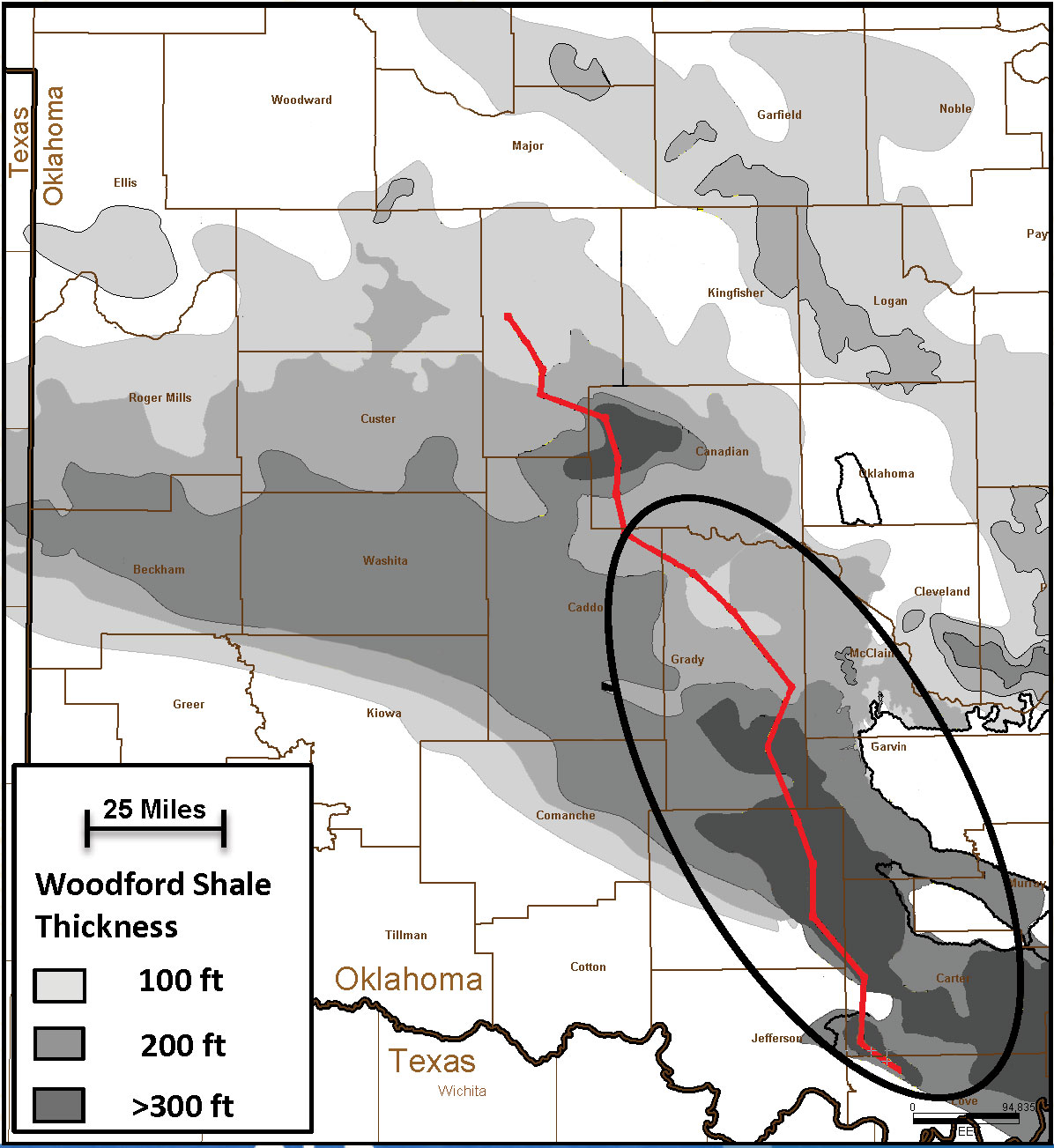
Our question is where do we acquire/find a map of the Woodford basin to understand where our mineral rights lie in relationship to this basin? Is there a map overlay, Ms. Barnes, that you are referencing (you mentioned you have identified the edges of your mineral rights in relationship to this basin). You mentioned all of this in response to someone else’s posting on this forum very recently and it caught our eye.
We’ve been in search of such a map online and have not found one - perhaps someone can help us out. We’d like to understand geologically where the basin is in relationship to our mineral rights.
We’d really appreciate any help with our attempts to acquire such a resource.
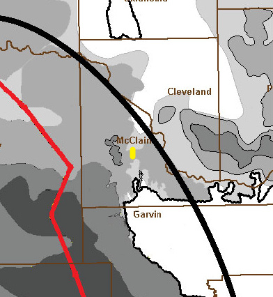
Our mineral rights are located at 6-6N-2W and in 31-7N-2W. We own mineral rights on 240 acres in McClain County.
Thank you so much for any help. (Apologies for earlier mistype).
Mr. Howell, How did you determine this may be the location of our mineral rights? Do you have landmarks, an overlay? Would you be willing to share the details of why you think this?
The geologic map is not precise, so to get a rough idea, go to:
Search for your Township, Range and Section.
You will get a table of Lat & Long numbers. You probably will do best to copy the Lat and Long of the center of your section. The center of Section 6 will be “35.0223557, -97.4504670”.
(There is also a table of the Township, so make sure you are in the correct table.)
Then, paste those two numbers in Google Earth, and search.
From Google Earth, you can identify the rough area of the County where your land is located and nearby towns. Compare that to the County boundaries of the geologic map.
In my opinion you are trying to tie it down too much when you consider the unit of the well bore in the Woodford will be assigned a full section. Normally 640 acres, but in this case both of these sections will vary slightly in acreage.
Thank you for all of your help and your willingness to share the maps. It’s incredible to see these!
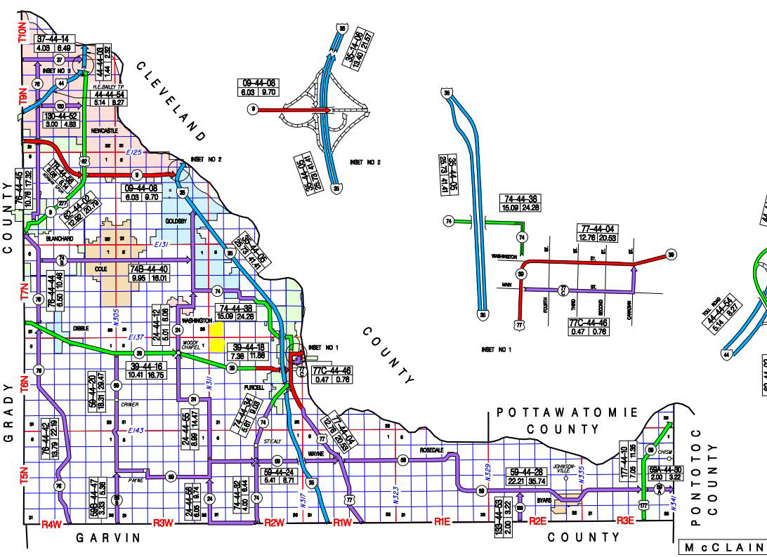
There are so many points of interest on the maps - from surnames, to well names and location markers (such as Woody Chapel) that I recall hearing referenced when I was a child. They are a treasure to read for these sentimental reasons as well as trying to better understand everything with regard to mineral rights.
Perhaps you can comment on something, again. I was wondering if there is a correlation between land elevation and oil identified under mounds or is a myth? One childhood memory I have is a family member mentioning that they thought there was. I never gave it a second thought until tonight when I reviewed the maps.
Lastly, if we may ask another favor: We were wondering how you came to acquire the maps identified as ‘Exhibits’? Some seem to be created by BP.
Thank you again. We are so appreciative of your help and guidance.
You will find not only the Orders, etc, but also the geologic exhibits introduced in the hearing. Not all CD cases have geologic exhibits. If you look carefully, you will see the CD# on the middle exhibit Rick H posted (although the year is wrong).
The CD #s are on the documents from the OCC that you received (or should have) in the mail.
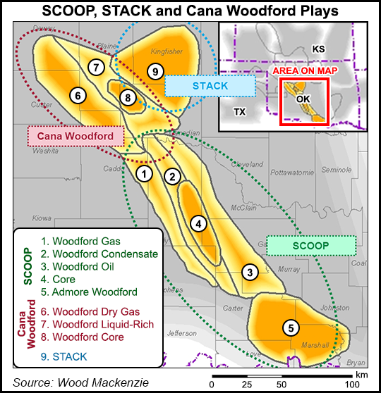
There is a good chance we will be putting out Stack and Scoop maps in the future from OK Energy Today. Will have detailed info, sections and wells drilled. Stay tuned.
I think there is a little bit behind this. Hopefully @M_Barnes will comment.
However, I do think this mainly comes from days in our area when exploration was primarily in the Permian basin. Over the millions of years erosion washes away much of the elevation changes and leaves less of a signature of what is below.
As Frank pointed out, the exhibits are in the hearings. If you know the Cause number you can find the imaged documents at the location he linked. However you need to know the cause numbers involved in the section and the surrounding sections of the area of interest.
Although a timely task, these can be found in the OCC case processing database. Limiting it to a Township, and recent cases is necessary. A knowledge of the Public Land Survey System is very helpful.
http://www.occeweb.com/Orawebapps/OCCOraWebAppsone.html
There are 3rd party subscription services that make this easier although they are costly for occasional or casual use.
Yes, sometimes the “mounds” we see today reflect deeper geologic mounds as the giant mountain building events affected the whole rock column. Not always, as erosion can change that whole picture over millions of years. Structure is important in conventional reservoirs, but not so much in the shale plays. Sometimes those big mounds are uplifts of much older rocks and younger rocks are stripped off-Arbuckle mountains for example.
Where you are in 6N-2W, the Hunton below the Woodford was eroded and then the Woodford filled in the holes. That is why some sections have good Woodford over there and some do not.
Oklahoma State and OU have great geology departments and many of their students have done theses on the Woodford. I have seen some of their presentations at professional meetings. You might troll their websites and see if they have published maps in your area.