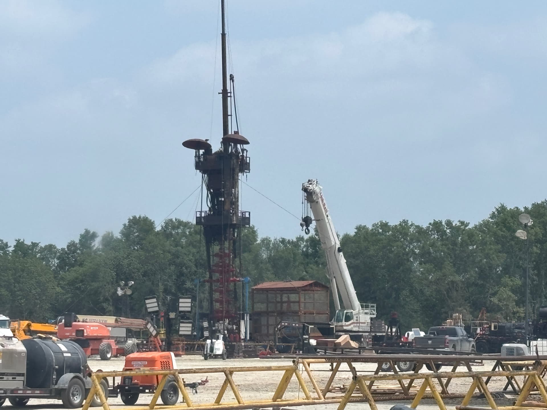
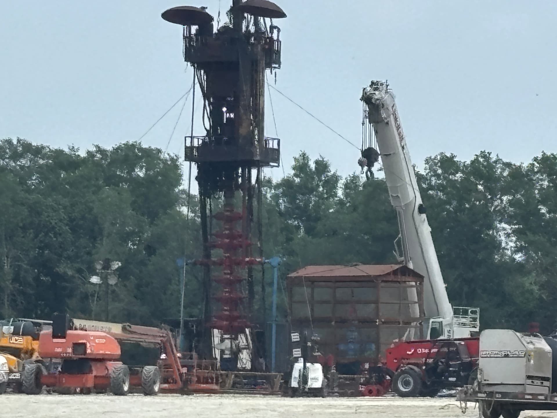
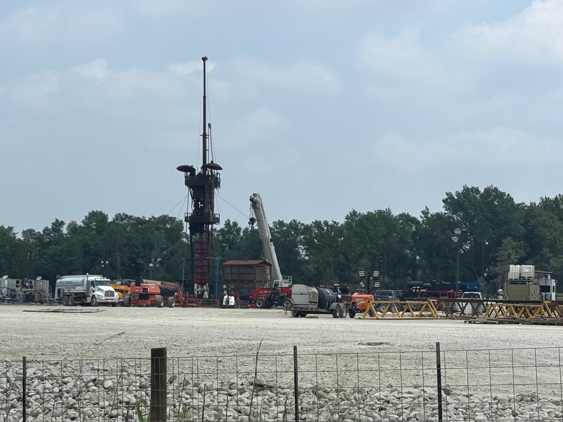
Drove out to see the Leon County Alloc and Williams wells today. Pretty cool! There were also water pumps and hoses leading to the site but they were not running. Not sure exactly where they are in the process but very cool to see. Hope the pics post.
5 Likes
Where exactly are these wells located on the map? Are they producing yet? (Sorry, I am lost and learning.)
Just checking if anyone had any updates on these wells? Nothing in fracfocus yet.
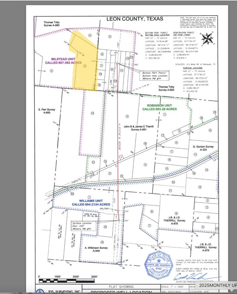
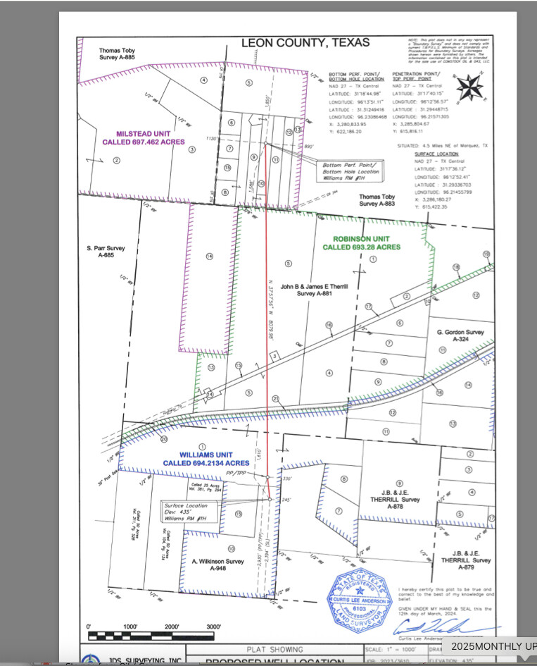
They are located just south of Highway 79. Split the difference between Marquez and Jewett.
1 Like
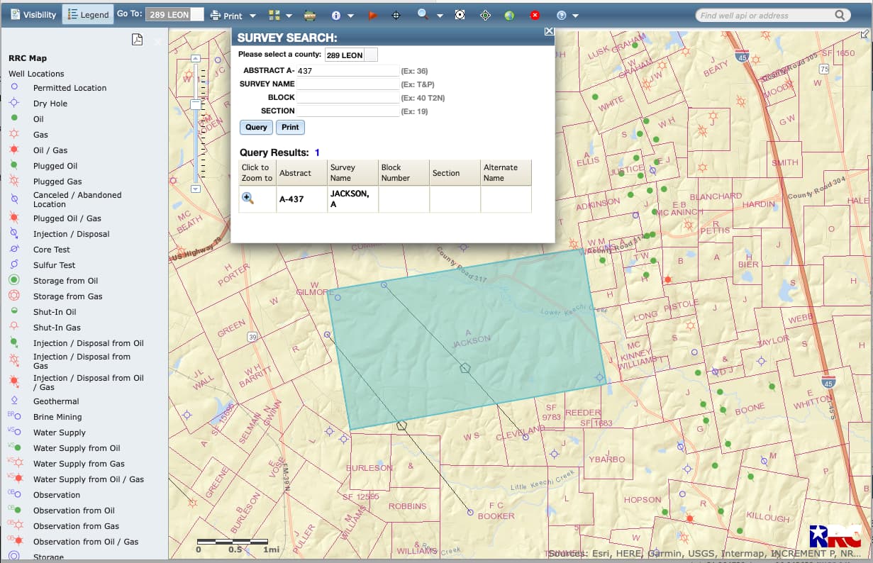
Are these the wells in the Alexander Jackson Survey with allocations to Brown Trueheart in several areas?
No. These are in the Wilkinson, A M survey.
Do you mean A Jackson 437? I have interests there about a mile from the eastern directional rig they put up. I haven’t heard anything about production. I don’t even know if I am in the pool, or if it is pooled yet. Obviously, I don’t know much.
Pretty wild setup, I’ve never seen them working things like that before but I’ve seen much smaller vertical wells… very cool!
1 Like
I also have interests in lot 2 of Alexander Jackson A437. I am finding it very difficult to verify if permitted well(s) cross that lot. I am hoping that the 225 acres I see included in the Hutto Pooling Authority pertain to lot 2. Learning to navigate the RRC has been quite an adventure.
Yes, parts of three wells. Go to LEON county using the upper left county tab. Use the magnifying glass in the middle to put in 437. A rig is onsite for the lower left one. It will depend upon the allocation spacing as to whether or not you will get royalties. If your acreage is in the upper right corner (NE) probably not.
1 Like
How can I find out if I should be included in the pool for that eastern directional rig? My property starts at the base of the survey, about 0.4 miles east of the newer rig. It is where CR 325 flattens out across the bottom of the survey, and goes north from there. Thank you all for your help.
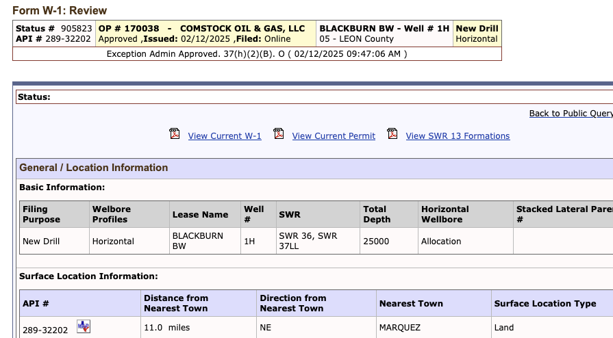
Look at the end of the well. The last five digits are 32202. Leon is 289.. type 28932202 in the search bar at the upper right.
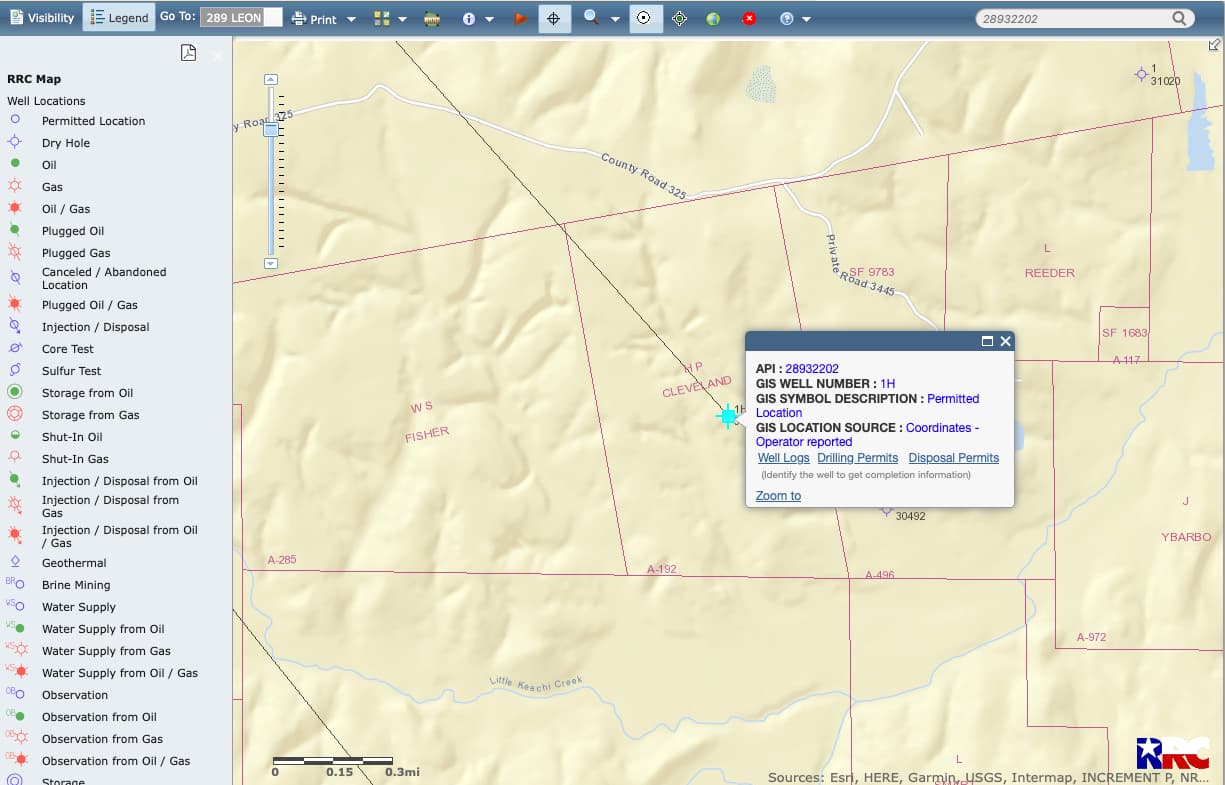

Go to Plat 1 to see the planned well path. There are three pooled unit plats if you want bigger shots. See if one of them is yours. They list who was pooled. Other folks leased. The skinny black dashed line on the well path is the unit drainage acres. See if it crosses your acreage.
1 Like
Thank you so much for your help, I really appreciate it.
Are there people/companies that can help navigate this journey/timeline? The more I try to follow the more confused I am. I am not even sure I’m following the correct well anymore.
1 Like
Friendly folks on the forum can help answer questions. The National Association of Royalty Owners (NARO) is an organization that helps educate mineral/royalty owners. www.naro-us.org. They have an active Texas chapter.
The wells in the pictures at the top of the thread are in a different survey than the wells at the bottom of the thread.
1 Like
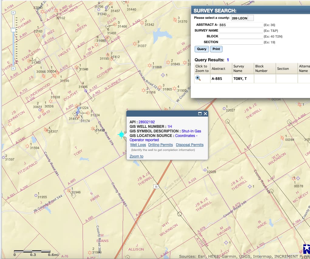
The Legal Description of the mineral property is Thomas Toby Sur A-0885 71.049. Would that be the Williams RM well?
The northern end of the Williams RM well is in Thomas Toby Survey A-883 which is just to the east of the Thomas Toby A-885. On the east side of country Road 379
1 Like
Thank you. This confirms I was looking at the correct well. When I look under drilling permits and review all the documents and see the names in the pools, ours is not listed. But the dates on most of the documents were before I signed my lease. Could we still be included in this well?
Are you in the Milstead Unit? The well path does not go across your acreage if you are in the west side of the unit. It may depend upon how the well is spaced. You would have to contact the operator.
1 Like