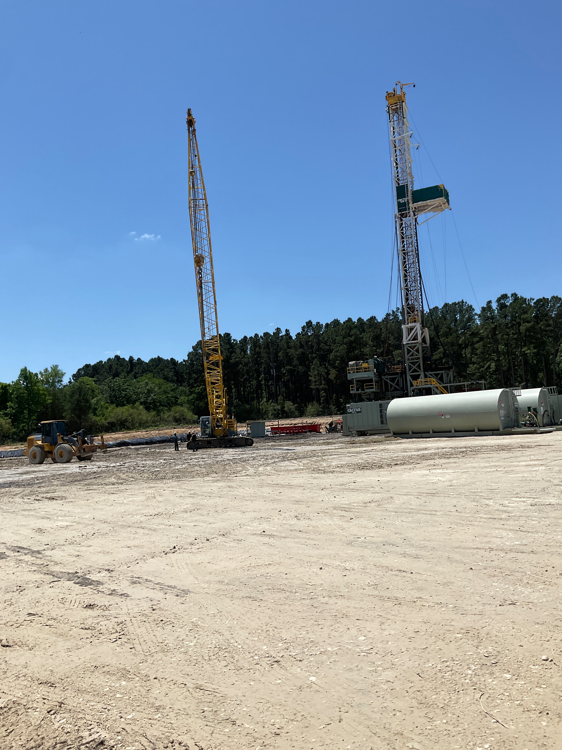
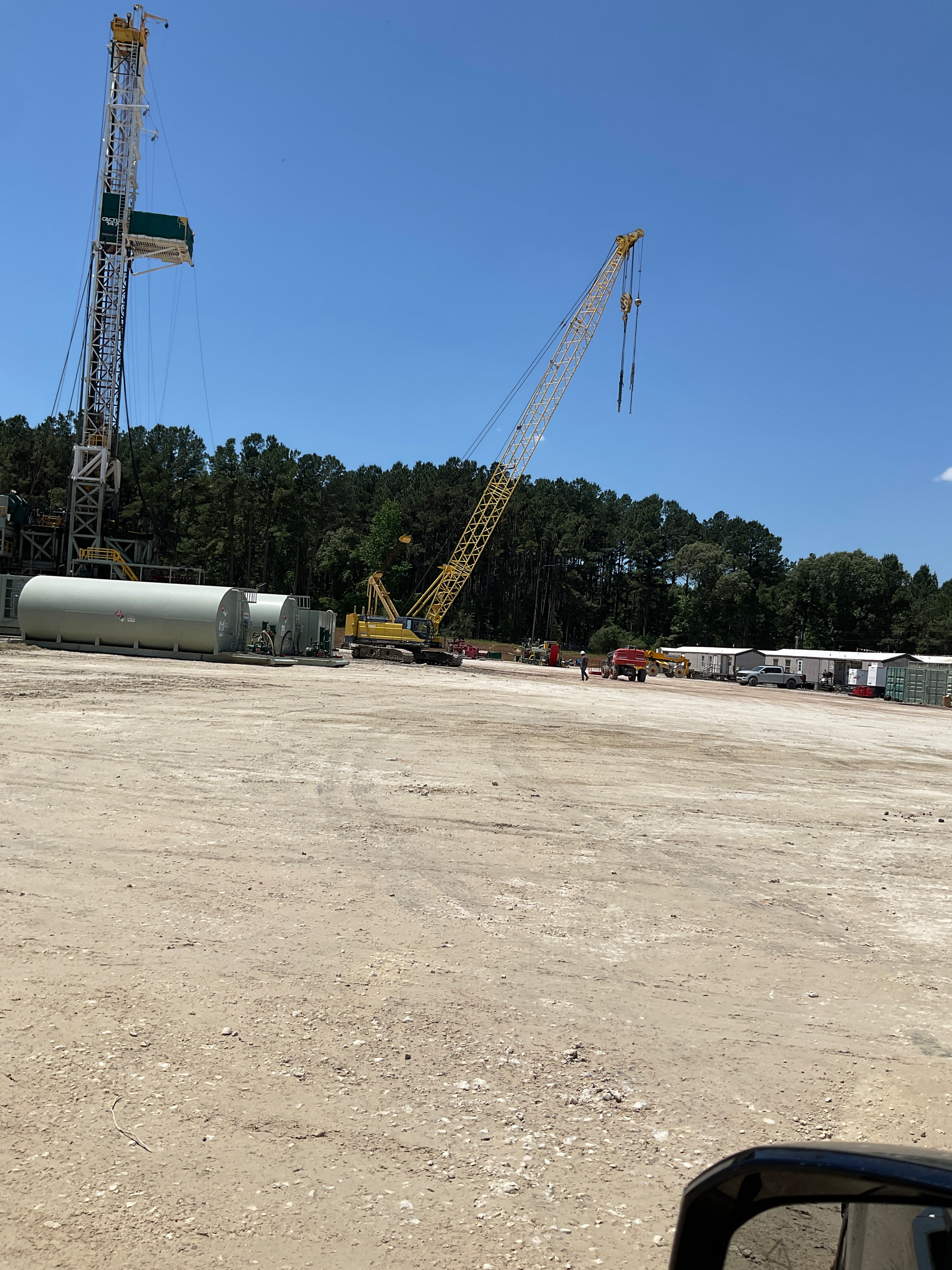
I am pleased to report that after 185 days on site Comstock and Cactus 147 have completed both wells successfully and they are actively tearing down the rig and moving SW to a new Comstock location off Hwy 832. Passed several trucks going in on CR 340 from Hwy 79 today and arrived at a busy scene. Also noted the construction of a 24” pipeline headed generally toward Oakwood. It appears the Mitsui Frac Pond is still holding around 15” of water but other than the supply wells it appears deserted. It has been quite the adventure visiting the active and now even more active pad and drill site over the past few months and if anyone knows the steps that will be taken from here on until final gas flow please enlighten those of us that are not well versed in final well completion. Thanks for all the help researching the progress for these wells.
The FRAC crew will do their thing, then a coil tubing unit or workover rig comes in and drill out the frac plugs between stages and circulate to clean out all the junk. Once that done they hook up the flowback equipment. Once the well has cleaned up and stabilize, (And this is the good part) You go home, set up an umbrella and a lawn chair in the front yard with a cooler of drinks AND wait for the MAILMAN $$$$$$$$$$ . Have a great one.
Those dollar signs will sure put a smile on anyone face today. They way fuel prices are going everyone will need a well to fill up the tractor.
Thanks for the info, the Comstock safety supervisor we spoke to is overseeing the teardown tried to explain the steps that they would take but most of it went over our heads. He mentioned something about inserting balls that self destroy and then drilling out plugs to get flow back. I watched a YouTube video about the fracking process and learned a little.
Your welcome. You can get a pretty good idea when you will receive your mailbox money. Look at the date when your well was spudded in. Then add a year and that’s when you will start seeing your money.
I have been trying to figure out the pipeline situation I noticed for the 24” line they are putting in. If you look at the last satellite view I was able to capture you will see several cleared sections starting by my pad and going generally over towards the Olajuwon/Pickens well but it is all segmented. If you look at the GIS map with the pipelines highlighted the first lateral you see from the left is the Dollie Jones, then the 2 Kretzschmar wells and finally the Olajuwon/Pickens so maybe someone can tell from the images what the ultimate plan is here for the tie in to the supply.


From what you’re describing, the clearing pattern you’re seeing is pretty normal for a new line of that size. Contractors rarely clear a full continuous ROW all at once. They usually work in segments depending on landowner access, survey completion, and which crews are available. So the “broken” sections don’t mean the project is abandoned — it usually just means they’re sequencing the work.
A 24‑inch line is almost always a trunk or takeaway line, not a small gathering line. That size suggests they’re building capacity to move a larger volume of gas or oil out of the area, not just tying in a single pad. When you overlay the cleared ROW with the GIS pipeline layers, it lines up with the idea that they’re creating a path to connect the Kretzschmar wells toward the larger system that runs past the Olajuwon/Pickens location.
The Dollie Jones and Kretzschmar pads sit in a spot where several gathering lines converge, so it makes sense they’d build a larger trunk line to move everything to a main takeaway route. The segmented clearing you’re seeing is consistent with that kind of buildout — they’ll connect the pieces once all the ROW is cleared and graded.
In short: • The segmented clearing is normal • A 24" line is almost certainly a trunk/takeaway line • The most likely plan is tying the Kretzschmar area into the larger system running toward the Olajuwon/Pickens corridor • Final tie‑in points usually become obvious once they start stringing pipe and trenching
If you post a screenshot of the GIS overlay with the cleared ROW, people here can give you a more precise read on the route.
I did find a survey of the proposed pipeline that shows the gaps so maybe from it you can gain some idea of what is taking place in this area. Pipeline.pdf (103.7 KB)
The well or wells will be capped with a 15K valve (maybe 20K) that can drift the production casing (prob 5-1/2). The well should be dead. It will remain this way until they can schedule a frac crew. Before the frac, a wellhead company will come out and install and test the remaining frac stack (big tree looking thing). They will add manifolds and all kinds of equipment and then begin frac. All of these tools are rental items to the oil operator so they are trying to coordinate subcontractors as efficiently as possible. After frac and flowback/cleanup of well they may elect to flow up casing for months if the have a good well. When pressures fall, they will set a plug, remove frac stack and flowback equipment and prepare to run tubing and install Christmas Tree (production tree. Most likely 2-3/8 w 10k tree to siphon hopefully a Very Long lasting well.
I’m not real familiar with the engineering of that particular area but these steps & procedures should be the same.
Best Wishes & Enjoy!
I know the pipeline is being installed by Pinnacle but where they will take it could be East towards Palestine. Thank you for your knowledgeable input! I will look for frac activity once the cloud cover clears and I can get a satellite view again. Last visible was 3/31. Those who have Enverus and related sites access always get a more up to date idea of what is going on.
You can watch for the end of the frac on www.fracfocus.org. Use the advanced search option. Once the frac is finished, the production will follow soon after if tanks are ready and a pipeline for gas is finished.
Checking Frac Focus I only see the Olajuwon well, would you see what you can find out about the current status of the 2 wells? I know the rig stayed a very long time drilling Kretzschmar PP 1H but PBH 1H went much faster. Welldatabase has had daily uploads for PP this week and the trajectory shows weird zig zags at the curve or kickoff point. No satellite views since May 12 to see if they are preparing for frac but the pipeline construction appears completed. Any news would be appreciated.
FracFocus is where I would look. Other public sites will be later in releasing info. Completion will not be posted until after the frac.
Thank you. Guess they are in some kind of completion queue. I found a site where it shows Comstock has 13 wells listed as DUC and waiting completion with my 2 as waiting the longest.

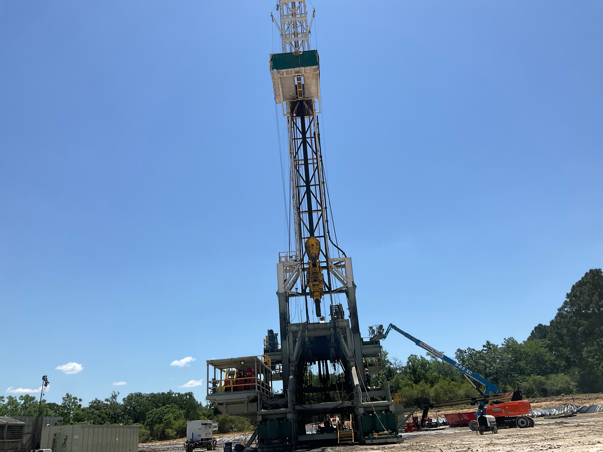
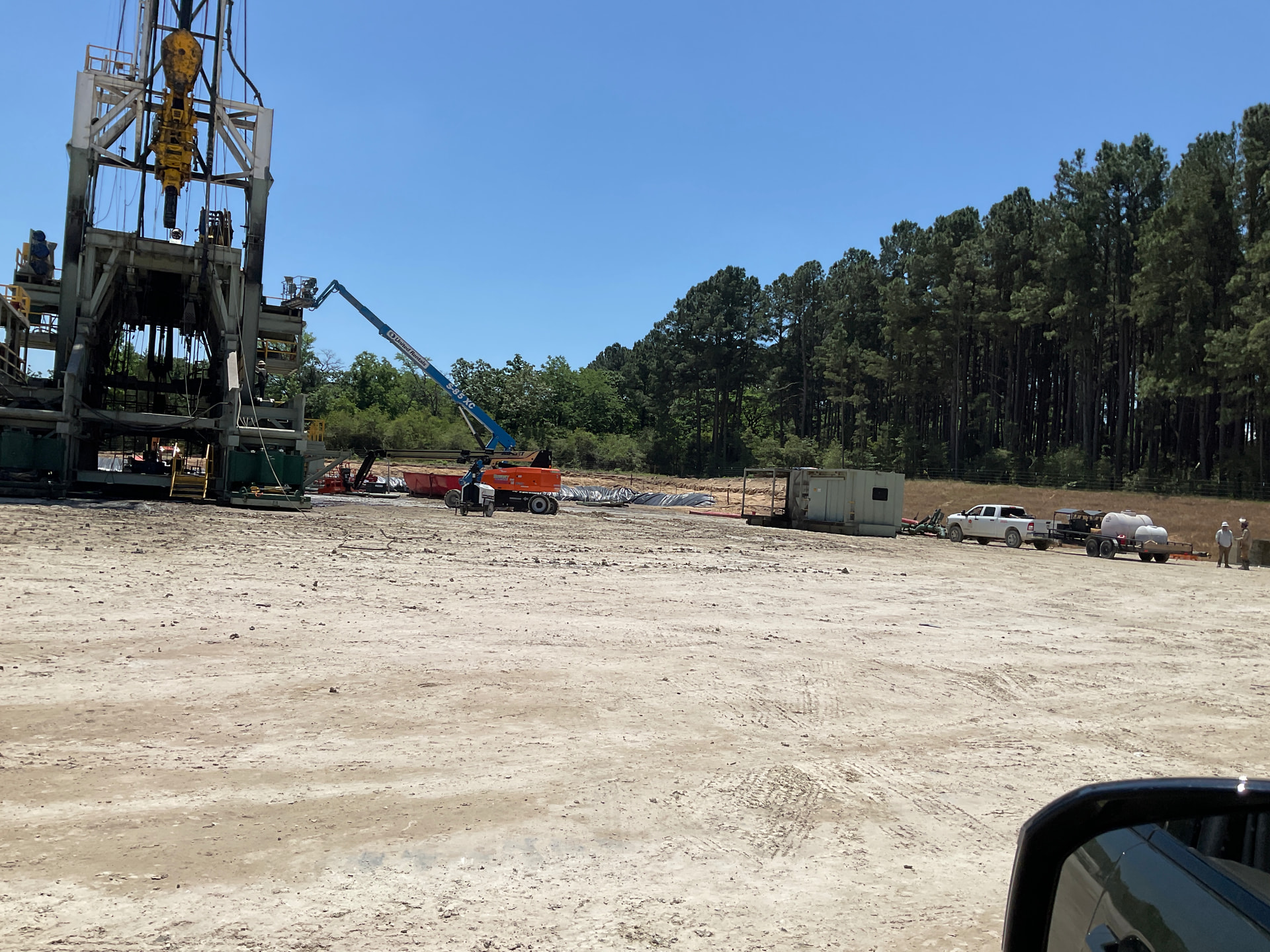
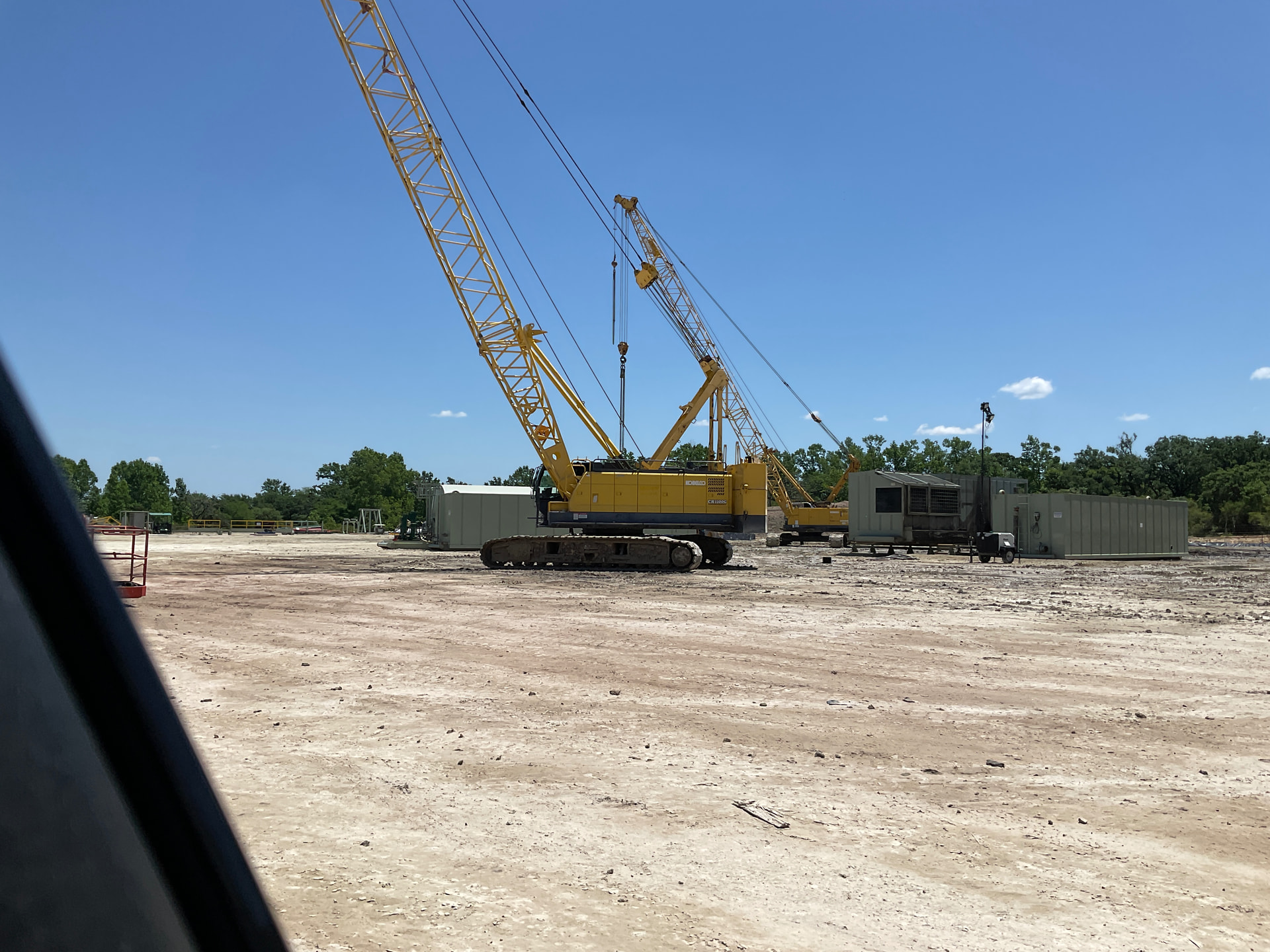
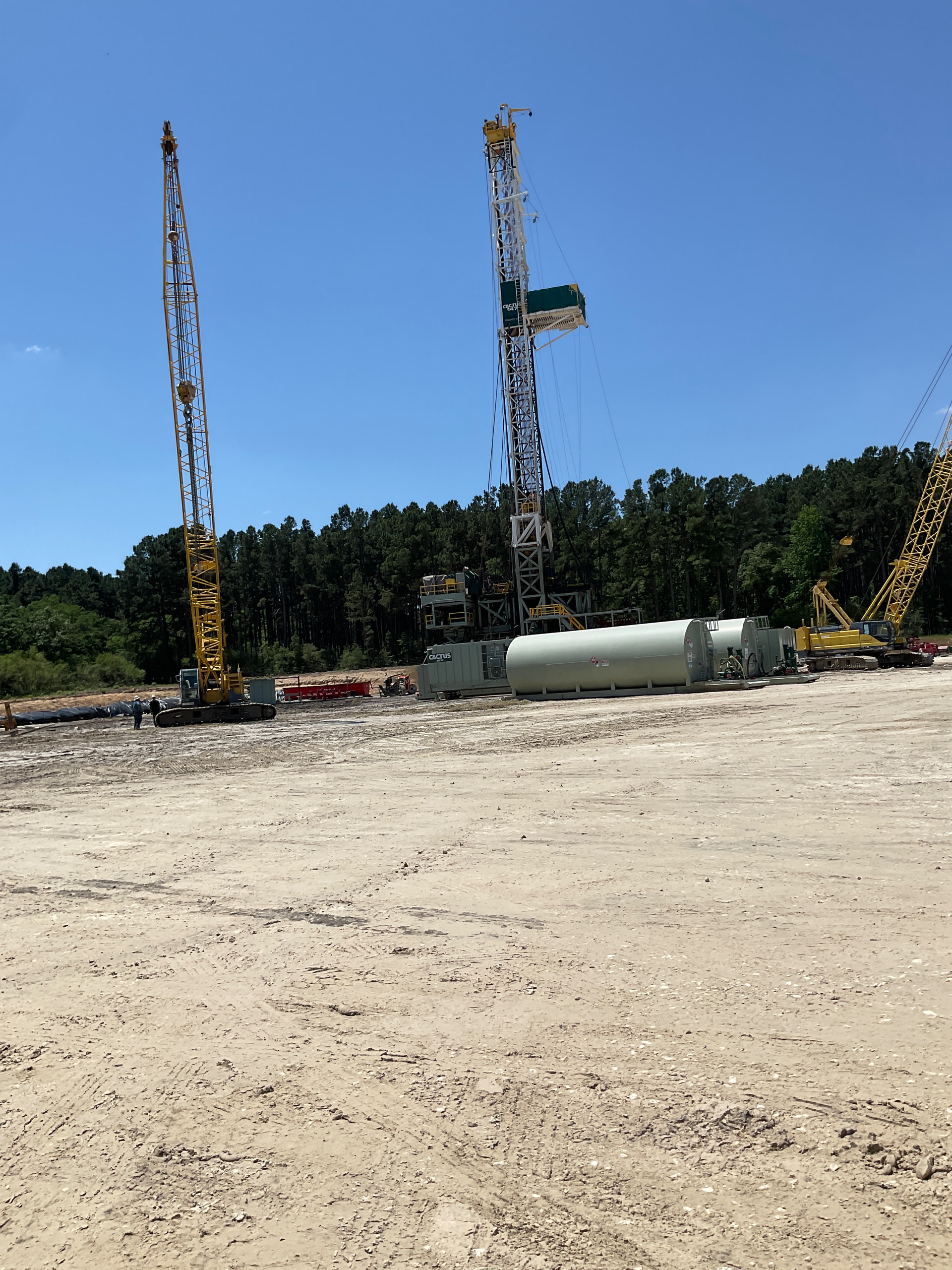
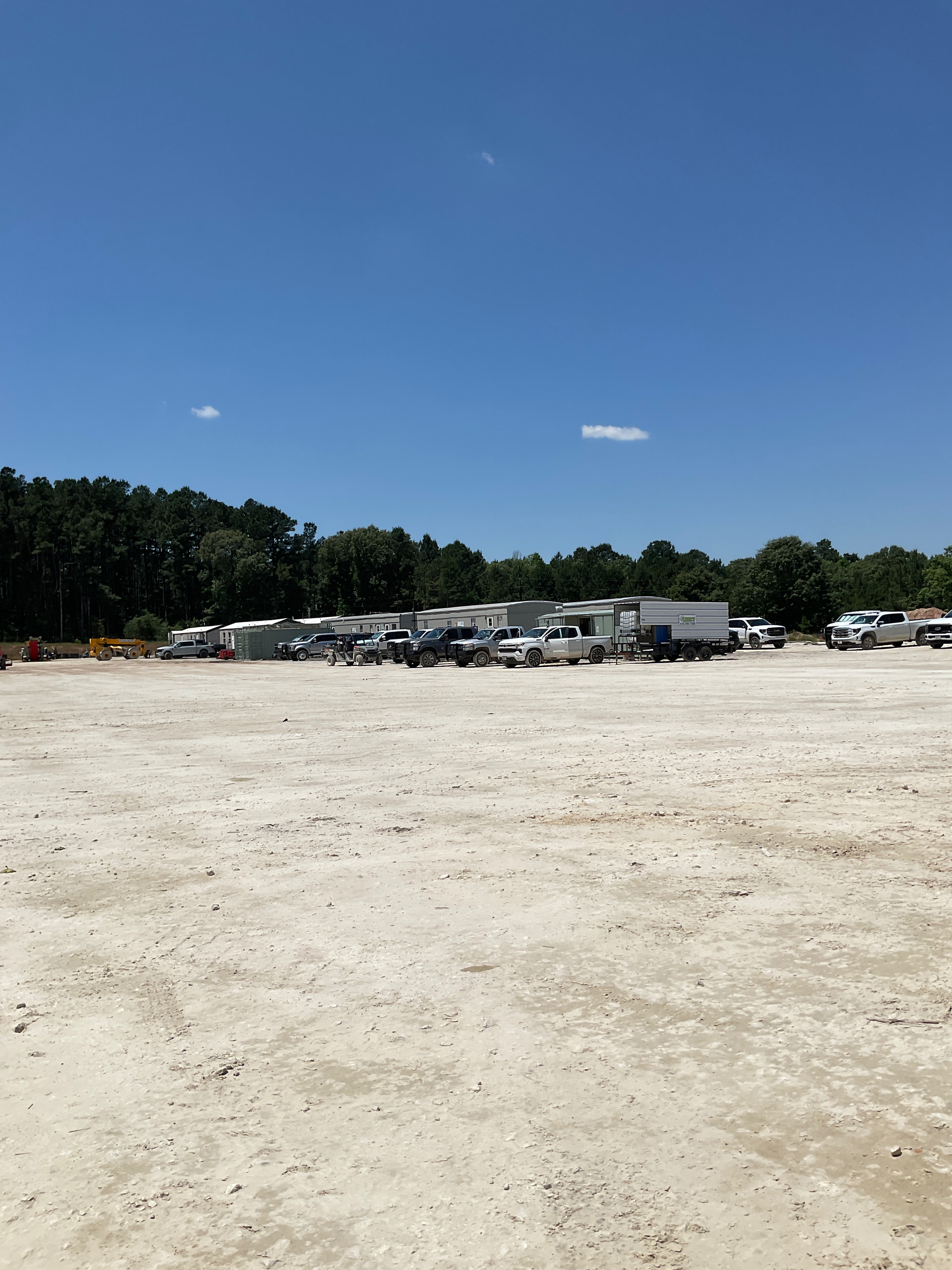
Finally gave in and drove over to the pad site to see why it has been so quiet. Pretty deserted with just one small trailer left out of the 12 or so when the rig was there. Can someone who may be able to interpret these photos look at them and see what stage the wells are at? I also do not know what the other pipeline stuff is and there was no one around to speak with. It alppears the 24” pipeline along CR 340 is complete and covered up and all the 18” at the wells seems to be finished as well. One well was showing around 3000 on the gage but the other 0.


Noticed yesterday they are laying temp water lines from same Frac pond Comstock has used before. This is off FM 1848. They maybe coming your direction. I am pretty sure this is where they got Frac water on Oblijuan well.
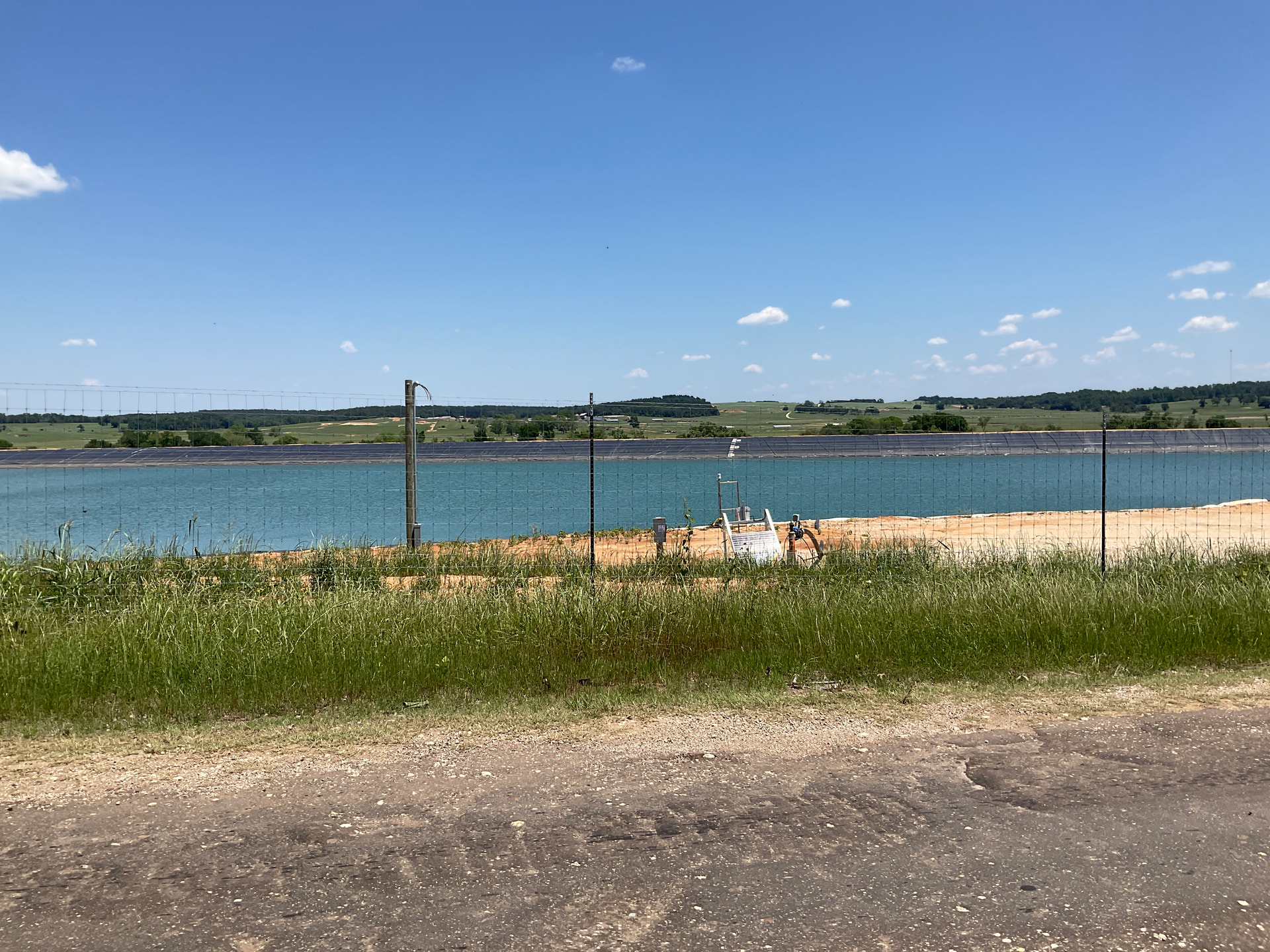
Great to have eyes on the ground there. Satellite views have been far and few between lately with all the clouds and rain. Is that the same road as Cr 340 or east. That Mitsui Lipsey frac pond just down the road is still holding 15+ feet of water so is that the pond you are referring to?
No. FM1848 is probably 5-6 miles east of intersection of FM 489 and CR340. When they Fraced the Olajuwon well they ran over 10 miles of temporary water line from this same Frac pond just off 1848. I may be wrong but guessing Mitsui is not interested in allowing Comstock to use their Frac ponds and vice versa. I know for sure that Mitsui built the Frac pond near the Baker well as well as drilling two water wells used to fill. I figure they probably did the same at the Lipsey site. I don’t know what Comstocks arrangement is with land owner at this site but assumed it is similar to what Mitsui did.
Should have said FM1848 is west CR 340 and intersection of FM 489
I see, too bad if you look at the photo you can see my pad upper left and Mitsui pond lower right. I do see some ROW clearing headed toward the SW so maybe that is part of the hose path. If it’s not raining I am going to drive over there Sunday and see what I can find out. Maybe someone will be around I can ask. Thank you again for the update.
