CD2023-001389 I was under the belief drilling started March 23. I was wondering if anyone in the area might know. I would like to go and take a few pictures of things that are happening. Section 13 has been my family for a long time. Can anyone tell me where to find the location and maybe some directions? Thank you, Vickey
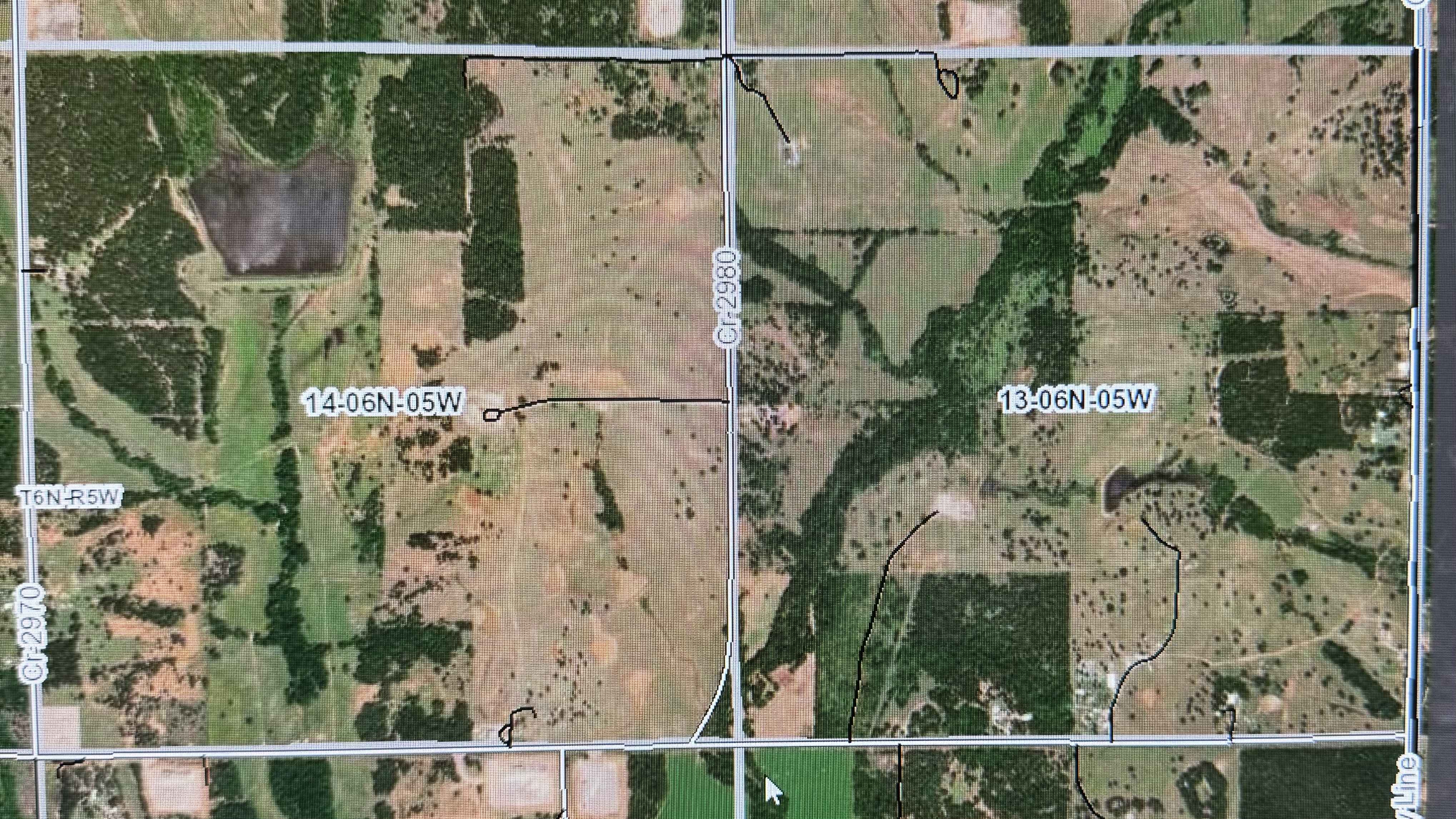
Just because there is a spud notice, doesn’t necessarily mean that a rig is on location capable of drilling the well to total depth. Many times these days, companies use “spudder” rigs to drill and set surface casing. Then the bigger rig will be moved in. It is possible that the latter has occurred and drilling is underway. I believe the actual location or drilling pad for these 2 wells is located in the western side of Section 14-6N-5W. You can inquire at the Grady County Clerk’s office or County Commissioners office if they have a county road map that will help you find the location if you are trying to drive there. You may also look on this forum under Grady County to see if someone has posted a county road map. Good luck.
Thank you Todd for your help, I was wondering if what you say is what is going on how long would this take do you think before anything would be visible to maybe take a picture of the location. Did you say that I might find a map of the site on this forum? Thank you again Todd for your help. Vickey
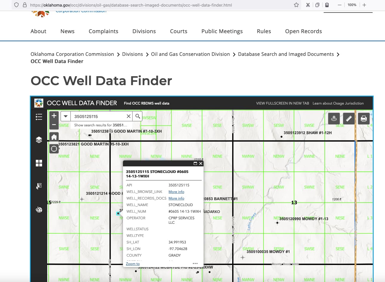
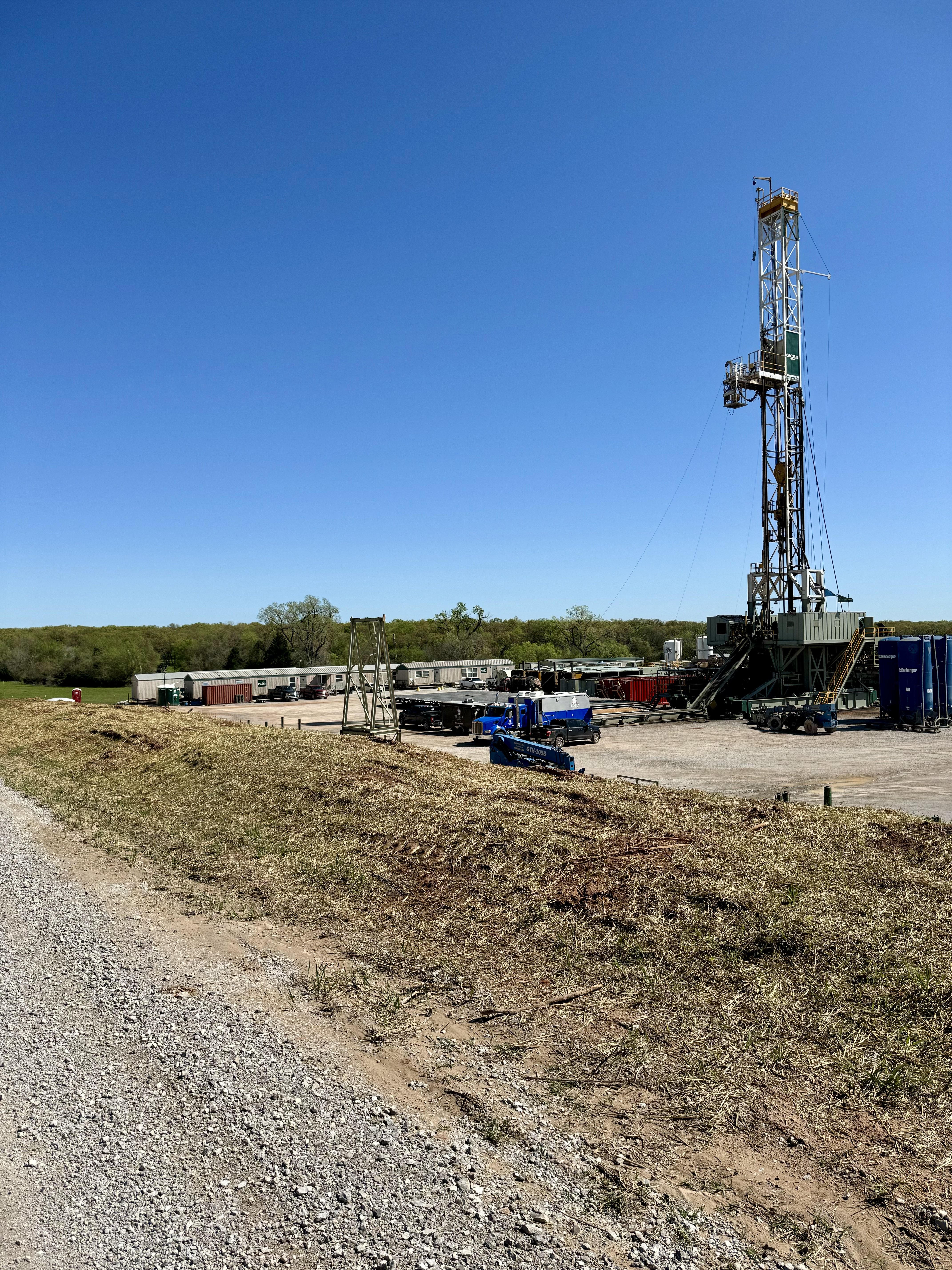
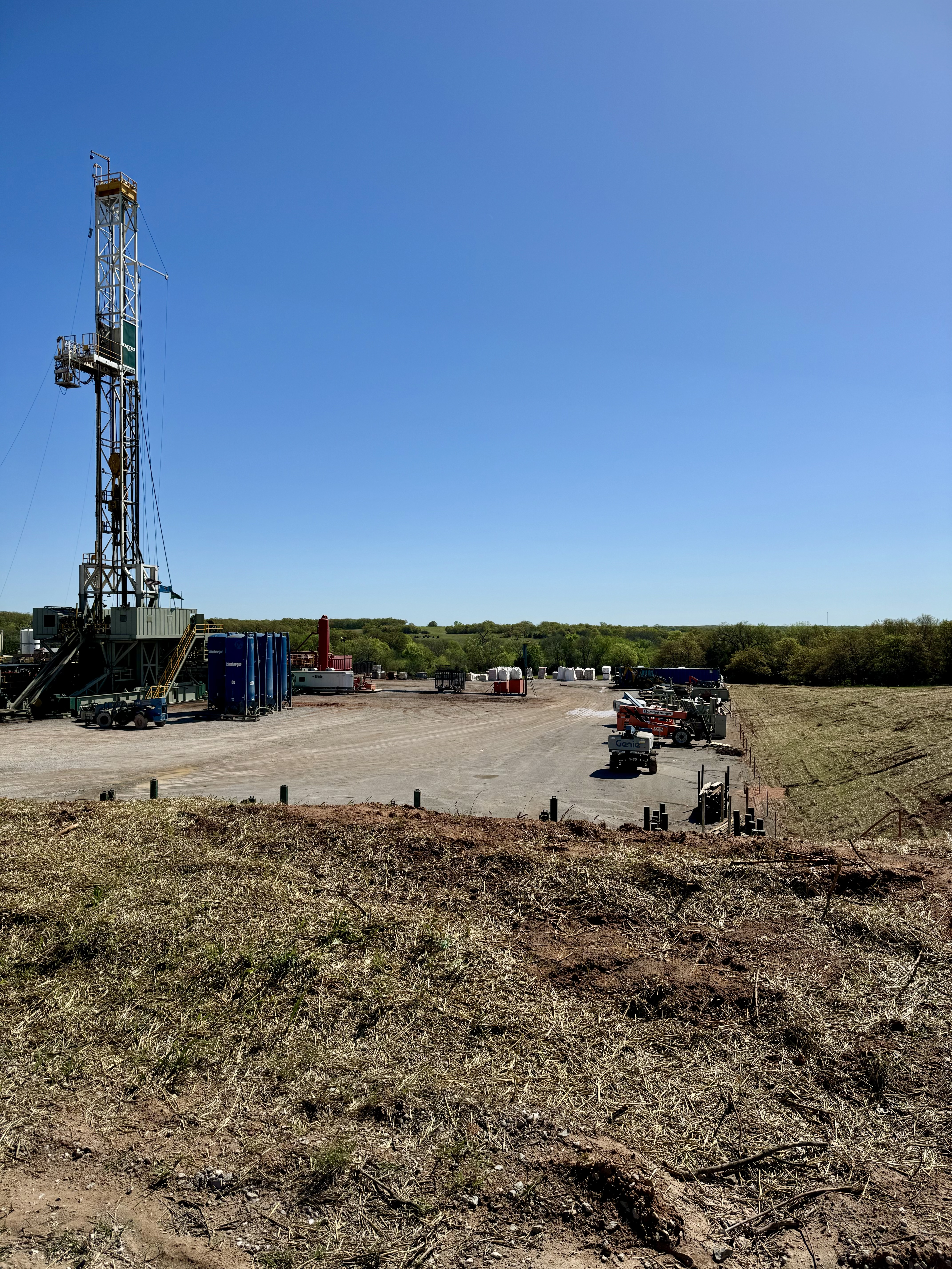
Cactus Rig 164 is onsite. The location is 34.9920664 (WGS84) latitude and -97.7049137 (WGS84) longitude . You can find the location on the Stonecloud permits. The surface hole locations are just a tiny bit different.
You ca find the location on the OCC well finder map. OCC Well Data Finder Type the API into the address box. 3505125115 is one of them. It is just off of County Road 2970.
1 Like
Home - Grady County OK | Assessor’s (gradyassessor.org) website for interactive map
2 Likes
Don a long time ago you were in the area buying feed and went by Section 13, Township 6N, Range 5W and nothing had been started. I thank you again for doing that, but can you tell me is this located in Alex’s if we wanted to drive down and see if anything was going on yet. I want to try to catch a picture of the drilling if I can. This property has been in my family for a long, long time and all my siblings sold their minerals, I’m the only one who did not. Love to get a few pictures if I knew where I was going lol. Thanks for your help. Vickey
The Grady County Assessor now has an online interactive map. You can turn on Townships and Sections. Best viewing is from a desktop or laptop computer.
About 5 miles north of Alex and Highway 19 to County Road 1400, then east 3 miles, then north on County Street 2970. I can probably get over that way and take a picture if you want.
Don, that would be great if you are going that way. Thank you so much for the directions. I’ve never been there and would like to go there when I can see something. This has been a long time coming. I would be happy to send you gas money for doing this. You are so appreciated. Vickey
Don, is that what Todd was referring to above as a Spudder rig then they bring in the bigger one for drilling? Just curious about the steps. Vickey
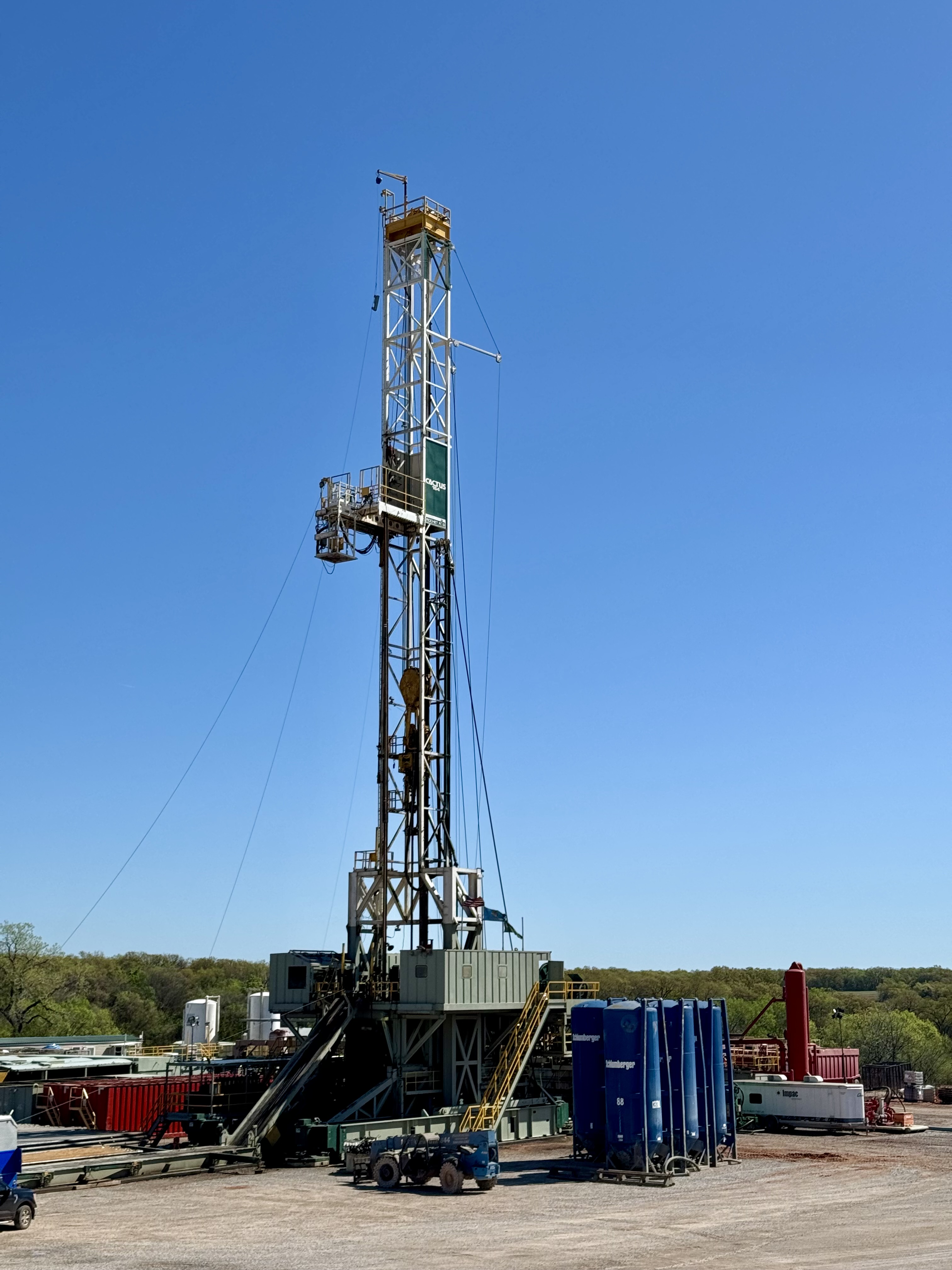
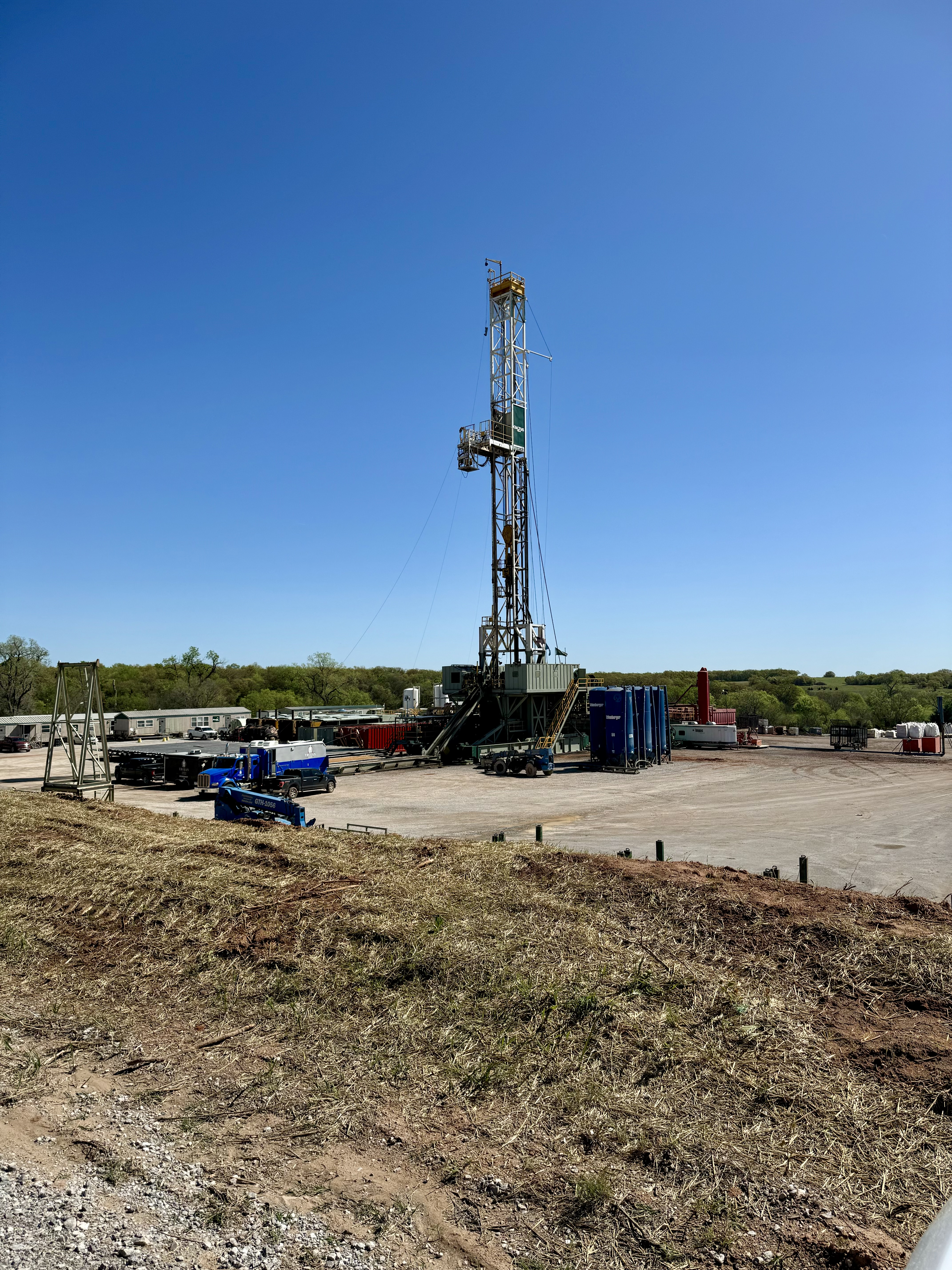
Vickey, that is the rig that will drill the well to total depth. “Spudder” rigs are much smaller.
Don, thank you so much. Those are great pictures. Don’t know a lot about what I’m seeing lol but they finally are drilling, been a long time coming. Wish my mom could have been here to see it but I know she is smiling down lol. I am not sure according to the exhibit if it was drilled in 14 and running through 13 or started in 13 and ran through 14. Guess it doesn’t really matter, I hope they get a good one. Guess time will tell. Thank you again so much for the pictures. Vickey
1 Like
Thank you, Don. Is there somewhere that I can follow at? How will I know if they get a well? Any idea how long it takes and what comes after it is drilled? Thank you again for all your help and the others on this forum. You all are so knowledgeable. Vickey
You can monitor the official filings on the Oklahoma Corporation Commission well records site. The completion report will not be filed for about four months after the completion is finished. It just takes that long. So about a year from now. If the well is successful, you will get a Division Order to notify you. In OK, you do not have to sign it, but you do need to give them a W-9. Come back and ask questions about how to handle that part when the time comes.
1 Like
M. Barnes, thank you for your help and all your knowledge. Vickey
When I have a well that I am watching, I wait about five months for a horizontal well and then start checking the Ok Tax site. The “active date” is my clue that the well is successful. https://oktap.tax.ok.gov/oktap/web/_/
Go to the HELP section and the Public PUN option. You do not have to get a login, just go straight down the front page on the left side. Put the name of your well into the Lease Name section. You may get some extra wells due to a glitch they have right now, but if your well is successful, it will eventually show up. Select the PUN blue numbers and the info will pop open. You can use the tabs at the top to get info. The PRINTABLE tab compiles all of it.
4 Likes