My father had some minerals in Texas. I have some questions.
I was the executor of his estate in Oklahoma. I have this letter from a company who leased them in 2010. I have the deed as well. I mailed all of this to Montague County—certified. They have yet to put in our names.
Do I have to go to court in Texas to do this?
How do you look up activity in this area? I am wanting to see what has transpired since 2010 and if it is currently leased.
Area: Bell County School Land Survey A-940 Montague and A-27 Wise County Texas 2.32 acres
@jennifermason, you can use the RRC GIS Viewer, to check on the wells in those areas. It does appear there are still active gas wells in both areas.
You will also need to mail your deed information to Wise County to have it recorded. It sometimes takes a few weeks, and may take longer to show up on the online sites. Also, note that documents must be notarized to be recorded.
After the deed is recorded in the counties, you will also have to send the same information to the oil operators (EOG, Bedrock Production, and maybe a couple of others) to get yourself into pay status under your own name. Hope this helps and I am not telling you what you already know. On the RRC GIS site, you can search for Montague A-940, or Wise A-27 using the magnifying glass and entering the abstract number.
Thank you so much, Peter. I appreciate all of that information… trying to use the GIS viewer… not having a lot of luck but going to work on that tonight. I sent the certified final decree from my father’s probate estate in Oklahoma to Montague County - but that must not be how things are done in Texas. I am guessing I will have to find a landman in Texas or attorney to help me.
Thank you so much. Do oil wells in Texas have API numbers like in Oklahoma? I am on the GIS link Peter gave - but I don’t understand how to see the wells in the areas I gave. We use Section, Township, and Range here - but this is really confusing.
In Oklahoma I can go to the OCC well search and look up by Section, Township, and Range… I am hovering over where I think the property is in Texas, but it’s only giving me random numbers.
The whole country uses the American Petroleum Institute (API) numbers. The first two numbers are the state code, the second three are the county code, the next five are the well code in the county, and sometimes there are four more digits to indicate a sidetrack.
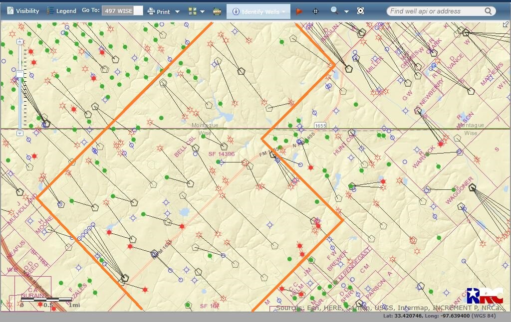
@jennifermason, yes, Texas does not use the Section, Township, Range (PLSS) system. The abstract numbers (Wise County A-27) are often the easiest way to find things. Included a picture of a map of your area below. There is a lot of activity.
@jennifermason, On the GIS Viewer, up at the top will be a drop-down menu for county. Select the appropriate county. Then click on the magnifying glass up at the top. Choose “Surveys” on the scroll-down option.
A screen will pop up that allows you to search the legal description. Click query and click on the correct legal description.
Finally go back up to the top search bar, click on the little circle “i” and choose “Well.” Then you can click on the different symbols to see the history.
Let me know if you have additional questions and I can try and help guide you through it further! MK
Look at page 13 of PDF for more info. userguide.pdf (1.4 MB)
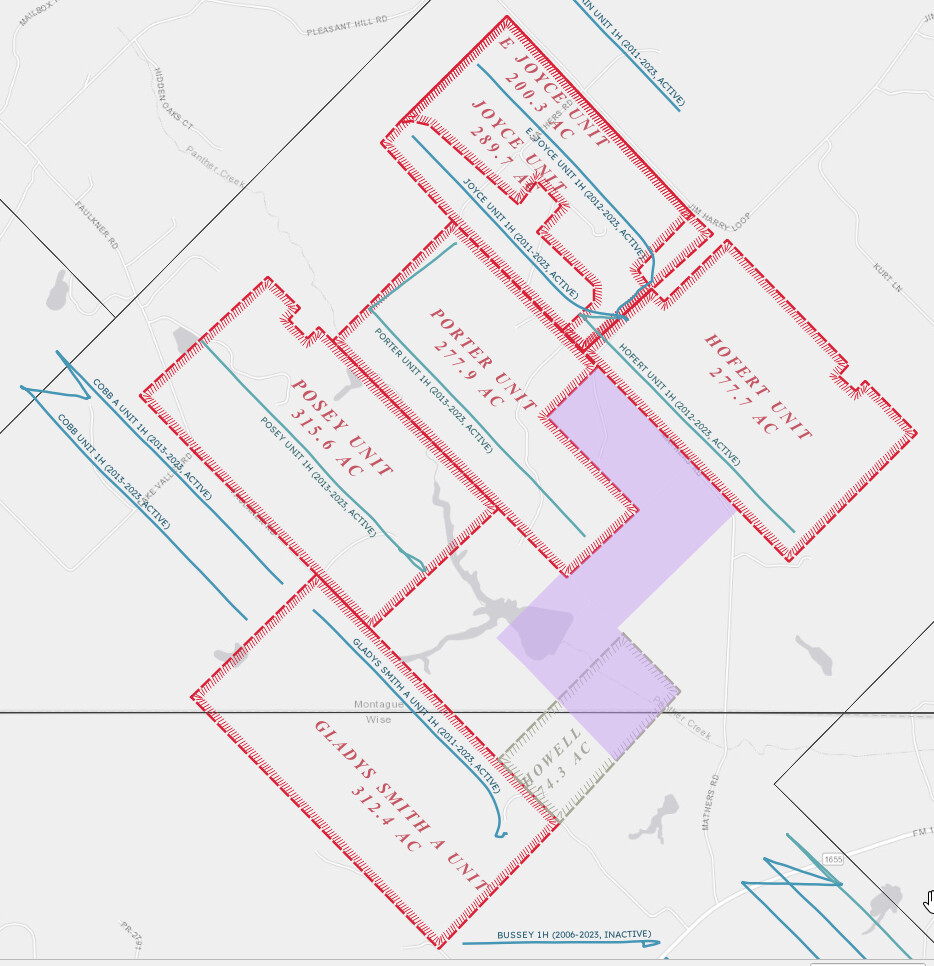
Just chiming in on a fun example of how unit size and shape matters and how Texas can be weird. Purple in this below map is Ms. Mason’s acreage, and the red outlines are the pooled units around her. She actually does not have any active wells on the acreage :(. (Howell is an old lease that’s no longer active)
Thanks, @PeteR! Was pretty surprised when I first mapped it up, but it’s always possible the uncertainty in title or difficulty finding the person to lease from was part of why the units were formed how they were.
Admittedly, that map is a screen capture from my personal tricked-out version of the tool I have on my desktop, but here’s the Pecan Estimate version of this specific property (I think I’m allowed to post these since we’re running the ad right now but a mod might remove the link if not).
https://pecanestimate.com/p/f8548e81700c4e
Working on some options to make the map fancier and to make the units more universally available. Right now the formally mapped units need to be entered one by one into the database so the area would have to have been reviewed once before for the units to exist. Otherwise the model uses approximations for units, based on how they’re typically formed and typical sizes and buffers around the wells.
Question: I looked on the Pecan Estimate Viewer and searched an area where I own some mineral rights and it valued them at $50/acre. The last time I leased them about 12 years ago was for $850/net acre. These rights have NEVER been leased for less than $200/net acre, which was in 1981.
I can take a closer look at it to see if there’s some anomaly in the model if you contact me (info in my profile) with more details. However, one possibility is the acreage is in an area that’s highly dominated by natural gas prices, which are currently in the tank but were flying high 12 years ago.
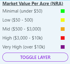
It’s also worth noting that if you were using the free map, these values are in $/NRA, which are dollars per acre per 12.5% lease. Something leased at 25% would be automatically double the values listed on the map.
I’m always looking for ways to improve how this information is communicated as well as the accuracy of the information, which is why I’d like to talk to you further via email to see where the disconnect is. Thanks!
This is not intended as legal advice but it’s possible you don’t have to do a separate probate in Texas. You may be able to file the Oklahoma probate with an Affidavit of Heirship in both Texas counties. If the oil companies accept things & pay you may not have to file anything, other than the deeds. Still should hire someone just to be sure, but it isn’t as complicated as Oklahoma probate rules IMO!