Anyone heard of any activity in 34 2N 3W?
Welcome to the forum!
Castell Oil Company and Red Rocks both have pending cases regarding section 34-2N-3W. You should have gotten notices from the OCC for horizontal drilling-case 201809649 and 201810346. You especially need to pay attention to the pooling notices if you are not leased. case 201810577 and 201900330 as you only have 20 days in which to respond with an answer. Is your name and address and title info filed in the county courthouse? Here is the link to the OCC cases to look them up. Contact the attorney for each if you did not receive the notices. OAP
Welcome to the forum.
The OK tax site has production and wells. Gross Production
The Ferguson well stopped production in 1985. Part of section 34 has been in the Panther Creek Gibson Sand Unit operated by Phillips. Have you gotten checks from them? If you are part of a unit, you get paid on the unit. The wells in your section may have been plugged but you get paid on the rest of the wells in the unit.
We haven’t received any payments at all. My wife’s mother was paid a one time payment in the early 80s I think from Conoco. We are at a loss of what and who may owe us royalties. I made a rookie mistake and was looking at the wrong section. I was looking at 34 & 27 2N 4A A D ours is 3. The Newfield map showed several wells in 27 & 34.
What is the exact legal description of your acreage? It should have something like NW4 34-2N-3W or something like that.
The Ferguson well was terrible. It only produced for two months, so the one payment is probably all there was ever going to be.
Yeah, they plugged it. Since the will isn’t done with the probate, my mom’s maiden name was Nichols, married name is Mildred Z. Hall. I wonder if there is a way to see if there are royalties owed or if there are any producing wells.
The link to the producing wells is listed above-Gross Production. Th only barely producing well is in the SW4. If you are not in that quarter, you will not get paid. It is very low. If you are in the quarter, then the Gross Production site has the operator name.
S1/2 of S1/2 S 1/2 of NW quarter & ME quarter as quarter Section 34, Township 2N, Range 3W of Indian Meridian, 80 acres, 1/4 royalties.
It takes a while to get used to it, but you read descriptions from right to left. So for S1\2 of s1\2 s 1\2 of nw quarter & ne quarter as quarter sec.34 2 n 3w , these are in the NW4 and the NE4. The first part is the NW4 (160 acres), then then south half of that (80 acres), then the south half of that (40 acres), then the south half of that (20 acres net) . The second part after “ne quarter as quarter” does not make sense. Does it say the NE4 of the SW4? That would be SW4 (160 acres), then the NE4 of that which is 40 net acres. That is a total of 60 acres, not 80 acres.
The Howell #1 is in the NW4 of the SW4. It says the Deese was not spaced. You might check with L.E. Jones Production Co 15 South 10th St. Duncan OK 73534 and see if they have your relative in their records for royalties.
I think it is NE1/4 of SW1/4 Section 34 Township 02N Range 03W.
I guess I’ll call Phillips and see. Thank you very much.
OK, that description is a bit shorter. I am re-writing it as they usually look. S2 S2 NW4 and NE4 SW4 34-2N-3W. The first part is read right to left. NW4 (160 acres) but only the South half (80 acres) but only the south half of that (40). The total is 40 net acres. The second part is read in the same fashion. SW4 (160 acres) but only the NE4 of that (40) acres, so a net of 40 acres. Total is 80 acres.
The Ferguson well is in the NW4. The well was spaced at 80 acres.
The spacing order for that well divides the NW4 into to 80 acre halves. They are called Stand UP units. See the picture in the spacing order attached. http://imaging.occeweb.com/AP/Orders/OCC_OG_0C8OSOT_01IFENK.pdf
The well is in the West half of the Northwest Quarter so only 20 of your 40 acres are part of that unit in the NW4. The completion report for the Ferguson is attached. http://imaging.occeweb.com/OG/Well%20Records/00000006/OCC_OG_35QJI1D_2QJSPD8.pdf The well originally was drilled by Conoco. The well only produced 628 total bbls. So not really worth going after.
The other well is the Howell #1. Jones is the operator It is in the SW4, but not spaced. Your 40 acres in the SW4 belongs to it. You need to contact Jones about any royalties on it. It did better. It had 51,606 bbls oil and a tiny bit of gas.
Do you need an address for Jones?
NAME:JONES L.E.PRODUCTION CO. ADDRESS: 15 SOUTH 10TH STREET or PO BOX 1185. DUNCAN OK 73534 TELEPHONE NUMBER:4052551191 This may be an old address. It was on the transfer order. You may need to look them up.
Good news on the other mineral rights. I suggest that you put together some paper files and a parallel digital set by scanning everything you find.
Make a big folder for each mineral tract. Then in it, put any title info, probate info, deeds, etc. that you can find. www.okcountyrecords.com is a good source for most of the counties in OK. You can go to the courthouses and look as well. Then, I put sub folders in my files for any leases, Division Orders, any well info.
N2 NE4 SE4 and E2 SE4 NE4 30-4N-3E. 20 acres in the first part. 20 acres in the second part. See if you can walk yourself through it. Remember, start with the right and move left.
No wells in the SE4. One very awful well in the NE4. Use the well record site listed above to look them up. Use 3004N03E in the location box.
A bit of a caveat on the last one. The earth is round and the surveying system makes corrections on the north and west sides of a township to account for that. So section 30 is not a perfect 640. See the map. Since you are in the NE4 and the SE4 of section 30, your quarter sections are 160 acres.
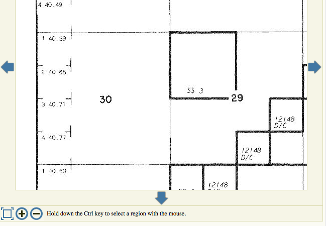
NW4 SW4 NW4 and S2 SW4 NW4 29-4N-3E. 10 acres in the first part. 20 acres in the second part.
No current wells in the section. You can look them up as well.
www.okcountyrecords.com has most of the counties in OK. Other counties usually have their own websites or a service. You can look up your ancestor’s name on there and see what digital files can be found. Easy to look, you have to pay a small free to print.
I also found out that someone who I won’t mention their name has signed a lease with Marathon in October 2018. Their family member has the same first and last name but different middle names. The court clerk said that they used a power of attorney to change title. So now I’m going to have to get a court order to straighten this out. I don’t understand how someone could change the title with a power of attorney. It’s going to cost me to do this. Any thoughts on this matter?
I can’t speak on the legal steps needed, but if you are the rightful heir, notify Marathon immediately of the error. You will have to fix the title at the courthouse, but Marathon needs to know as well.
I’ll call them as well, thank you so very much.
You may need a quiet title if the wrongdoer does not rescind.
Thanks for responding. The proof of title will be easy to prove as we have old leases, will, and family members who also received pooling orders from Casiilas. What are the odds that someone else has the same first and last name? The middle name, however, isn’t close. Or who was married to. Her husband also signed one of the leases. This makes me wonder if the person who signed the new lease did know that they didn’t own the rights.
Thanks for responding. I’m still learning.