I am currently under a lease with Englemann Land Services, starting March of 2024. All I know is that the land in question is from the G.V. Lusk Survey, A-484. I don’t have a block number or any other information. Where is this, exactly? How do I go about getting more information on this?
https://gis.rrc.texas.gov/GISViewer/
Type in Leon in the county box. Then use the magnifying glass under Surveys and type in 484 after Abstract A-
You may have meant Luck, not Lusk.
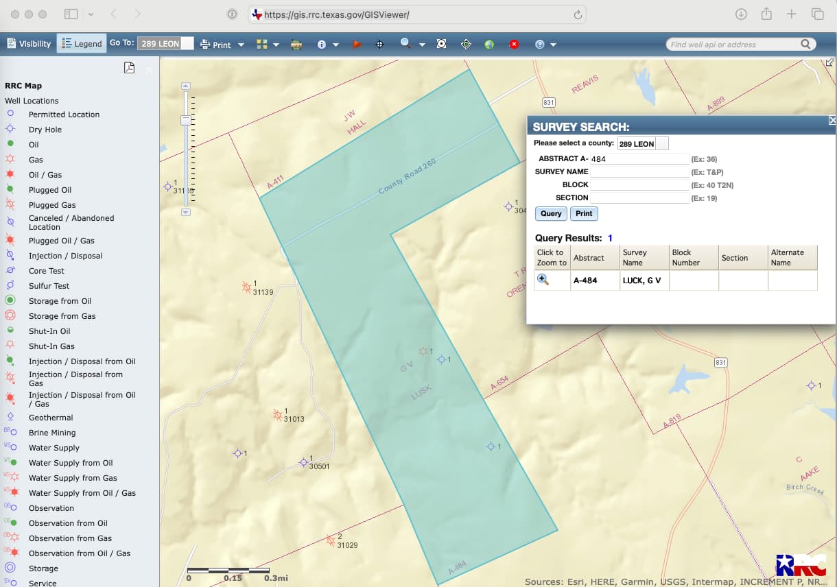
Thanks! I found some lease paperwork that also states the survey as Lusk, and I am seeing that it says Lusk on the map here. Could this be a typo on the district side?
There were some Lusk surveys, but I don’t think they matched your Abstract number. Was there any further info?
Oddly, the map detail above reads Lusk while the survey search shows Luck. May need to look at GLO data.
1 Like
Same discrepancy on GLO. But scanned land grant documents clearly indicate Lusk as original grantee. So typo on GLO and RRC maps. Never seen this before. GLO needs to correct and then RRC will pick up change.
1 Like
You are probably right. Never seen a typo like this before. Make a note in your files to hunt for both names.
Thanks, all for the follow up!
This topic was automatically closed after 90 days. New replies are no longer allowed.