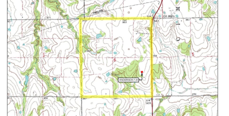
Good day, I have well rigging up today in this section, which is south of my property line, at Section 6, Township 16 North, Range 3 East. I was wondering where I might find some information about the oil company in Section 6, Township 16 North, Range 3 East.
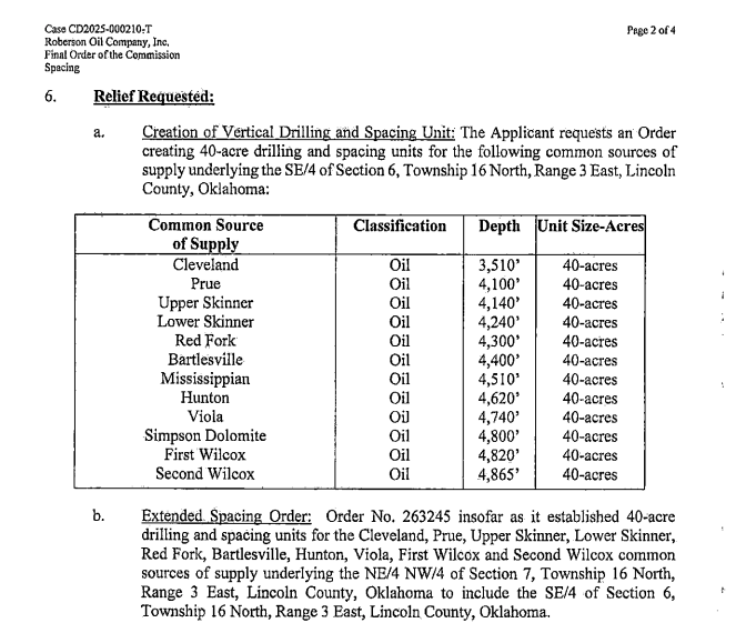
The well is Roberson Oil Company Inc. Anderson 1-6 API 3508124367. The address for Roberson is on the permit.
Here is the permit link. https://public.occ.ok.gov/OGCDWellRecords/DocView.aspx?id=17933098&dbid=0&repo=OCC&searchid=ce8482f1-ebbd-49d2-a4fe-2b589f0ee3c0
Thanks Ms. Barns, I have no notifications of leasing in the sections.
Your acres may not be in the spacing unit for the well. Or you may have old leases that hold the section, so no new leases are required. What is your description?
Northeast 1/4 of Section 6, Township 16, Range 3 East of Lincoln County, Oklahoma. My section has more production than in areas south of me.
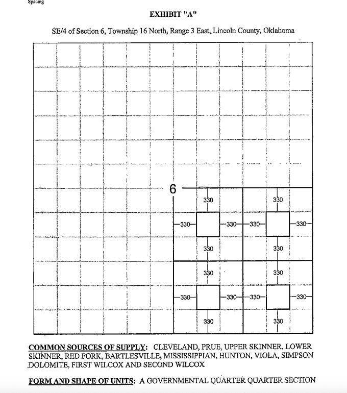
Roberson Oil Company spaced the SE4 separately in case 2025-000210-T Order 747969. If your acreage is in the NE4, then you will not be leased or included for any wells in the SE4 under this order.
Thanks Ms. Barns, I appreciate the information. I have a feeling they will have to drill a saltwater well for the production. I had a straight hold well in 1981 to 2017 that produced around 320 barrels a day of water from the Hunton formation.
Hi M_Barnes, I don’t understand mineral acres at all versus actual acres in our lease. Would you mind giving us your expertise in this area? Our deeds are in Leon and Limestone County. Thanks!
The acres listed on a lease are usually the gross acres of the tract. Usually goes back to a title perhaps as far back as the patent at statehood. Many generations have passed since then and the original grant from the land run has been fractionated into smaller net acre ownership.
1 Like
This topic was automatically closed after 90 days. New replies are no longer allowed.