My brother was told that there are 5 new permits issued on our rights. That’s all he knows and can’t give me more info. We have also received a few offers, suggesting new upcoming activity.
Does anybody know if new upcoming wells or activity is to be expected in Eddy County, in:
The west side of 11 has a rig onsite now drilling to the south into 14. (Coterra) The east side of 11 has surface locations in the northern part of 2 (Mewbourne). 12 has surface location in section 1 drilling through 12 into 13. (Coterra)
Thank you for providing that! Are these new wells? I should have said that we are receiving royalties from Mewbourne and Coterra already. I was wondering if there were any new upcoming wells to look out for. Thanks again.
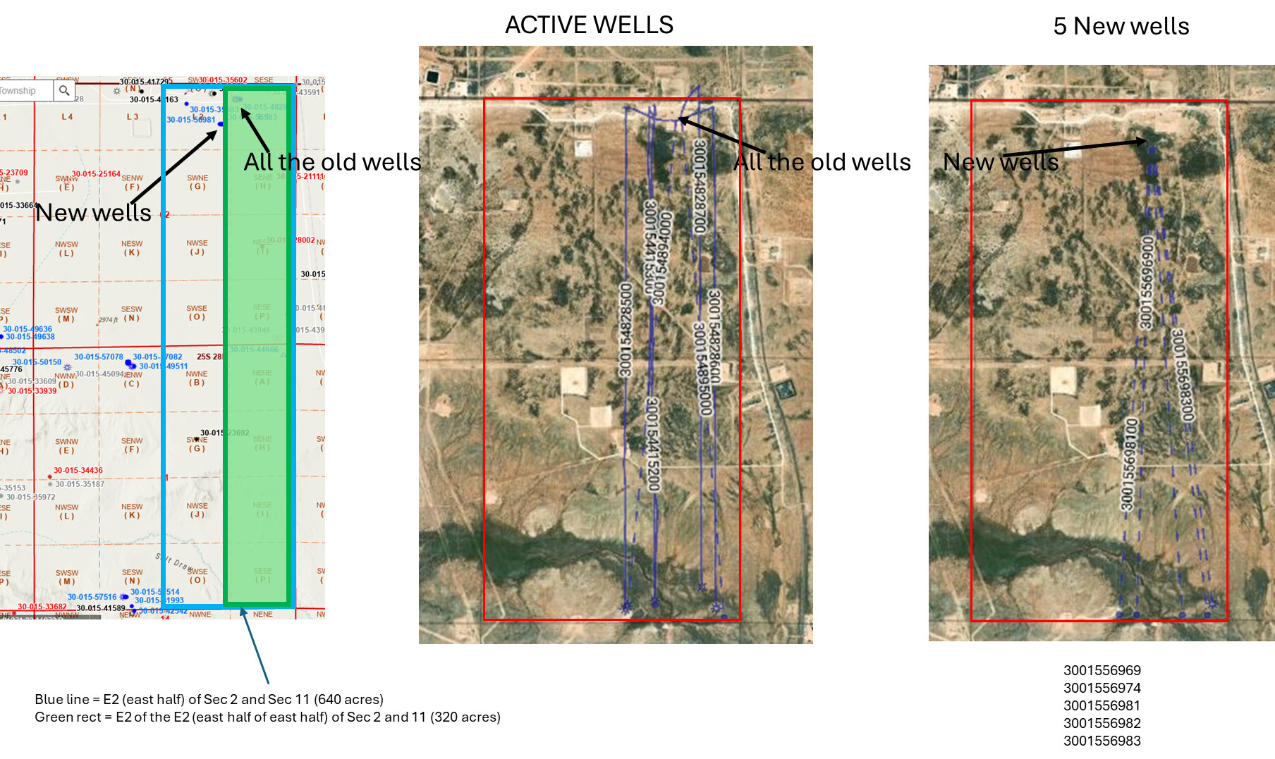
There are 5 more Hoss permits approved in July 2025. I didn’t check zones on them, but 3 of the 5 were in the E2 of the E2 of Section 2/Township 11 so those at a minimum should be in your acreage.
Laugh. Well this is the kind of attention to detail one might apply if one’s well decimal started with 5 zeroes. All of those wells have spud. They are all BoneSpring wells.
@M_Barnes & @NMoilboy - Ok, I must be missing something. Because our sections are
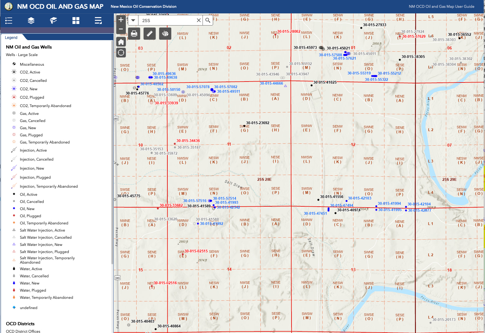
Section 11: SENE (“H” on the map)
Section 12: SWNW + NWSW (“E” and “L” on the map)
When I look at those sections on the NM GIS map, I don’t see any wells IN those sections. Would either of you help me understand what I’m missing here? I’m truly lost.
The GIS map does not show the laterals (the horizontal part of a well), just the surface location as a dot. So it, sadly, is a really bad way to look at horizontal wells. You’d need to find the well API dot and then scroll down to hit “well details” to go to the NMOCD page that has more info.
I will confess that I pretty much never use GIS map unless I am looking up a lease outline, but I have access to better subscription services. So I don’t necessarily have a better suggestion for you.
Here are some maps. Maybe helps, maybe doesn’t. GIS Map and then a map from subscription service showing horizontal laterals. The E2 of the E2 of Sec 2 and 11 would include LOT H (SE of NE).