Can anyone tell me who is shown as current mineral owners of the well described above? It is currently operated by EOG. Thanks, Jim
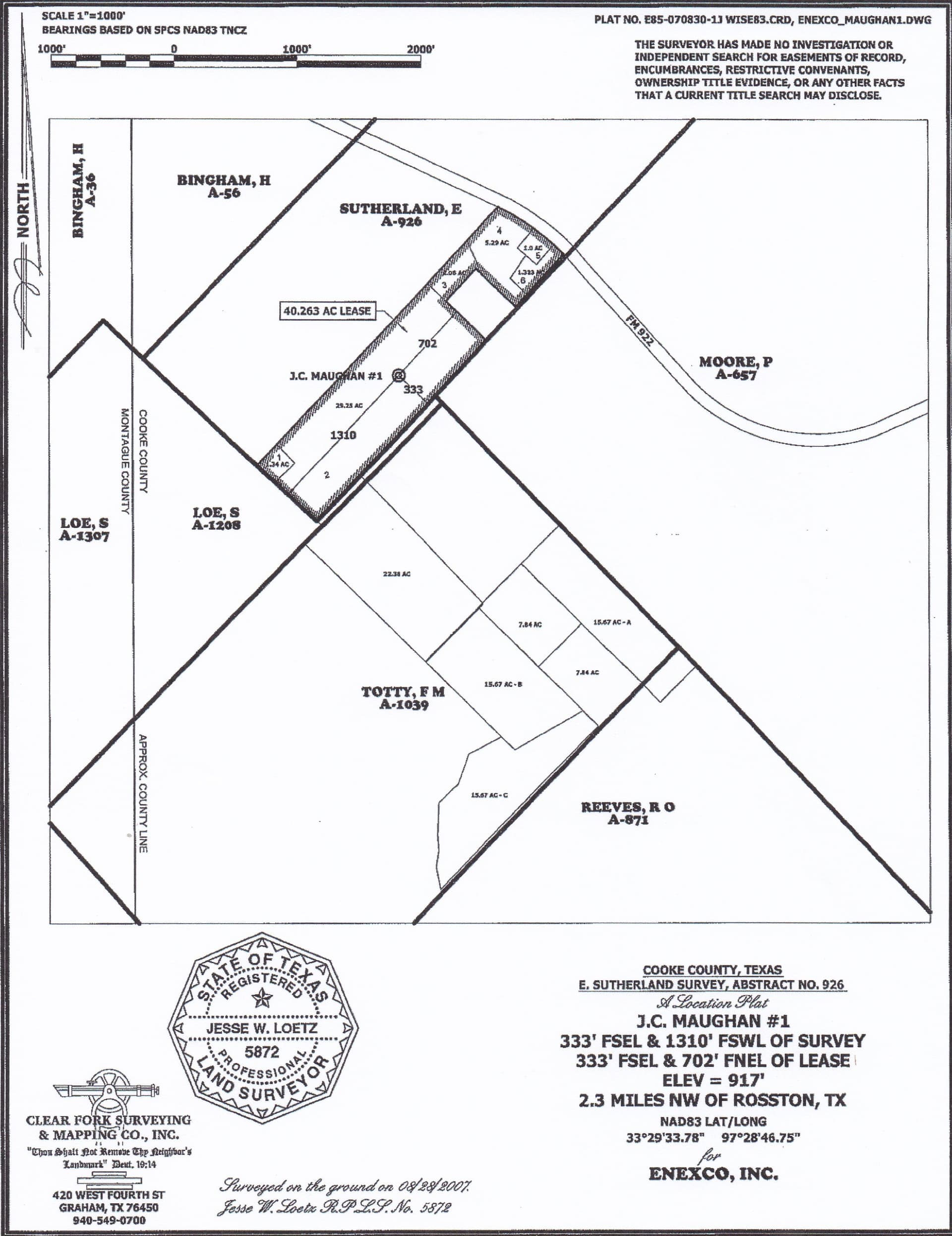
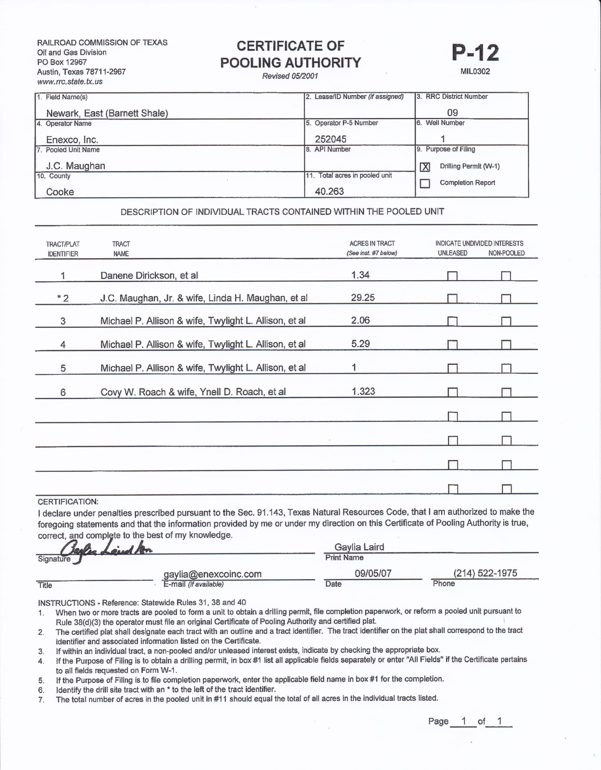
Below are the unit plat and the P-12 showing the ownership makeup of the 40 acre unit in 2007 when the well was permitted. Determining the current ownership interests would take some research in the deed records since things may have changed in the last 15 years.
That well is only 1/2 mile from Montague County but just to the east in Cooke County.
Last production EOG reported from it was in May 2020.
Where did you get your unit plat map from? I am in a pooling concern and I’d like to see our unit plat map. It is not detailed like this in the pooling document I have. How do I obtain one like this that shows how much each owner has?
Permit plat and P-12 are among documents filed by oil company to get well approval. Available on RRC website under Queries and then Permits. The owner name under each tract is most often the largest undivided interest in the tract, and there may be dozens of other smaller owners. Once a well is producing, all the mineral owners will be individually taxed by the county. Those names and addresses are public information, although it will take some work to assemble the full list. That is how mineral buyers know how to contact royalty owners with offers.
A preliminary plat is filed with the Railroad Commission as part of the drilling permit application. The application also includes a P-12 form showing the ownership breakdown. They sometimes seem to show surface ownership rather than the actual mineral interest breakdown in the well.
On horizontal wells the path of the lateral often varies some from the proposed route that was shown in the original plat. After the well is completed the operator files another “As Drilled” plat with RRC showing the actual path of the horizontal leg.
Below is a link for RRC’s Online Research Queries. Go to the Permits section, select the County, put in the lease name and at the bottom of the page enter a general time range when you think the well was permitted. When you find the permit go to the second page and there will be a list of attachments at the bottom that should include the plat and the P-12 form.
https://www.rrc.state.tx.us/resource-center/research/research-queries/
This topic was automatically closed after 90 days. New replies are no longer allowed.