If one looks at the permit for a well (329 38967) drilled in Abstract 1451 in Midland County, Texas on the RRC site and the permit lists an acreage of 80 acres, is that what is referred to as the pool size? Is this defined as a circle centered on the well comprised of that many acres? Since that circle has a radius of 1053.2 feet and the well is drilled 475 feet from Abstract 1380, does that mean that a person who does not own mineral rights in A-1451 but does own mineral rights in A-1380 is entitled to royalties on the well? What percentage of the generated revenue falls within A-1380? What is the best way to get on the pay list for the well?
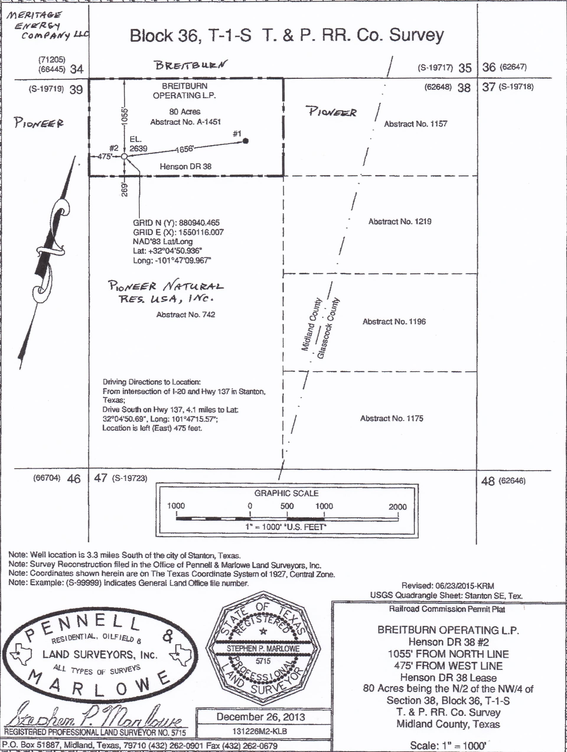
Below is the plat Breitburn filed when they applied for the permit to drill the well you referenced. The pool or unit includes 80 acres but rather than being a circle around the well the 80 acres is the area within the boundaries of Abstract 1451.
I expect a document legally establishing those same boundaries for the unit is also recorded in the Midland County deed records.
The API number you posted was the second well drilled in that unit, and it may have been completed in four formations, or fields, Spraberry, Upper Strawn, Mississippi and Atoka.
When the drilling permit was approved RRC granted Breitburn exceptions to the normal survey or the lease line spacing requirements. Pioneer who the plat shows held the lease at the south boundary of A-1451, 269’ from where the well was drilled, was the only operator that had to be notified and given an opportunity to protest RRC’s approval of those exceptions. Apparently they didn’t elect to contest their approval.
This topic was automatically closed after 90 days. New replies are no longer allowed.