Here is some sort of a map. A number of 2018 wells drilled and coming online in Section 17 and 18. Wells drilled in Section 9. Nothing really yet in 3, 4, 11. It’s a good horizontal area.
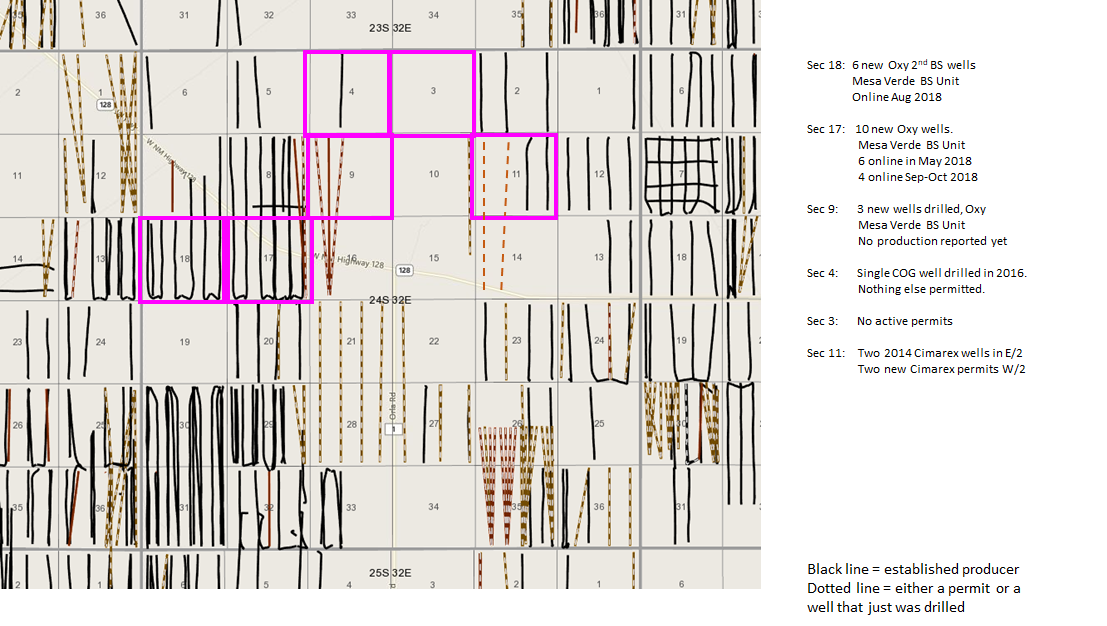
Thank you for the map and feedback, NMoilboy. I’m learning about this and gathering info on the fly. This area looks very productive. That’s great to see.
I am trying to determine any activity in T25S Sec 6 Sec 38E and T10S, Sec 8 R38E. Any help would be appreciated. Our interest in T25S is so small I am worried we were not leased. Thanks
Susan, sorry, not much/any activity there. The far Eastern portions of Lea are not in the Delaware Basin, and thus don’t have the horizontal targets that have been driving the activity.
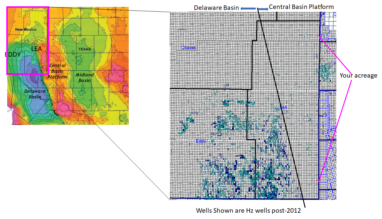
Thank you. Did you notice anything for 10S Sec 8 R38E? Is that also far Eastern? Thanks so much.
Received checks this week from Apache and Oxy for Section 12 & 13, Township 24 South, Range 36 East. What’s going on there?
Susan 10S 38E is the northernmost arrow in that map above. Also right on the New Mexico/Texas border and in the Central Basin Platform (not Delaware). Nothing going on there either.
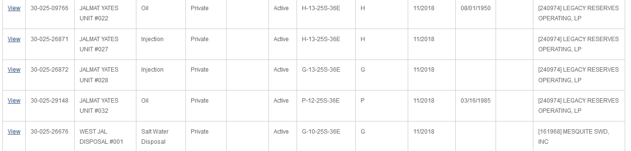
Nothing new, Vivian, all old wells you’re being paid on it looks like. Use the below link to look up your wells by Section, Township, and Range.
http://ocdimage.emnrd.state.nm.us/imaging/WellFileCriteria.aspx
Thanks for answering. Are new wells ever drilled on old sites? And I have another question. I used to get royalties, tiny ones, from Range which became Vanguard, which I guess went bankrupt, judging by all the paperwork I received. How do I know the status of that situation? I guess look at the map, right?
I saw several wildcats listed in the Midland newspaper: Section 30, Township 24 South, Range 33 East; Section 30, Township 24 South, Range 33 East; Section 3, Township 24 South, Range 33 East, all EOG; and Section 9, Township 25 South, Range 35 East, both COG. Is that close to us?
Susan,
Maybe this provides a little context on where the various Townships are located. Same map with a hastily created “scale” on it along the N/S and the E/W edge. The Township # gets larger the further South you go, the Range # gets larger the further East that you go. Red arrows, as example, show where 24S 33E is located. Those COG wells are in the heart of the horizontal development areas in the Delaware.
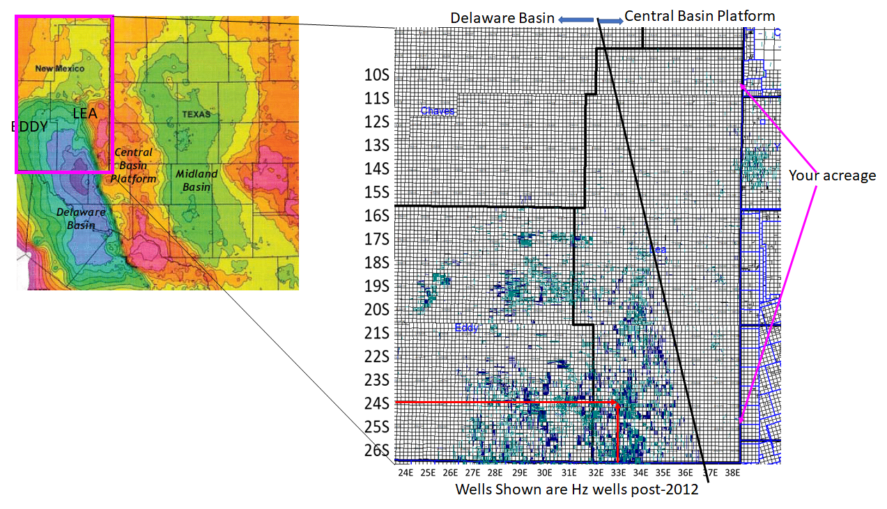
So our 25S Section 6 38E is outside the “hot zone” and Township 10 South way out. Won’t make my fortune there!
Thanks for posting this graph. We own many ORI interests in 23S, R31E and 24S, 30E, Eddy County and 25S, 32E and 26S, 32E, Lea County.
You are welcome. Though based on those locations it would appear that you should be able to afford a map ![]()
We have some acreage in Sections 23, 26, and 35, Township 19S, Range 35E. There have been a number of wells staked within a mile of this area since November 2018. We are trying to determine what a leasing bonus would be for this area. Any help would be greatly appreciated.
Likewise. We are in the same area with our holdings in Section 23. Latest lease offer was $4,000/net mineral acre.
Thanks for the reply. Did you receive this offer recently? Was it for a three-year lease with 1/4 royalty? FYI, I am not a landman or lease broker. I work with a company that owns a small interest in 1280 acres in these sections via an old deal purchased many years ago. They are looking to sell their interest.
1 Like
Offer made verbally today. Three-year lease, 1/5 royalty.
Thanks. We received an offer of about $720.00 per acre about six weeks ago from the controlling partner in our deal. We are 3.0% working interest owners with an 85.5% NRI, and 6 old, but still profitable, vertical wells. We did not take it. Sounds like it might have been a bit low.