These Texas RRC data accessibility tools are new to me even though it looks like they may have been introduced several years ago.
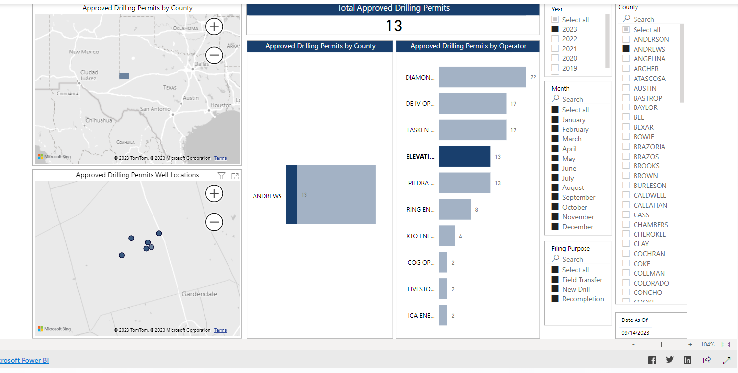
The Approved Permitted Wells data visualization resource webpage allows one to find permitted wells and have them projected on a map. In the attached screenshot, Andrews County is the chosen area with all the wells permitted by Elevation Resources in the year 2023 shown.
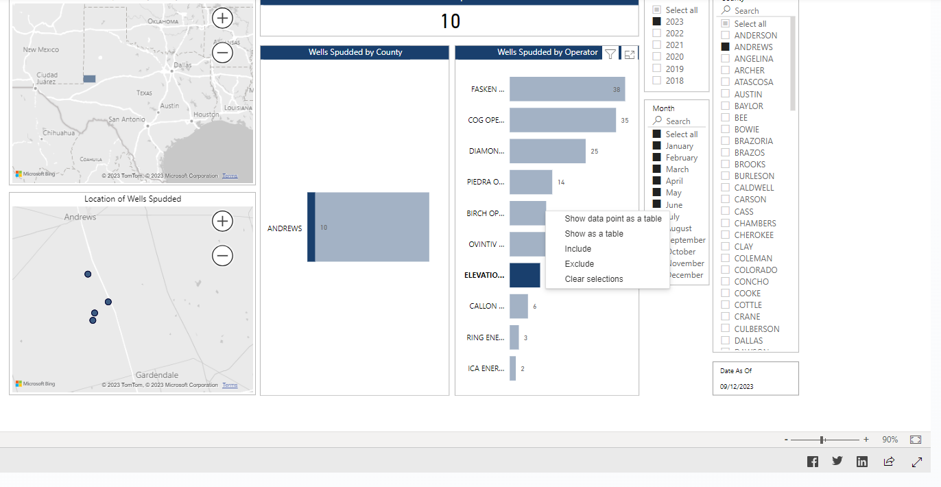
The same county, timeframe, and operator are shown in the screenshot from the Wells Spudded data visualization resource
[scrnli_9_23_2023_11-41-59 PM.pdf|attachment](upl