I have mineral rights in Pecos County Block C-4 Sections 42, 50, 52 and 54 all West half (W/2). Attempted to locate on the RRC GIS and failed to find them to determine if any activity is going on. Can anyone help?
@Fletcher_Bishop, please see map of the area you described below. At least from the RRC map, it doesn’t look like there is much activity in the area.
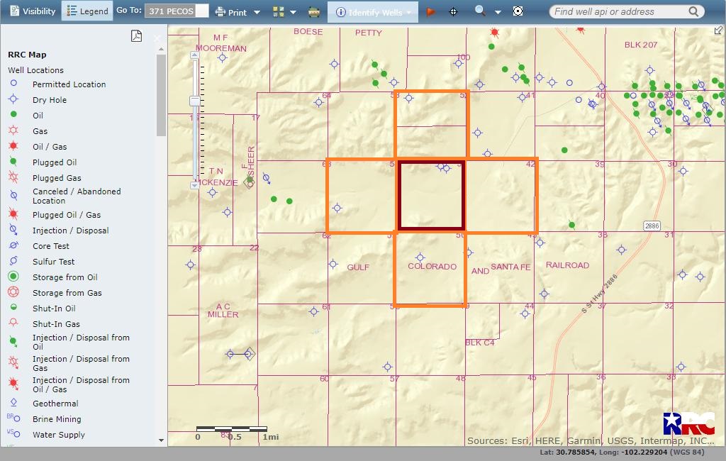
Also, if you want a little walk-through of how to search yourself in the future: Go to: select county, scroll to Pecos. Then, click on the magnifying glass and select Surveys. Then, in Block type C4 and in Section type 42. Then click Query. If it gives you multiple options (as in when there are multiple surveys with the same lot and block), then you click on the ‘click to zoom to’ magnifying glass until you find the right one. Hope that helps!
1 Like
This topic was automatically closed after 90 days. New replies are no longer allowed.