Is there any way to find out which formation was drilled on a well completed in Reeves County called the State Desert Gold Unit. I believe it came on in February 2019. There are at least two productive zones in the area, one the Woodford and the other the Barnett. The well is located in Block 13, Section 14. Thanks
Hi thomasgray, the api for the State Desert Gold Unit well appears to be 42-389-37557. It is in A-4777 & A4778. API depth is listed as 9349 ft, with total depth of 16000 ft. Attached chart from form SWR13 which shows the formations in the area and their approximate depths. DesertGolddrillingPermitDetailAction.pdf (15.5 KB)
State Desert Gold(Exploratory Test Well)API 389-37557 was completed in January 2019…Drilled by Apache Corporation into and producing from the Alpine High formation… http://webapps2.rrc.state.tx.us/EWA/drillingPermitDetailAction.do?methodToCall=searchByUniversalDocNo&universalDocNo=492042243&rrcActionMan=H4sIAAAAAAAAAMVQy2rDMBD8mvRiEJJsB-ewB9O4vRTaxqY5mBwUWzgCv1jJtAV_fFcuhTx6bk8azY5GszMLzkHOggsQd4hVWjkz9LsK65IfYOHf9VGNo5WMxsw65TRzH2yyqzBNOCkkrORDtk8Jhh7WaNrW9M2Lxs44-zpp_Py2ZfVAogg67U5DXQz3qm2JiAG1m7AvhlwrrE5EJcBv0pR2mabYWDYqVN2baie9hKSPeeLPCMJk40EMR92Y3u6N835keHnfQF6kRRZsszzbFcHj89M28NvKS50497lKJP6uH_vTyxpG1Wg82__XssShvNb5sCBmCYLPIYEI-BzTuSbi9vV_V_0FFfIMspcCAAA
Production Data on Lease # 287911/Well # 101AH… http://webapps2.rrc.texas.gov/EWA/specificLeaseQueryAction.do?tab=init&viewType=prodAndTotalDisp&methodToCall=fromGisViewer&pdqSearchArgs.paramValue=
Completion Report on State Desert Gold Well #101AH/Toward the bottom of the page on this report you will find the formations that were encountered during the drilling of this well. The Woodford(Alpine High) was the targeted formation.
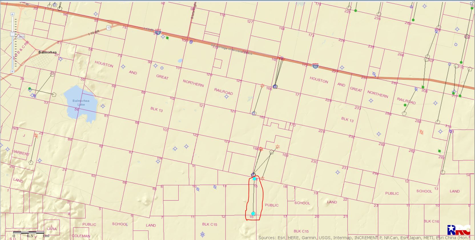
Left click on map to enlarge. State Desert Gold Unit 101AH circled in red.
Thank you.[quote=“Clint_Liles, post:3, topic:62834, full:true”] State Desert Gold(Exploratory Test Well)API 389-37557 was completed in January 2019…Drilled by Apache Corporation into and producing from the Alpine High formation… http://webapps2.rrc.state.tx.us/EWA/drillingPermitDetailAction.do?methodToCall=searchByUniversalDocNo&universalDocNo=492042243&rrcActionMan=H4sIAAAAAAAAAMVQy2rDMBD8mvRiEJJsB-ewB9O4vRTaxqY5mBwUWzgCv1jJtAV_fFcuhTx6bk8azY5GszMLzkHOggsQd4hVWjkz9LsK65IfYOHf9VGNo5WMxsw65TRzH2yyqzBNOCkkrORDtk8Jhh7WaNrW9M2Lxs44-zpp_Py2ZfVAogg67U5DXQz3qm2JiAG1m7AvhlwrrE5EJcBv0pR2mabYWDYqVN2baie9hKSPeeLPCMJk40EMR92Y3u6N835keHnfQF6kRRZsszzbFcHj89M28NvKS50497lKJP6uH_vTyxpG1Wg82__XssShvNb5sCBmCYLPIYEI-BzTuSbi9vV_V_0FFfIMspcCAAA
Production Data on Lease # 287911/Well # 101AH… http://webapps2.rrc.texas.gov/EWA/specificLeaseQueryAction.do?tab=init&viewType=prodAndTotalDisp&methodToCall=fromGisViewer&pdqSearchArgs.paramValue=
Completion Report on State Desert Gold Well #101AH/Toward the bottom of the page on this report you will find the formations that were encountered during the drilling of this well. The Woodford(Alpine High) was the targeted formation.
Left click on map to enlarge. State Desert Gold Unit 101AH circled in red. [/quote]
Thank you very much.
This topic was automatically closed after 90 days. New replies are no longer allowed.