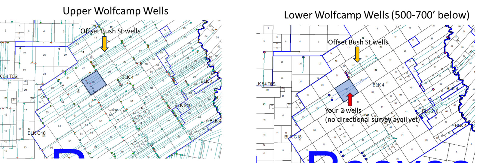
We were recently surprised to find that our operator drilled 2 new horizontal wells almost exactly under 2 older wells. The originals were 8,000’ laterals at a depth of about 10,500’. The new wells start from the original well pads and extend about 12,000’ at a depth of 11,000’. These are Wolfcamp wells. From the Texas RR GIS, both appear to be nearly exactly underneath the originals rather than a “wine rack” location used by other operators.
Given that the bottom of the Wolfcamp is a depth of about 15,000’, there might be room for many more.
Cristoforo Colombo (the patron saint of serendipity) would be proud.
I too have Wolfcamp wells, however it sounds like you have longer experience with them. When were the vertical wells dug? One thing for sure I am going to make it a habit to keep close eye on what the RRC is showing because of the numerous horizontal wells going in several locations.
Interesting. Have you looked at your as-completed survey plats to precisely dimension areal spacing? How many years apart are these parent-child wells? I’d be curious to look at your spacing if you want to give your API numbers. I’m also in Reeves County, obviously reserves vary by location. In my part of Reeves, Bone Spring 3rd approx 9,500’ deep might be half as productive as upper Wolfcamp. Wolfcamp A 10,500’-11,300’ is richest, Wolfcamp B 11,300’-11,500’ is second best. Wine rack spacing drills top & bottom of Wolfcamp A thus draining the top of Wolfcamp B. Wolfcamp C 11,500’-11,700’ and Wolfcamp D 11,700’-12,300’ are said to be gassy & there are no lower Wolfcamp offset wells anywhere near to compare.
This may or may not be useful. Here are two maps. On the left is what I would call the upper Wolfcamp wells in the area. What currently exists on your acreage. I would call those WC A wells, but that’s semantics. On the right is the deeper WC wells (like you say, 500-700’ deeper), I would call those WC C but maybe B or whatever. Far fewer deeper wells but a number of them being drilled in the area under the WCA wells. Production results just north of you look similar to the WC A wells. Ok oil, lots of gas.
You’d think that eventually the map on the right will look like the map on the left. 500-700’ is maybe enough vertical separation between the two zones to avoid any frac hits or shenanigans, but I still don’t think I’d tell folks to drill directly beneath the WC A wells. But shrug. I’m also not looking at a log for frac barriers.
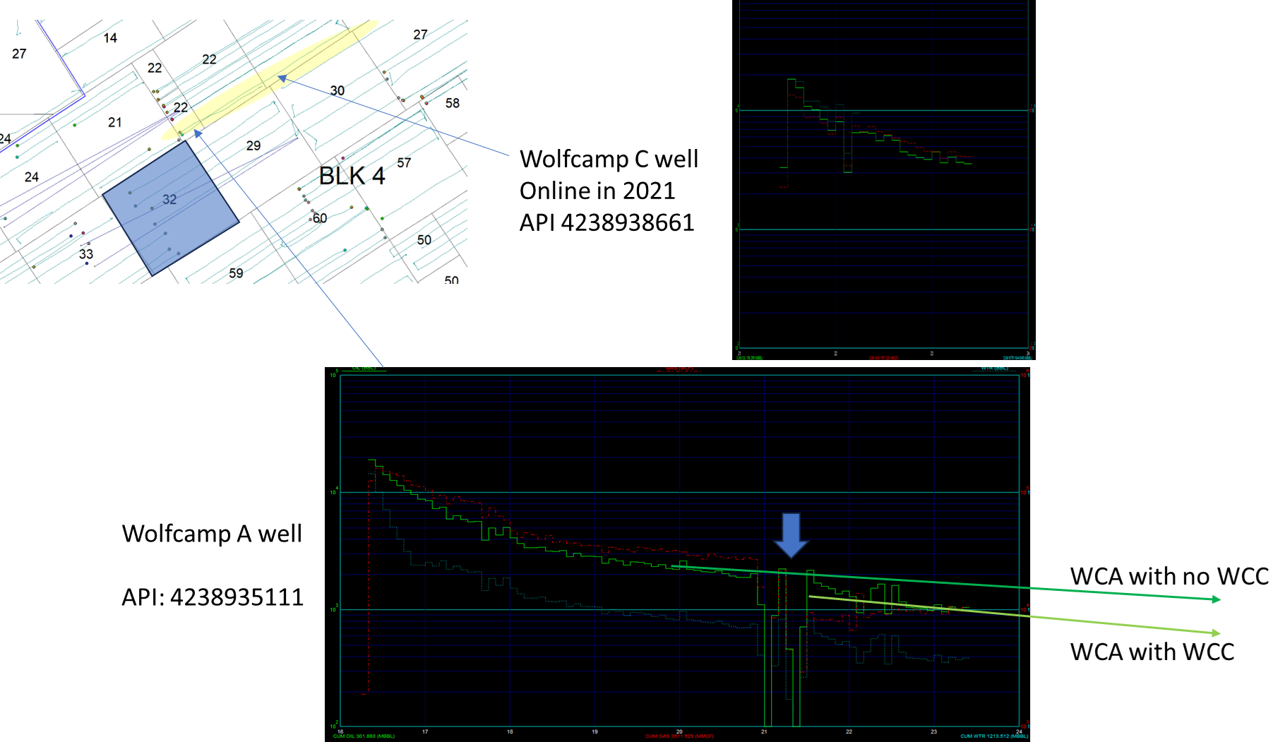
It sure looks like in the unit right next to that drilling and fracing a lower Wolfcamp well under an older upper Wolfcamp well made the older well lose reserves. See below. Lots of ways to draw a line through a single data point. If your wells are already online then I guess you may already know how things are going, public production info lag means it’s not apparent to me.