Susan,
This is the plat map of the lease.
http://webapps.rrc.state.tx.us/dpimages/img/3500000-3599999//PR0003547671_0001.pdf
Link to approved drilling permit for well 389-35900:
These attachments are at the bottom of every approved drilling permit. After clicking on the approved permit link scroll all the way to the bottom and click on plat #1/Ligon 730-19-4305H Plat.pdf to view plat map.
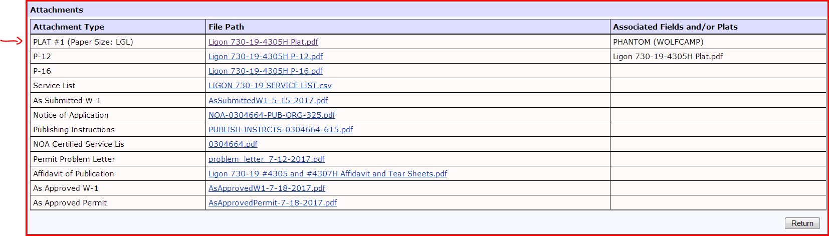
DOUBLE LEFT CLICK TO ENLARGE DOCUMENT When you click on the P-12 it will show that you own 80 acres of minerals in this lease.
Clint Liles