I am new to the whole oil and gas thing. I own royalties in Beckham County, Oklahoma. I recently got a printed list of all the wells that have been drilled and are producing in the sections etc that I own. There is one company listed that I do not receive a payment from. It is drilled in the same property description as another well that I do get paid on by a different company. Is this something that I should look into?
Welcome to the forum. Yes, you can contact the one company and ask their Division Order department why you are not in pay. If you want to list the name of the well, I can check it quickly to see if it is still online or if it sold recently to someone else.
It’s Carlson 32-11-25 9H. I’m showing Riviera Resources as the payor. It is located in Township 5-10W-25N.
I am receiving payments on Carlson 32-11-25 12H under the same land description from Latigo.
It is producing according to Drilling Info. Riviera Resources was listed as the operator. Not much gas, but a little. Latigo Petroleum has the other horizontals in the section. I checked the OK tax site and don’t see it, so that is interesting. LINN Operating had it, then Riviera. API is 3500921923. I would think that Latigo would have bought it, but I do not see the form 1073. Here is their permit info.
| Operator Name: | RIVIERA RESOURCES | TD: | 10,965 ft | Name/Title: | |
|---|---|---|---|---|---|
| Lease Name: | CARLSON 32-11-25 | Received: | Phone: | 4052412237 | |
| Operator Address: | 717 TEXAS AVE STE 2000 HOUSTON, TX 77002-2854 | Issued: | 10-02-2013 | Type: | H |
2 Likes
I also have one other question. What are the chances of lithium being sought after out in western Beckham County in the future?
Most of the lithium interest is over in the Smackover of E TX, Arkansas and Lousiana right now.
Is there a chance for it to ever move this way?
That reservoir does not exist in far western OK. Other reefs do. The lithium is extracted from either the oil and gas stream or from a brine aquifer. In OK, the brine aquifers usually belong to the surface owner. The produced water usually belongs to the operator, so unless a mineral owner reserves the lithium in the original lease before drilling, they will not get the right to it-my general understanding. Laws keep changing by state, so this may be up to the legal folks to determine.
Ok. Thank you so much. Reason I was asking is I am in the process of potentially selling a few of my rights that are not producing much anymore and they mailed me a deed to look over and I noticed that they specifically stated “including and prospective or potential lithium. That just made me curious.
It is possible that it is over in Beckham, just not where a lot of folks are focused right now. They are trying to cover their bases for the future.
I don’t mean to interfere in your post but we have never gotten a printout of all wells drilled and producing in the Sections like you say you have gotten or had anyone volunteer to look at our wells online. I have tried using the tools suggested but am not savvy at it and cannot find the information on the maps. I have been a part of this forum for several months and have learned so much. Any suggestions on how to get this information you have been able to?
SHeath, Where are your minerals located and I can point you toward the tools for your state and county.
Thank you. I have already tried the tools; I cannot figure it out. It’s JY Aguilera Survey A-2 Freestone County, Texas. 201.6 acres (my share 22.6). E US Highway 84 Fairfield, Texas.
That survey is huge and has many wells. You need a more distinct description for the tract to figure out if any wells are on your acreage. You can see the large abstract on the TX RRC site. I can see a few wells along Hwy 84
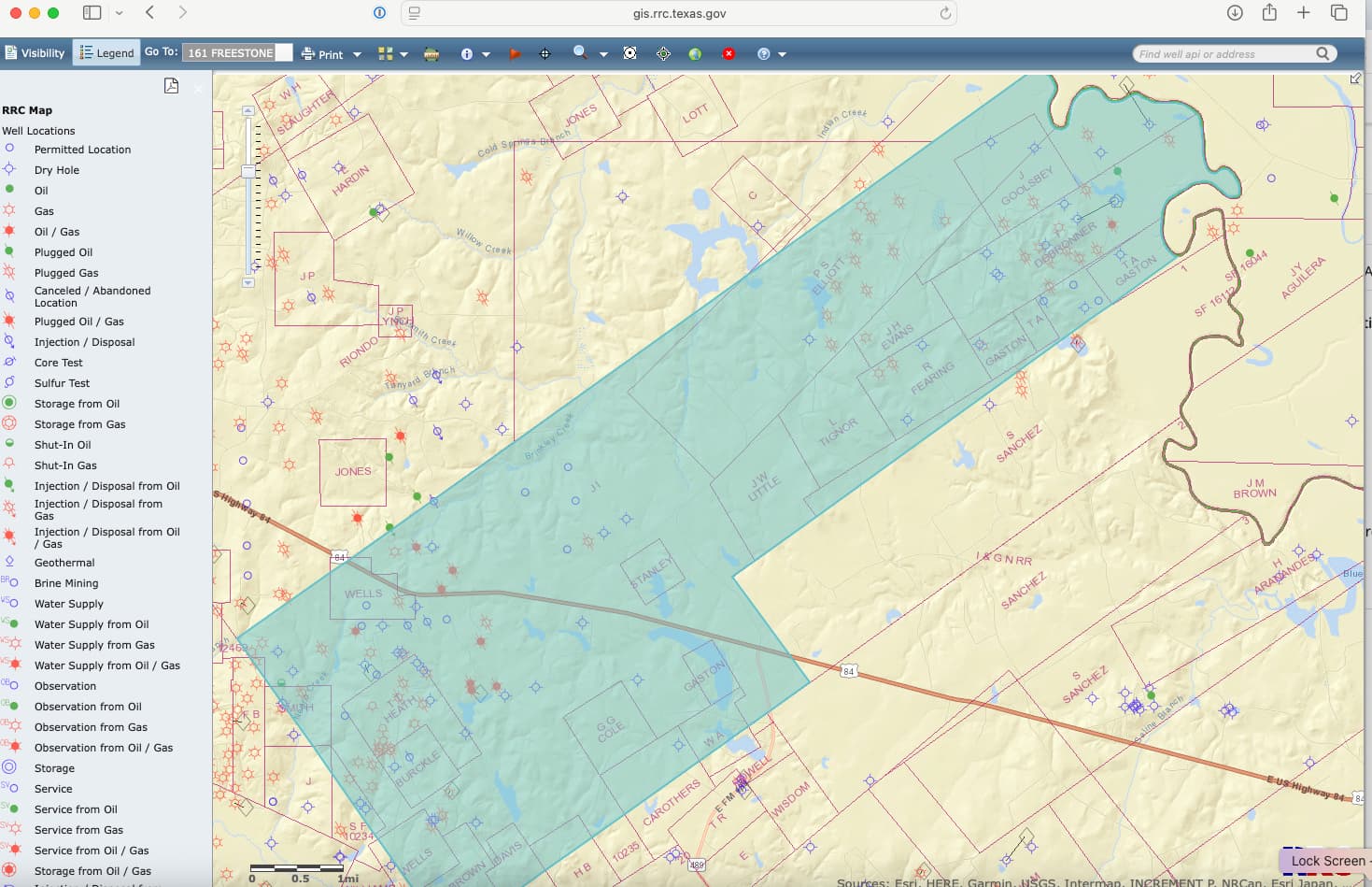
I have seen the mention of “blocks”, in Texas at least with our NMAs, they are called tracts. JY Aguilera Survey A-2, tract 1… 160.00 Acres tract 2 …41.6. Subdivision name JY Aguilera E US Highway 84 Fairfield Texas That is all the information I have.
The Block is the larger parcel made up of Abstracts which are similar to a township in other states. The Blocks and Abstracts in Texas are tied back to the original Land Grants from Spain. “Tracts” are even smaller sub layers and can have many different definitions from a tract in a subdivision of a city or “someone” just randomly named a set of acres tract 1, 2, 3, etc. Without specific information with the metes and bounds descriptions, it is hard to narrow yours down without a complete title search in the county courthouse back to patent at statehood (or perhaps from an old will probate).
Are these possibly a description of the measurements and angles to get to the specified number of acres? Could be in feet or in rods, and mention turns at points where there is a post or a tree, etc. That would be a metes and bounds description of where each tract lies within the larger survey. It should be detailed in your deed or the deed of your predecessor.
This topic was automatically closed after 90 days. New replies are no longer allowed.