I have been perusing a lot of these threads in an attempt to learn more.
I received a letter in the mail, completely out of the blue, from a genealogist in Norman informing me I owned 5.575 net mineral acres in the above sections and offered me a sum to sell, within 30 days.
I didn’t know anything about these rights, and I don’t know enough to make an informed decision. I don’t even know what it is I really own. He did explain to me that I don’t own surface rights; those were severed about 70 years ago, but the mineral rights were retained and passed down after members in the family had passed on.
Is there a person I can hire to tell me what it is I own? Or a geologist that can perform a survey? I’m not going to sell without knowing what I have. I didn’t even know I inherited this, so the money wasn’t being planned on.
I don’t know if there are wells on the property, or if they are active, or if this is natural gas/fracking. Maybe a combo of all.
I will keep reading these forum threads; there is a lot of very good information being posted here. If anyone knows anything about these sites and can post anything, I would appreciate it.
First of all, very good approach: not doing anything until you get informed and are armed with the appropriate knowledge and details.
Did the genealogist provide you any insight as to how you inherited the acreage - from whom, when, etc.?
Do you have any insight as to whether you are leased/opened? And if leased, what the terms are?
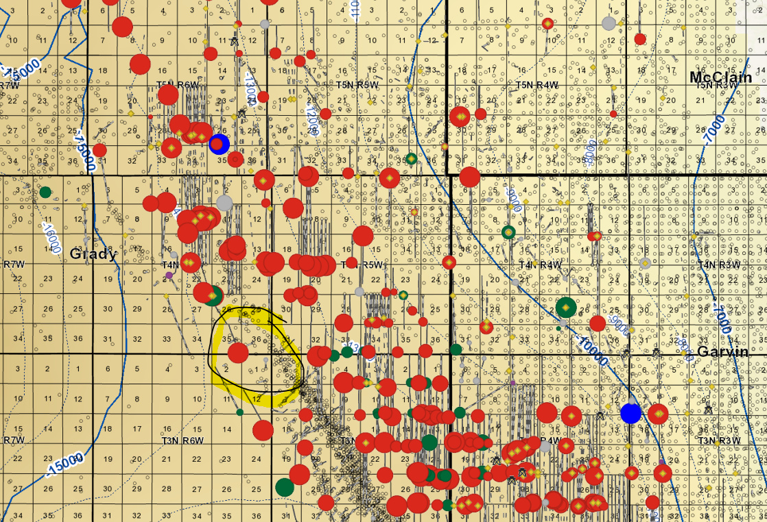
The 4N6W acreage is on the southwestern edge of the SCOOP play, west of CLR’s Springboard play (Blue circles = Miss/Meamec, Red = Woodford, size is relative to first 6 months BOE, blue depth lines are the top of the Woodford).
The genealogist works for a company called Lost Legacy. He had all the exact names, dates, deaths exactly right, going back to 1995. He has the correct information and knows which wills were probated, etc.
I thought it weird that an oil company would have a genealogist be involved in deals. I understand using one to track families and inheritance but thought it weird they would use one to offer money for rights. The oil company is called White Harvest out of Bartlesville.
I don’t know anything about whether there is a lease or if it’s opened or if so what the terms are.
Tracking down heirs is a key to getting the title straight. Interesting that they have a ‘genealogist’ as well—typically a landman does the same thing… might be a self-imposed title to make them sound legit/important.
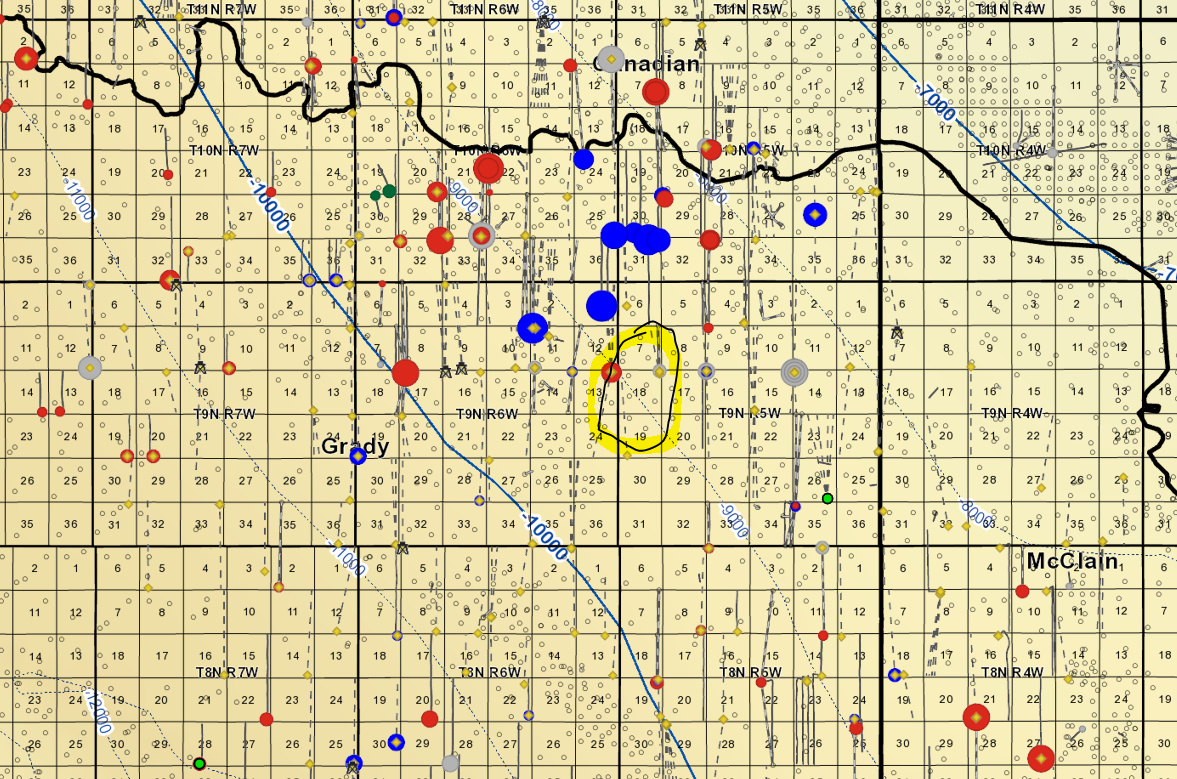
On your 9N5W acreage—there’s a multi-section well going from Section 19 into Section 18, so they probably worked backwards from the regulatory filings. Linn (now Roan) went through the regulatory process in late 2017—the well was drilled/completed in July. Attached are some of the regulatory orders for the section. If you look through Exhibit A you might find your relative.
Another thing you may want to do is check the lost property on the Oklahoma Treasurer’s website and search for your relative’s name. If there was production on the acreage, you may have royalties sitting with the treasurer.
If you want, PM me your relative’s name and I can look through my title info to see if I can find any lease info, etc.