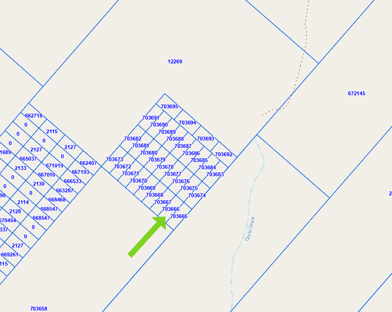
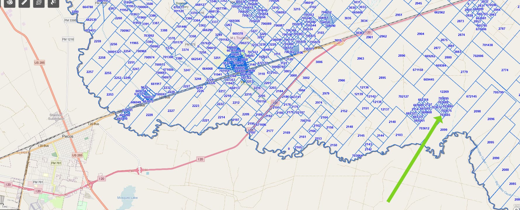
Looking to get some help locating property in Ward County.
Tract # <" Legal Description W703651-- H&TC-- H&TC, Block 33, Section 28, S1/2 Lot 47 Abstract, 28- Block 33
W703652-- H&TC-- H&TC, Block 33, Section 28, S/2 107 48 Abstract, 28-L Block 33
It is two properties with a combined acreage of 10.20.
Here is a more precise description:
Lot 47:
LEGAL DESCRIPTION FOR LOT 47 A +5.10 ACRE TRACT
Being a tract of land out of the South Half (S/2) of Section 28, Block 33, H&TC Ry. Co. Survey, Ward County, Texas, and being more particularly described as follows:
BEGINNING: At a point 2,061.70 feet N 40° 00’ 00" E and 1,815.15 feet N 50° 00’ 00" W from the south corner of this tract, and also known as the east corner of Lot 45;
THENCE: N 40° 00’ 00" E 538.56 feet to the east corner of the lot;
THENCE: N 50° 00’ 00" W 412.50 feet to the north corner of the lot;
THENCE: S 40° 00’ 00" W 538.56 feet to the west corner of the lot;
THENCE: S 50° 00’ 00" E 412.50 feet to the Point of Beginning at the south corner of the above referenced lot and containing 5.10 acres of land, more or less.
All sidelines of this property are subject to a 10-foot access easement.
The foregoing description is based upon metes and bounds data provided by the owner, the Texas Railroad Commission, Texas Natural Resources Information System, and the Texas General Land Office, and has not been surveyed as of this date.
LOT 48:
LEGAL DESCRIPTION FOR LOT 48 A 5.10 ACRE TRACT
Being a tract of land out of the South Half (S/2) of Section 28, Block 33, H&TC Ry. Co. Survey, Ward County, Texas, and being more particularly described as follows:
BEGINNING: At a point 2,061.70 feet N 40° 00’ 00" E and 2,227.64 feet N 50° 00’ 00" W from the south corner of this tract, and also known as the west corner of Lot 47;
THENCE: N 40° 00’ 00" E 538.56 feet to the east corner of the lot;
THENCE: N 50° 00’ 00" W 412.50 feet to the north corner of the lot;
THENCE: S 40° 00’ 00" W 538.56 feet to the west corner of the lot;
THENCE: S 50° 00’ 00" E 412.50 feet to the Point of Beginning at the south corner of the above referenced lot and containing 5.10 acres of land, more or less.
All sidelines of this property are subject to a 10-foot access easement.
The foregoing description is based upon metes and bounds data provided by the owner, the Texas Railroad Commission, Texas Natural Resources Information System, and the Texas General Land Office, and has not been surveyed as of this date.
Any help would be greatly appreciated. I’ve been trying everything I can to no avail.
Thanks!