Hello, I hope someone can help me because I am well below novice level!
I found a mineral deed with this description for Presidio County:
Section 46, Block 1, Certificate 1/657, T & P Railway
It was in my grandparent’s name. I don’t know if this has been drilled on, or is still sitting there. How can I find out? Is there a site? One that is easy to use for the layperson?
Thanks in advance!
Lisa
Lisa the nearest thing that I find was back in 1979-1983 Gold Fields Mining Corp did numerous core tests about 20 miles SE searching for gold in the mountains/hills and that was in Blocks 6, 7, 8 and 23.
Thank you for this information. It is interesting to see what has gone on in these areas that we cannot really go look at! I really don’t even know if this deed I have is valid anymore. It is from 1927. Probably doesn’t make much difference. My grandparents bought in a few counties back in the 1920s, and some are actually producing a little! But I guess there isn’t gold in that area of Presidio County!
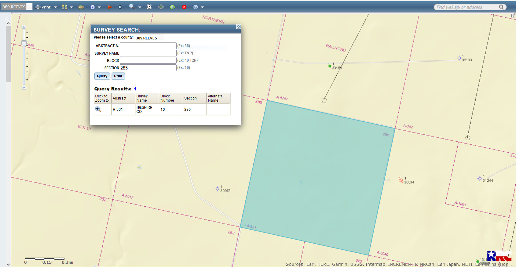
Can you tell me how to use that site? I want to look up something in Reeves, Texas but I don’t know how to format the description. I tried, but it didn’t really work. I typed in: Section 285, Block 13, H & G Railway Company and it said “location not found.”
Lisa, right now I have to go help my cousin. She wants me to till an area for her garden. Later I will be glad to try and help you find the area in question. Don’t give up on me. Later
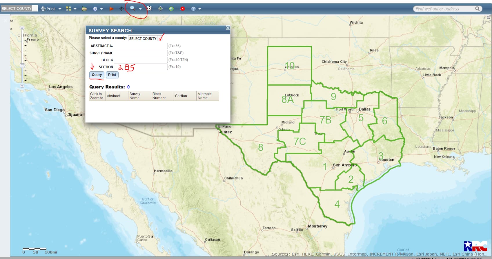
Then click on the magnifying glass toward the middle top of the page…you will receive a popup screen that will say Pipelines, Surveys, Lease ID, CWD Sites & Discharge Permits..click on ‘SURVEYS’..after the Survey thingy pops up click on the blank square box next where it says SELECT COUNTY and all the counties will pop up…scroll down to and click on Reeves County..then type in your Section 285 and then click the word ‘QUERY’
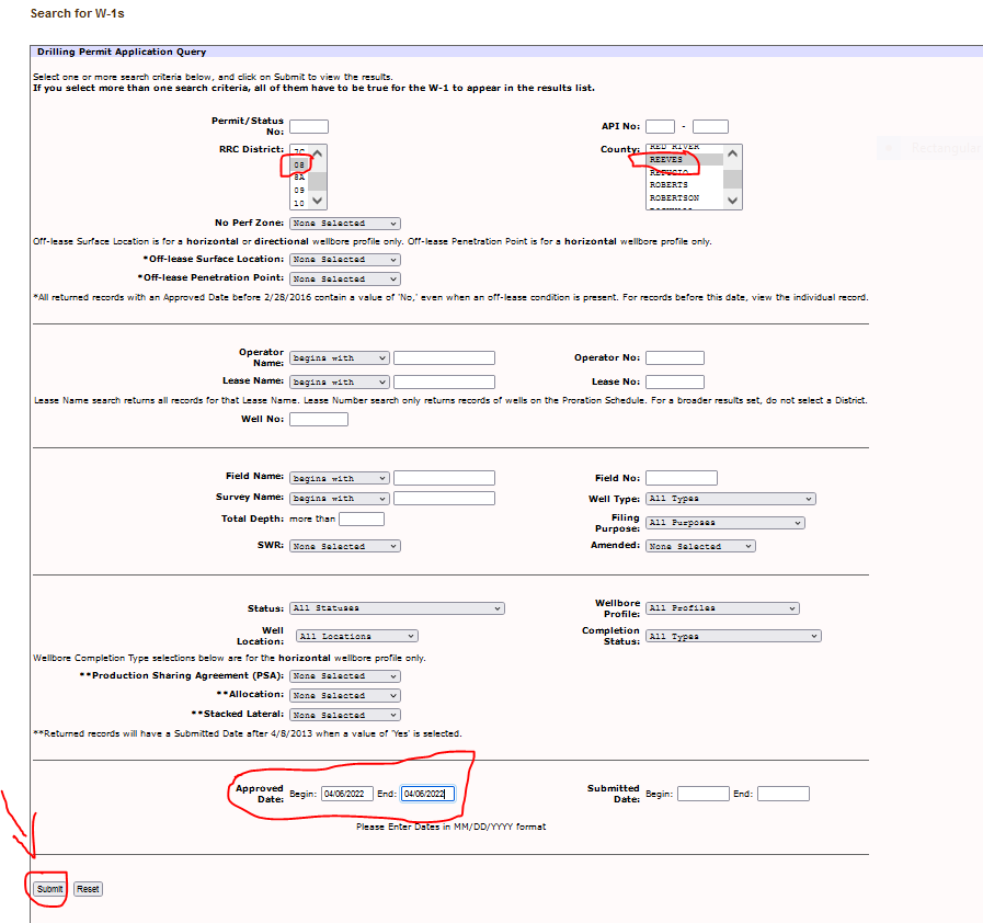
To search for approved permits use this link: http://webapps.rrc.texas.gov/DP/initializePublicQueryAction.do. Reeves County is in RR Commission District 8 so click on 8 and scroll down to Reeves County/click on Reeves County and then type in the correct date and click on ‘SUBMIT’ at the bottom left of the page.