Plug and Abandon

Good day!

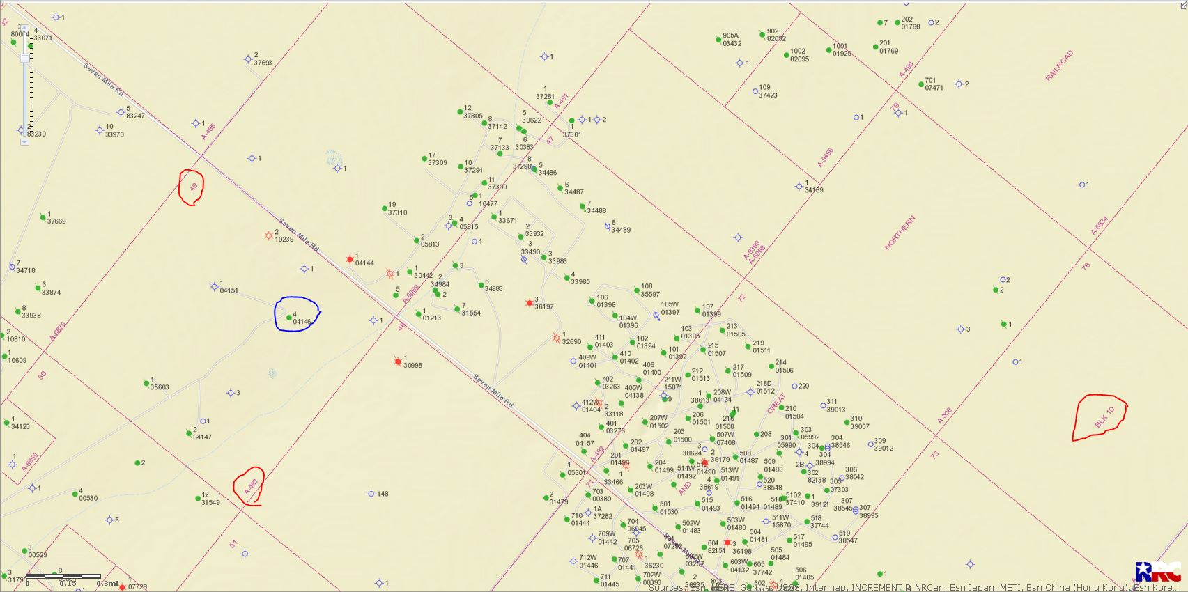
I received a letter from PO&G today stating that they plan to abandon and plug ‘…the Bertha D Young #4, located in Section 49, Block 10, H&GN RR Co Survey, Ward Country, Texas.’

I own land on that section and block but was unaware of any drilling or active wells. I know very little about what this means or what I can infer from the letter. Anyone have any advice or insight?

Kyle, after checking the RR Commission GIS map I find no Block 10 in Ward County…Check your numbers again…and are you sure this is Ward County?

Hey Clint,

Rechecked the numbers…what I typed above is correct based on the letter I received. It looks like the county is a typo on their part since they listed the correct county (Pecos) in the ‘Re:’ sections and listed the incorrect county (Ward) in the body. My land is in Pecos.

GIS)Geographic Information Survey) map of Pecos County Section 49/Block 10/A-493

LEFT CLICK ON MAP TO ENLARGE

Bertha D. Young well #4 is 04146…

Well 10239 is a producxing gas well. The Operator is Rayden…Link to production data from well 10239…http://webapps2.rrc.texas.gov/EWA/specificLeaseQueryAction.do?tab=init&viewType=prodAndTotalDisp&methodToCall=fromGisViewer&pdqSearchArgs.paramValue=

…04147 &35603 are plugged oil wells…04151 is dry hole…

Thanks Clint,

I own 10~ acres in Lot 47. Any idea why I would receive a letter from them?

Section 49, Block 10 H&GN Ry. Co, Pecos County, Texas, Lot 47 +/- 10.18 acres

Call and find out.

Capture

Fair enough, I appreciate your time!

This topic was automatically closed after 90 days. New replies are no longer allowed.