I need help. Recently I found that my father inherited land in Cherokee County, Texas. He owns undivided mineral interest in 40 acres of the Lacy GB survey A-525. About a month ago I found out that 2 of my father’s distant relatives had leases out on this very land. I called East Texas Energy Corp, who took out the leases and left a message. They had a petroleum man call me the very next morning offering my father a lease as well. Problem is they are saying he holds very little interest because about 35 others could hold interest as well. Problem is they don’t have leases out. There are only 3 that exist. 2 family members and my father’s. Also they are offering a 3-year lease with option to sign for 3 more. At $100 an acre. The last time a lease was done on this property was in 1983, a month before I was born. This land is very old. My family purchased it in 1897. I just want to do right for my dad.
I cannot comment on the price range since I do not know the area, but I never allow an option to extend as too much can happen in that time frame. I suggest that you read the Mineral Help tab above. Also peruse the Texas county forums nearby as Texas leases need certain terminology to help protect you.
Jamie, next door to the West in Section 836/A-134 Buffco Production Inc. has an approved permit (as of Feb. 8, 2019) for a 10,000’ wildcat well. Also in Section 836 are 2 shut-in oil wells (30473 & 30493) that were drilled (Woodbine formation) in 1982, also 1 plugged oil well.
I suspect East Texas Energy is wanting to lease your acreage on the cheap and flip it to Buffco and make some money. It is my understanding Cherokee County leases go for about $250 per acre and 22 1/2% royalty and no option for 3-year extension.
Jamie, this is the GIS map of Cherokee County A-525/Section 123 and surrounding area:
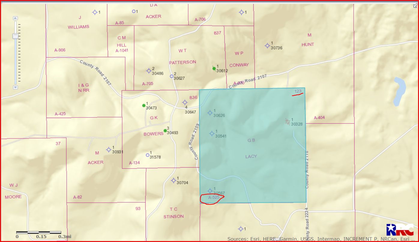
DOUBLE LEFT CLICK ON MAP TO ENLARGE
#30626 what is that? That’s definitely where the land is located.
30626, 30541, and 30567 are dry holes that were drilled. 30328 is a plugged gas well.
http://wwwgisp.rrc.texas.gov/GISViewer2/GISViewer/docs/Public_GIS_Viewer_Legend.pdf