I have a question or if can someone screenshot me a plat or map of Howard county of 34 T2N Sec 12 Iwanted to see if any activity is in the working. Thank you
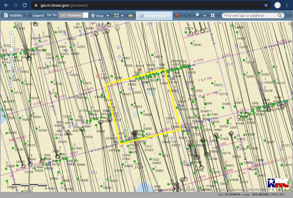
Here is a screen shot of the areas covered by A-1668 & A-1334. The wells in the NE were mostly permitted in 2020. The wells in the SW were permitted from 2014 to 2018. The surface location for permitted wells that are mostly in the next section to the south were permitted in 2021.
Thank you! So their is really nothing going on around there?
This topic was automatically closed after 90 days. New replies are no longer allowed.