Helpful persons directed me to the exact location of the 134.5 acres south of Moundsville my wife is partial leassee of. EQT remittance statement shows “LO15642.00 Hicks A lH”, possibly a well site. Permission to drill, drilling has begun, production has begun, can not decypher EQT remittance statement. Very frustrating for the layman! Always appreciate professional insite. Glenda/Paul Gill
Maybe this matches up to well api # 47-051-01897, Hicks M01H, operated by EQT. Location 39.8718N 80.7183W. Currently producing around 600,000 MCF per year.
Not seeing an example of the statement makes it a bit difficult, but in general the statements of most operators contain the month of production, the product, the amount of the product, the price paid and any deductions. There is usually a gross portion of the statement and then a net portion that explains your receipt along with your decimal amount. The net at the bottom of the statement should match your check. Keep your statements for seven years for IRS purposes and to match against your 1099s.
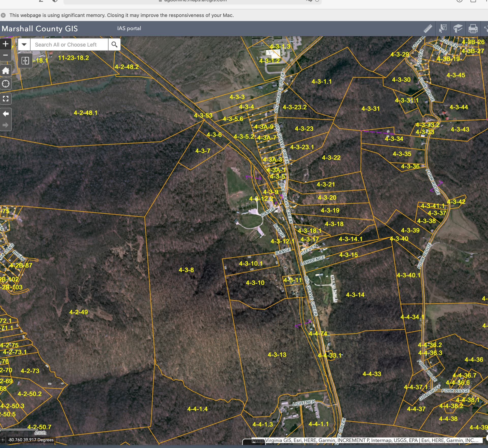
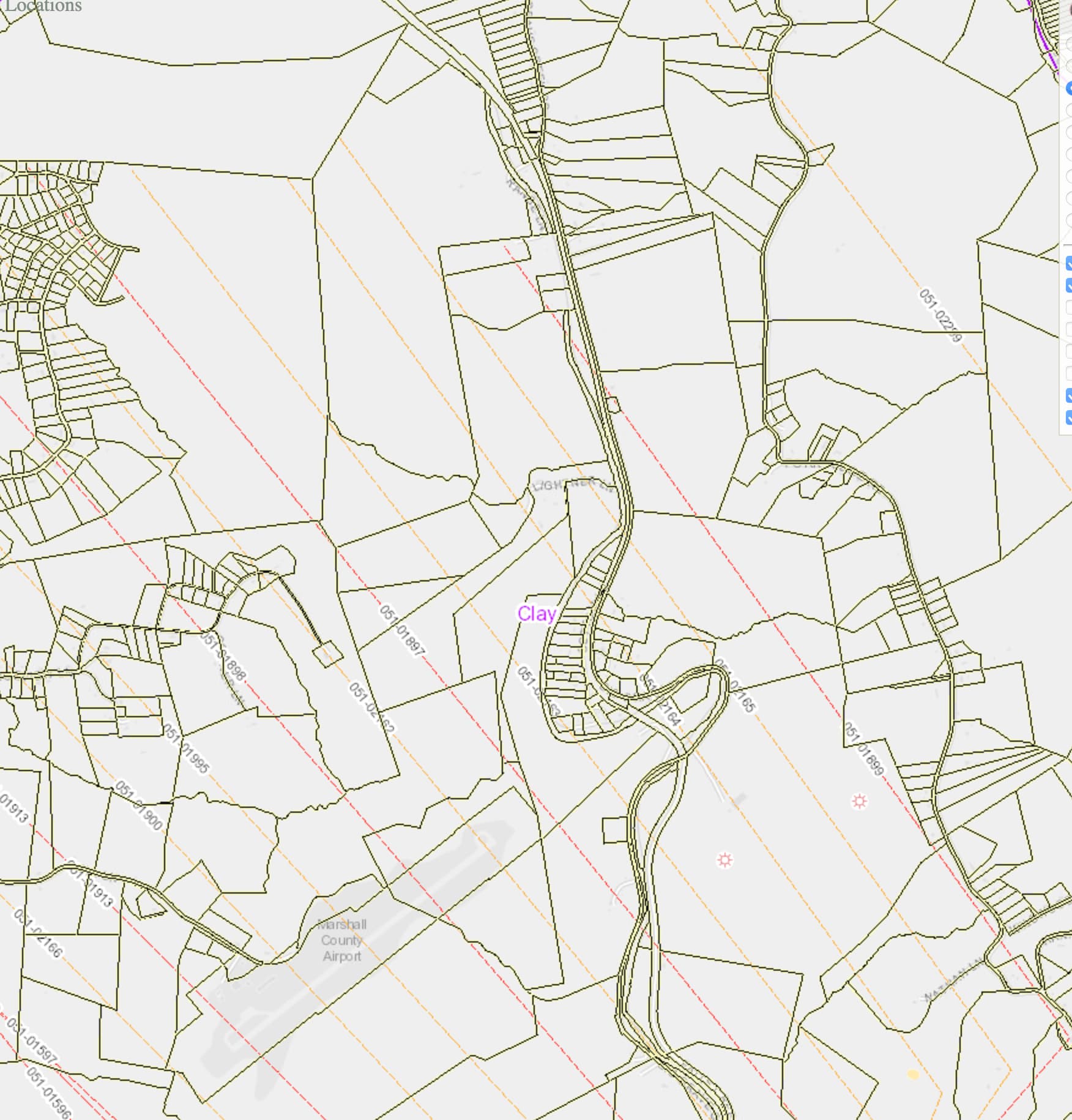
Paul, I looked up the EQT Hicks A1H well and it is in production and has been since Aug of 2020 based on WV DEP Production reports. The actual well API number is 47051018990000 and it shows the drill line stopping right at your 4-3-8 property line from the the SE. You are probably an adjacent parcel owner in the DPU. The other permitted wells that definitely cross your parcels are the Hicks M17H API 47051021640000 and Hicks M18H 47051021650000. They do not appear to be producing as yet and were originally Chevron leases that EQT has probably purchased. They do not show production on the WV DEP production reports for this year as yet. They were both permitted on 2/21/19. There is also an API 47051021630000 that just misses your 4-3-8 parcel to the SW that could also be an adjacent owner situation. If you have parcels a little further west of 4-3-8 then the 1897 well that PeteR mentioned is a definite possibility.
As to the statement it is hard to discuss as MS Barnes mentioned and she is an expert on the subject. However it should have sections for oil, NGL’s and Gas. There should be a decimal interest for each and a breakdown of your royalty interest RI for each in barrels for oil and NGL and MCF for gas. There should also be a price for each of the three commodities that is multiplied by your RI to give a total for each and a grand total paid. Very confusing. Hope this all helps. Good luck.
1 Like
Paul, For clarity below are screen shots of your property and the well paths. The 1899 on the right is the one that stops just short of your parcel. It is actively producing. The other two permitted wells 2164 and 2165 definitely cross your parcel but are not yet drilled from reports from WV DEP. The other permitted well 2163 edges against the SW corner of 4-3-8. Hope this helps.
Dome, thanks. Received more info since May than past 16 years. Enjoyable to know where parcels are located in the district. Things I could never have suceeded in researching. P & G gill
This topic was automatically closed after 90 days. New replies are no longer allowed.