I have been told that 2 areas I have properties in are being investigated for future activity and several of my neighbors have been contacted. The areas are T&P RR CO-A-188 BLK42 T2S-SEC21 and T&P RR CO-A-464 BLK42 T2S-SEC28. How can I find out more about this?
Please add your county and state, am assuming TX from the description.
Odessa, Texas, Ector County.
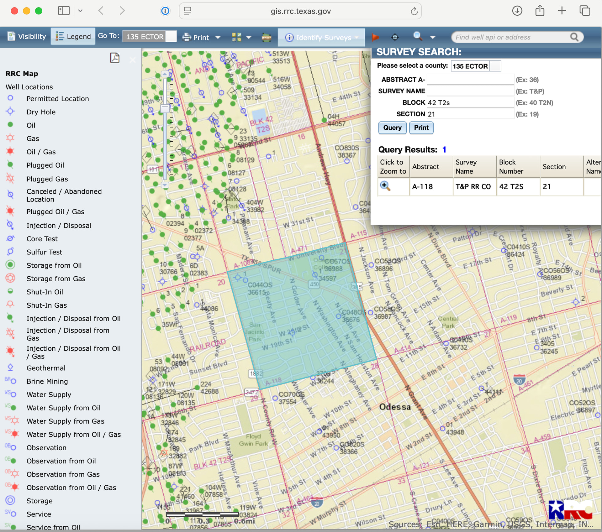
You can use the GIS RRC map to find the area. (the Abstract is 118, not 188) 464 is just to the south of the blue box shown for 118.
If your name and address are properly filed in the Ector county courthouse with the recorder, then the landmen will find you. I only see three leases in 464 at the moment. They are at 25%. Best to get an attorney to help you with the clauses in the lease. The first draft will not usually be in the mineral owner’s favor. The current leases are with Venture Royalty, but that does not mean they will be the operator.
There are three rigs drilling for Diamondback about 2.5 miles to the east of you with long horizontal wells. They need a good surface location to the south since they are drilling to the north underneath part of Odessa.
These things take time to develop. Keep up with the activity notices in the newspaper and online if posted. Arrington has a permit for a stratigraphic core test one mile to the east of you. That will probably be a straight hole. It was spud in October 2025.
If you get approached by a leasing agent, ask tons of questions. Who will be the operator, when will they plan to drill, what type of production allocation will be done, what reservoirs. Find a good attorney!
1 Like
This topic was automatically closed after 90 days. New replies are no longer allowed.