My family has quite a few of these! I don’t really expect searching each of them to provide any real insight but we have these and I feel like I need to at least investigate. My problem is, I can’t find them on the Oklahoma Commissioners of the Land GIS site. I do realize this will be perhaps wasted effort! But how should I go about trying to find out if there are any wells drilled on this and other similar properties?
@TripleF, The Phillips and Mead East Side Addition is just east of downtown Oklahoma City. Translating to PLSS or the Township Range system, this looks to be around 34-12N-3W SE. From the Oklahoma County assessor records it looks like lot 4 block 16 is around 805 NE 1st Street. It doesn’t appear that there are any active wells in the SE quadrant, but there are a couple in the other quadrants of Section 34. These wells date back to the 1930s and 1940s. It also appears that there is an active disposal well nearby, API 35-109-20077, Walnut Grove.
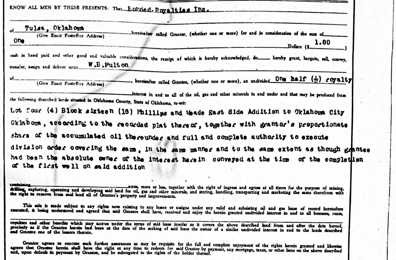
I could never have figured this out!! We have mineral rights in 42 lots in East Side Addition, Walnut Grove Addition, Terrance Lawn Addition and Armourdale Addition. I’m guessing all those additions are real close together, but probably not even existing today… these deeds were from 1931 I believe. It seems odd to me that people purchasing these lots sold their mineral rights! It also seems odd that my grandfather bought them!!!
Pete… thank you for this! I do really appreciate it!!
You would be amazed at how much drilling was done in OKC in what is inside today’s city limits, but might have been nearby farms back then. I drive by neighborhoods with pump jacks still today (including the state capital!). A lot of folks severed the mineral rights during the dust bowl times.
1 Like
Maybe I need to take this more seriously and follow up on this. For sure there are wells not very far away.
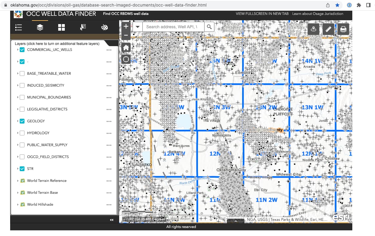
@TripleF, as you suspected the Walnut Grove neighborhood and the Armourdale addition are adjacent to the Phillips-Mead addition to the south in 3-11N-3W and 2-11N-3W. The Terrace Garden addition is a little further south in 10-11N-3W. It does look like there are several active wells in the Terrace Garden area.
In general, Oklahoma mineral rights don’t expire as you have found in other states. Also the Oklahoma laws are often more favorable for mineral owners than other states, particularly in the area of force-pooling. It is good to at least keep track of them and to know what you own.
1 Like
ReteR - Thanks so much! Thanks to you… “I’m ON it!”
You can use the OCC wellfinder map to zoom into those subdivisions. As you can see, there are lots of wells in 2,3,and 10-11N-3W.
1 Like
I went to the county deed search and found I can enter the lot, block and subdivision and find my deeds. But I can’t figure out how to convert that to Section, Township, Range. I will call the county court clerk next week and see what can be figured out.
Thank you Martha… AGAIN!
I did figure out how to convert lot, block and subdivision into Section, Township and Range. Using the county deed search and then opening the underlying documents, shows the initial plot laid out and that includes what I needed. So that’s good news! The bad news is it doesn’t look like there are any active wells on any of my properties. ![]()
I didn’t expect any good news, and I did learn quite a bit. So all in all it was a worthwhile exercise.
This topic was automatically closed after 90 days. New replies are no longer allowed.