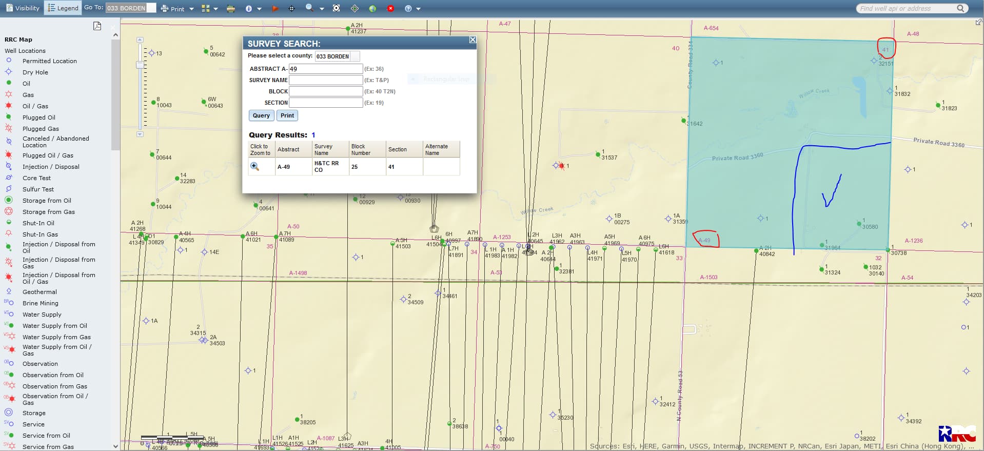
How can I monitor the activity for SE/4 of Section 41, Block 25, H&TC RR Co. Survey, Borden County, Texas? There was a previous topic (2022) similar to this that was helpful.
Is there a website? I own mineral rights in North Dakota and the state of ND provides a website.
Does anyone know the latest (like in the last few years) status of Oil/Gas drilling or exploration for this legal land description?
Does anyone have a recommendation of an attorney that could help us in determining the status of these mineral rights?
Reason for me asking these questions is my wife recently discovered she inherited these mineral rights (divided amongst other relatives) about 30 years ago (a will came to her attention). We need to understand her situation more, so we can ask the right questions. In ND I had to go through probate (messy) to legally show ownership for the years that allocations were not applied.
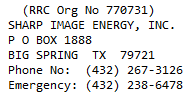
gljohnson, SE/4 of Section 41, Block 25, A-49 has 1 producing vertical oil well and 1 plugged vertical oil well. The lease # of the producing oil well is 68964, the producer is Sharp Image Energy, Inc., the well name is Vernon Wolf, well #1. This link is to the total production data on the Vernon Wolf well #1:http://webapps2.rrc.texas.gov/EWA/specificLeaseQueryAction.do?tab=init&viewType=prodAndTotalDisp&methodToCall=fromGisViewer&pdqSearchArgs.paramValue= On the left-hand side of this data page you will see the beginning date range. If you change this beginning date range to June 2006 and click SUBMIT you can see all the production of the life of this well.
GIS map of Borden County Section 41, Block 25, A (Abstract)-49