How do I find information on mineral rights I inherited? I found a signed lease in my name but it doesn’t say much of anything.
Your lease should have some location information… County, Abstract, block, survey, etc. Once you know the county, you can search the county records for your name, the names of people you inherited from, or for that particular location. Some counties can be searched online, but others may require a visit to the county courthouse by you or by a landman you hire. You would have to repeat the search for any county you suspect you may have inherited property in. Obviously, any hints your family records can give you from previous wills or deeds filed by law offices will help narrow down your searches.
I know it’s in Shelby County, Texas. The survivor contact info is not available and shows permanently closed. It also says J.B. Survey Inc., but I still haven’t been able to find contact info for them.
@Dama_Chopelas See Abstract 721 (A-721) in Shelby County. Several active gas wells in the area. Map on reply post that is pending…
James B. Baker Survey is another name for A-721 in Shelby County. This area can be viewed on the RRC Public GIS viewer. Pending post also includes link to county property search site.
It looks like Shelby County has a nice site to access property records. http://cc.co.shelby.tx.us/RealEstate/SearchImage.aspx
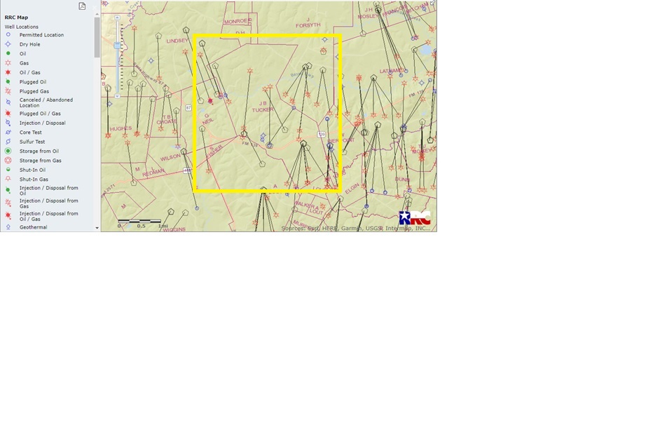
Your property appears to be in Abstract 721 (A-721) of Shelby County in the James B. Baker Survey. Looks like a property with several active gas wells in the area. See map below.
Not sure if this answers all of your questions, but it gives you some points of reference. Welcome to the forum by the way. There are many people knowledgeable about Texas who participate in the discussions here.
2 Likes
Thank you so much. Is there a way to find out about my mineral rights and payments? I signed the lease in 2011 but haven’t heard anything else since then.
Hi Dama, attached another map that shows a sketch of where the 22 acres described in your lease appears to be located. The description is from book 385 pg 513 of the Shelby County records. Sorry I previously called the A-721 JB Baker, when the survey is actually JB Tucker. Anyway the description begins 536 varas (around 1487 ft) from the NE corner of the JB Tucker survey and is approximated in the attached sketch. (Blue rectangle with flags) This area does not appear to overlap any of the drilling, pooling or proration units for the wells in the area. Since there isn’t any part of your lease used or allocated by the wells in the area, this may be why you have not received or heard anything else since 2011. The well allocated areas all appear to end on the other side of the riverbeds from your lease according to the drawings available in the RRC files. Others with access to better information, or actual professionals may come up with a different answer, but I hope this information helps clarify your understanding in some way.
This topic was automatically closed after 90 days. New replies are no longer allowed.