I’m owner of one mineral rights in Liberty. Deed says 1873. How do I find out if there is production?
This number… 1873… does that refer to section #, abstract # or what? Do you have the deed to the mineral rights? If you do the legal description should be there.
NPRI in 18.19 acres, part of Section 174, Certificate No. 25/1364 issued to H&TCRR Co., Liberty County, Texas 1925.
texaslandmineralrights… 6 parcels/abstracts make up Section 174/Abstract(s) 555, 768, 958, 963, 966, & 967. I find 1 vertical gas well still producing. It has been a very good gas well with condensate. The well name is Levigne #1/drilled and produced by Ballard Exploration/Lease # 278319.
Production data since Nov. 2019:
CLICK ON DOCUMENT TO ENLARGE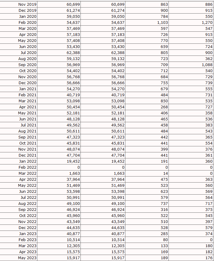
GIS map of Liberty County Section 174/H&TCRR:
CLICK ON MAP TO ENLARGE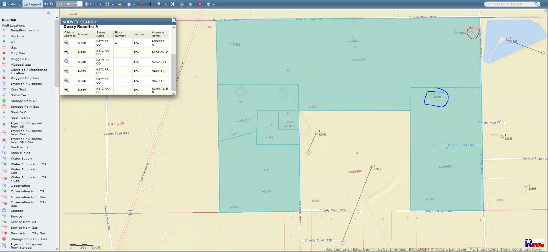
This topic was automatically closed after 90 days. New replies are no longer allowed.