My family was recently gifted some mineral rights to a few sections in Township 19 North, Range 67 West, 6th P.M. from a friend. I am quite new to this, and my friend also did not know much about it since she inherited the rights. I would very much appreciate any advice regarding the following:
how do I find out if there are any historical lease payments due to my friend?
how can I find out if there is any current or upcoming activity on these sections?
You can always check the state unclaimed property/funds
site for royalties that may have been paid but unclaimed.
If there were active wells in the area, you could also check with the well operators, but from the above sites it doesn’t appear that there are any active wells in 19N 67W.
It does appear that many permits were issued a few years ago and allowed to expire, and some permits are still awaiting approval, so there has been interest in the area.
I searched Wyoming unclaimed property for my friend’s name and found nothing, so I guess that answers that question.
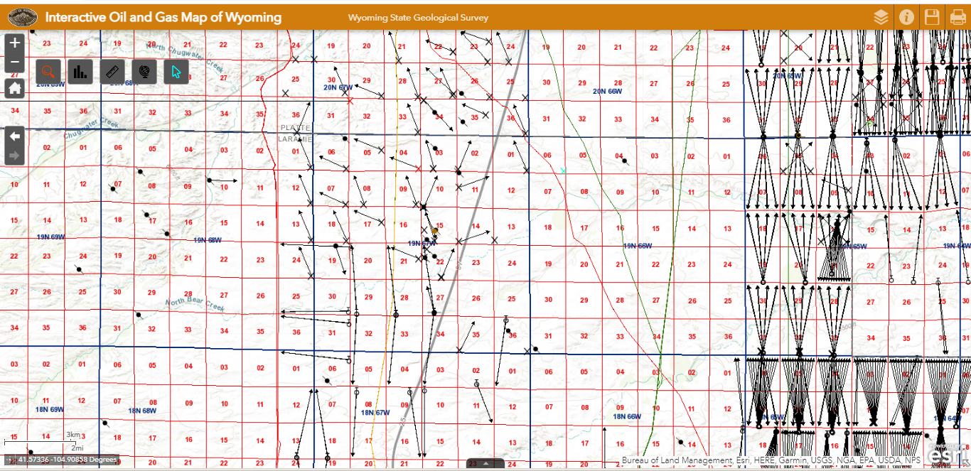
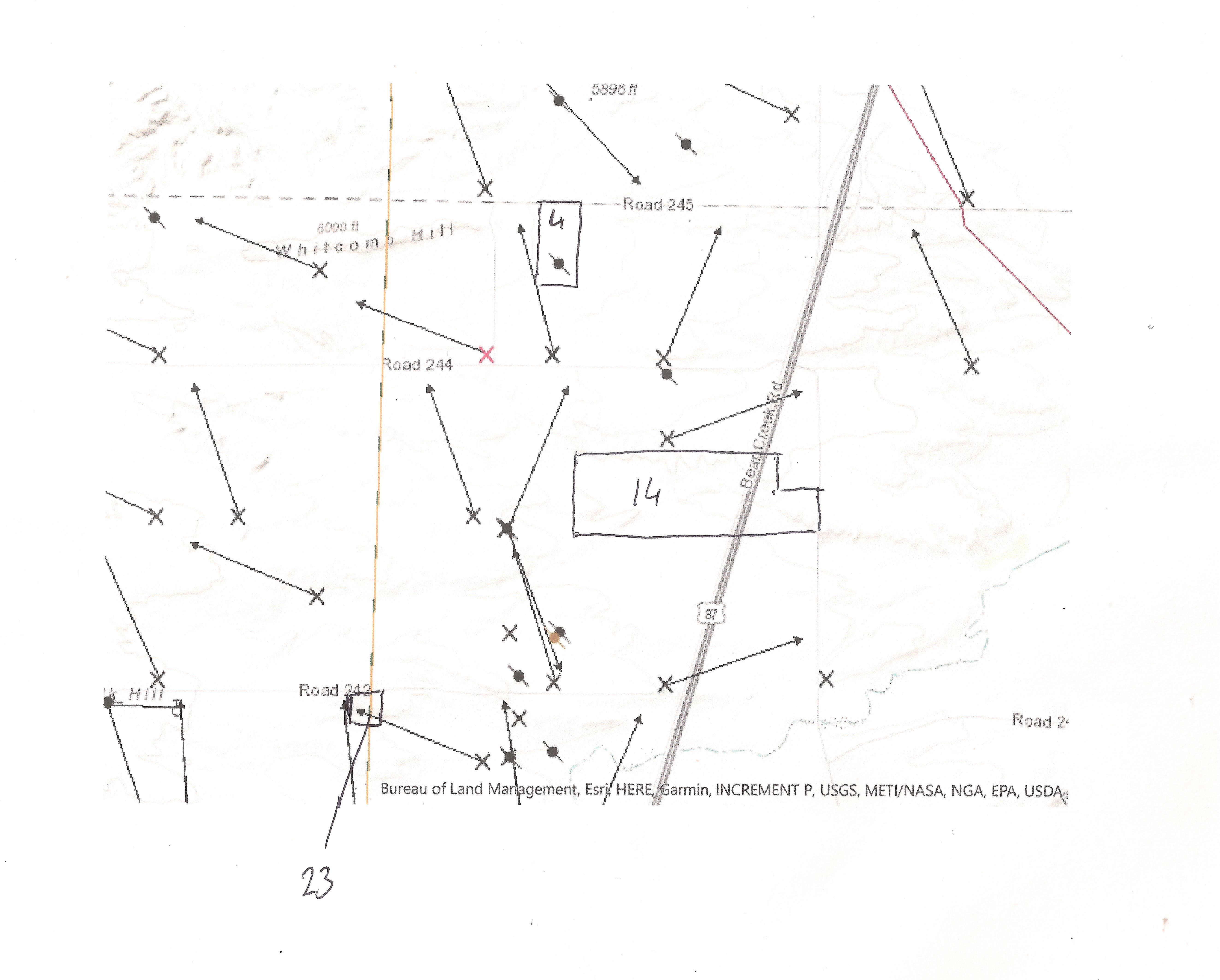
I don’t see a way to easily overlay the map of the sections with the oil map, but attached is an image of my approximate sections. What does the mark in section 4 mean?
The dot with the slash through it represents a well that has been plugged and abandoned… no longer in service.
In the layers menu you should be able to turn on the PLSS
townships and sections. PLSS abbreviation stands for
Public Lands Survey System (Township/Range/Sections).
It does take a little time to get familiar with the lingo.
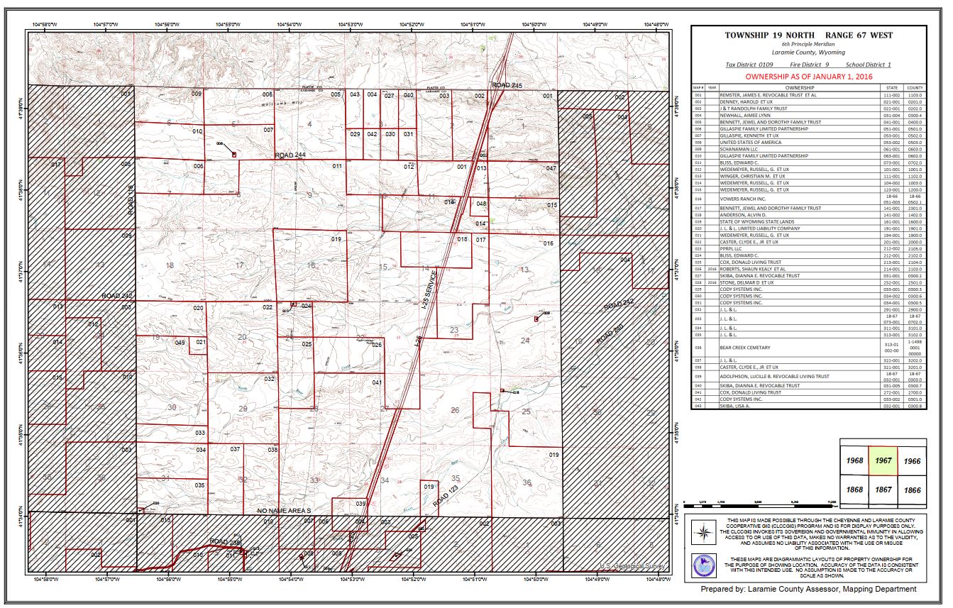
Oh, in that case I may have been working off the wrong map! This was the map that I thought defined the sections of Township 19 North Range 67 West, with their irregular shapes and all.
But the map on arcgis.com seems to show a much more regular distribution of square sections. Is that the correct map then? If so, then there is a red X on section 04 and a black X on section 14. I can’t find a legend for this map which would tell me what the difference between the two marks is.
I think you’ll find that the red X is for a gas well, while a black X is for an oil well. Looks like you were working off of a tax parcel map, but the PLSS sections are also visible on your map, they are just more of a fainter background. The sections usually referenced with Township and Range are mostly regular one mile squares (around 640 acres each).
Very familiar with this area. Per some business associates, the oil drops off in township 66. So anything west of there, not much will happen. Thats probably why all those wells were left to expire. A company may come around every so many years and offer a few bucks per acre just to add to there portfolio, make it appear larger to investors, but I would not expect big bucks anytime soon, or drilling for that matter. Especially with the current state of things in this country and what the current administration is trying to do. Best wishes.