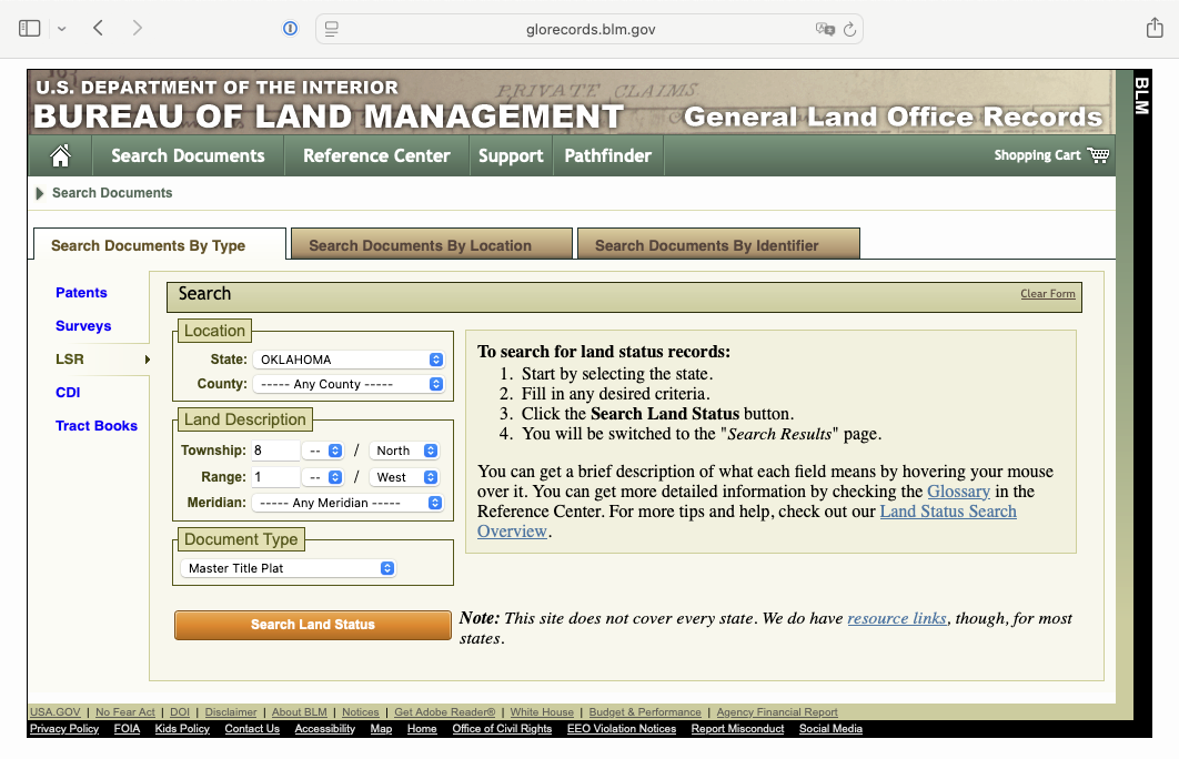
In one of my Quit Claim Deeds for Cleveland County, there are some descriptions of where our mineral rights are that don’t look like anything I have seen before. They mention Lot Numbers. For example, there are the following descriptions:
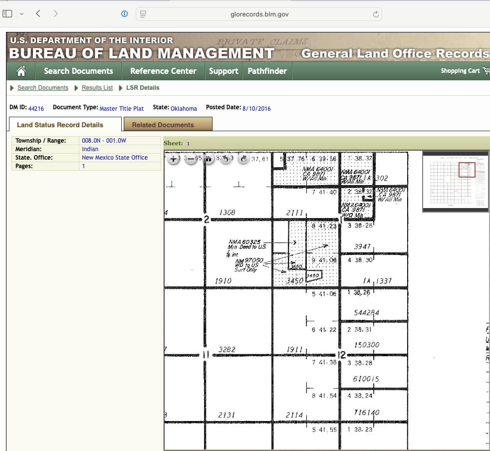
**Lot Two** and the Southeast Quarter of the Northeast Quarter, sometimes described as South Half of the Northeast Quarter of Section 12-T8N-R1W 78.31 acres.
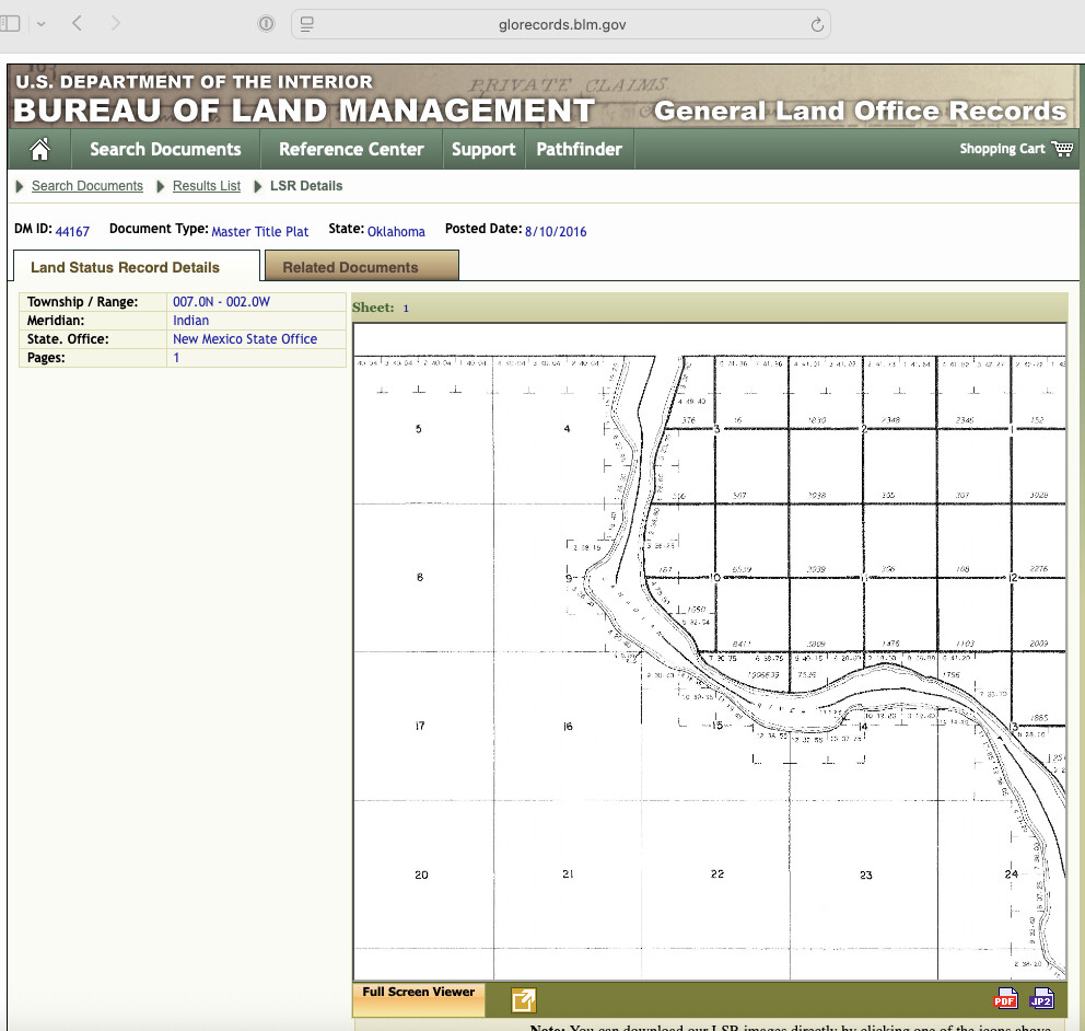
The Northwest Quarter of the Northeast Quarter (NW/4 NE/4) of Section 10, T7N-02W. **It is the intention of this deed to convey a full 3.94 acre mineral interest. 40 acres.**
**Lot 5** and *more description deleted to make less writing* containing 80.79 acres more or less
Several other descriptions mentioning lots and acreages I can’t make sense of.
I don’t know what is meant by Lot numbers. I am hoping someone can clear that up.
As far as acreages, the 2nd description is NW/4 NE/4 Sec 10 7N-2W. This comes out to 40 acres, which it says. But it also mentions a full 3.96 acres. This is where I get lost. How does the math work out? Obviously I am missing something.