I am trying to get a map showing the sections of Payne County, Oklahoma.
Payne County Map.pdf (2.2 MB)
The PDF file is printed too small to see the sections’ numbers.
Sorry, that is how it came. You can print on a larger sheet of paper or half at a time. If you find the edge of a township, the upper right corner is section 1, to the left is sec 2, in a serpentine fashion.
Here is a article that explains the numbering system
S-T-R Legal Land Descriptions in OK_Kletke-1.pdf (59.7 KB)
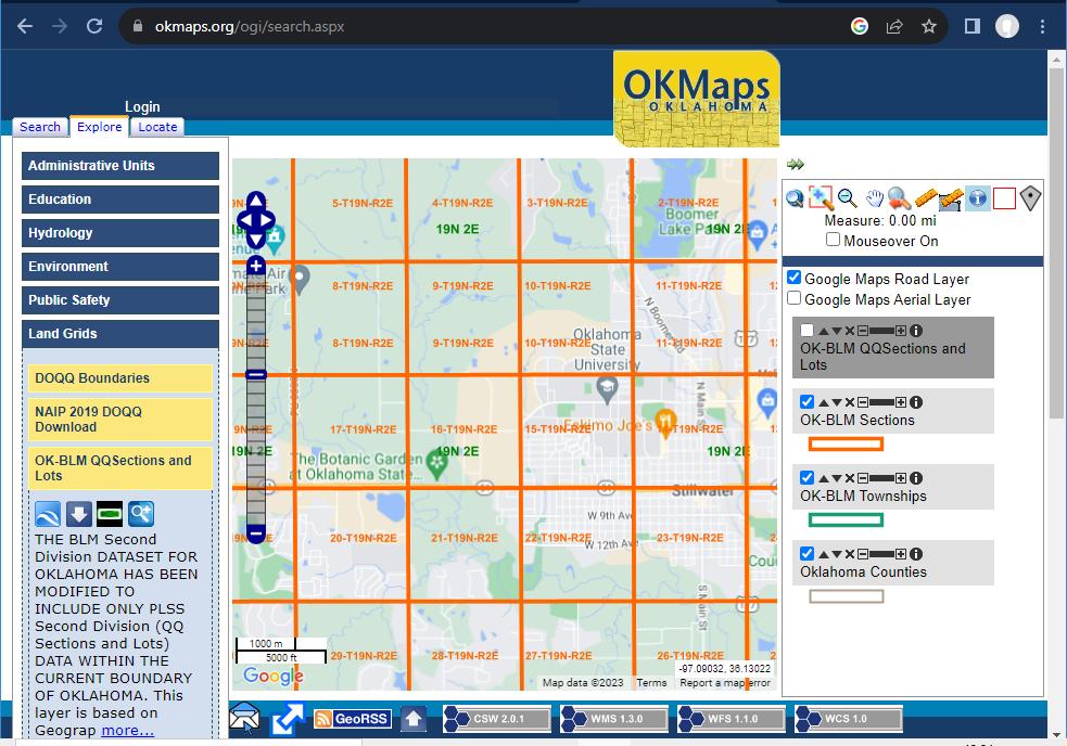
@willyd, here are a couple of other options that show the sections
for any County in Oklahoma.
OKCommissioners Gives a fairly easy
map to use. Just check the PLSS box in the layers list.
Example below:

Also there is OKGISMAPS that gives a nice, colorful, good looking map. Example below (same area in Payne County)
1 Like
This topic was automatically closed after 90 days. New replies are no longer allowed.