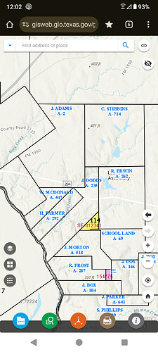
Does anyone know of a map tool I can access that would show all of my interests/surveys on one map? Thank you.
I was told by the landman that originally leased a couple of family tracts, that locating and mapping in this area has been extremely difficult and very complex for even an experienced GIS professional. The only advice I think I would have would be to see if the appraisal district website has some clues on the surface tracts.
If they are non producing, they will not be on the tax role and you will not be able to digitally map under most free services, (I’ve tried a ton of potential sources). You can obtain a physical map with abstracts and surveys shown from Anderson County, the RRC, or a map company. You could physically highlight the area of your tract in the correct abstract and be able at least know where these are located. You can track permits thru the RRC. Mineral Answers offers a free good service as well and their payment options are not that bad if you want to track more than the free 10.
Could you tell us exactly from where from Anderson Co. would I obtain a map showing surveys. I just can’t find a location at the county courthouse website for survey maps. Many thanks.
This topic was automatically closed after 90 days. New replies are no longer allowed.
