Could someone help me locate SW/4 SE/4 of Section 13 Block C-21 in Reeves County? CINCO Energy notified us that great grandmother has mineral rights in that 40 acres and we are interested in finding out if any of her relatives still live on or around that land. Last name of Farmer.
Also, here in Oklahoma we are paid royalties if minerals are within the same section that we are owners. Is there different spacing in Texas?
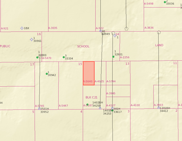
Here’s a map of the land.
Thomas,
Section 13/Block C-21 consists of 6 Abstract #'s, Abstract # A-5640, 4025, 5744, 5187, 3945, and 4127.
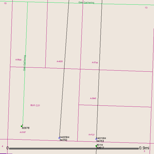
Several older vertical wells in the vicinity. Vertical well # 32876 completion report showed 83 BOPD/446,000 MCF gas/Flowing/completed in 2012.
Horizontal well # 34253/Permit approved 5/28/2014/not sure if this well has been drilled yet/Resolute Natural Resources
Horizontal well # 34250/Spud Date (Began drilling) 9/4/2014 in Section 14/Blk C21
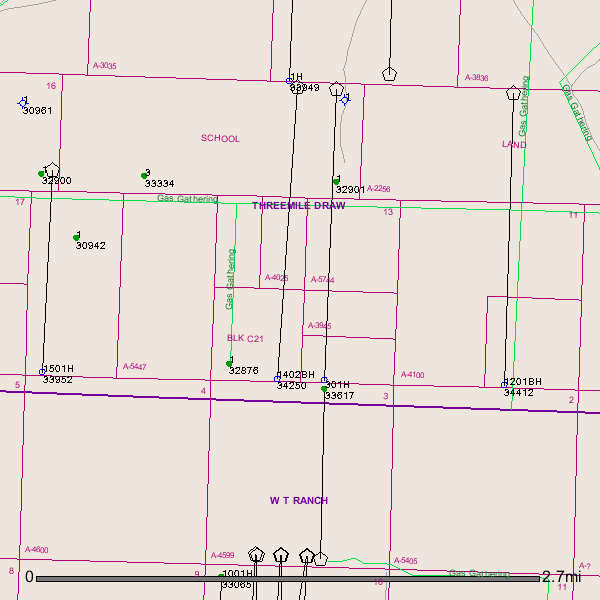
GIS Map of your Reeves County Section 13/Block C-21 and surrounding area:
ZOOMED OUT GIS MAP OF YOUR SECTION 13/BLK C-21:
Clint Liles
Thanks. Any help on my other questions?
Thomas, here are a couple of pictures where your property is located (purple marker) on my 1945 map. Linton
1551-IMAG1188.jpg (325 KB)
1552-IMAG1187.jpg (308 KB)
Have you received any paperwork from the oil companies about a lease?