I’ve recently been offered a 3-year lease from CGS Operating, LLC. $550 an acre, 22% royalties. Is that a fair deal? Should I obtain an oil and gas attorney?
How do I know if my acreage is producing? How do I find out where, exactly, my acreage is located in Dawson County? I don’t know anything about it other than I inherited it from a parent recently.
Thanks for any information/insight you can offer me!
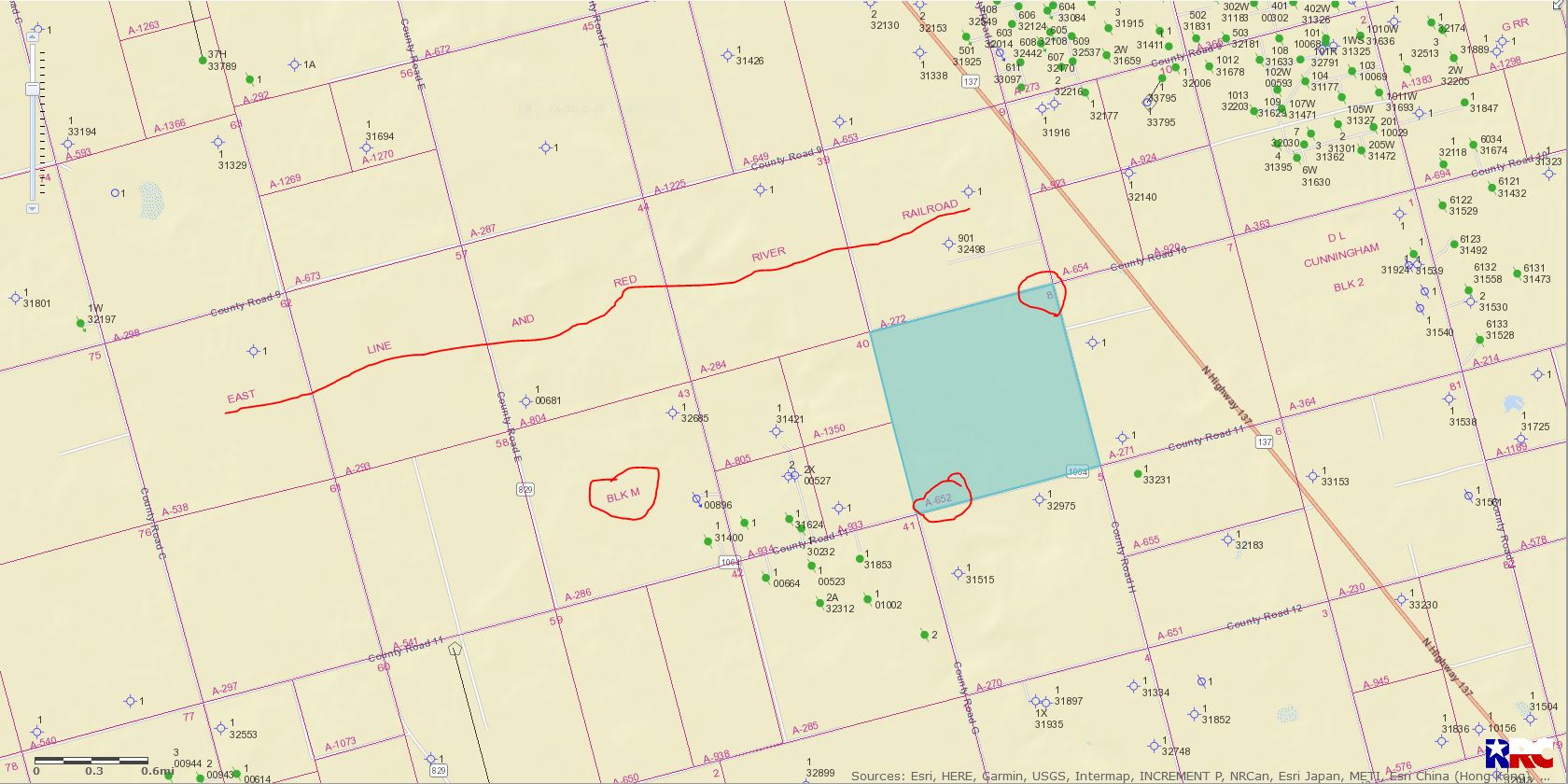
Can you tell me what is the Block and Section number it is. That’s a pretty standard lease though I have seen $500 per acre at 23%. So I would that’s in the ball park. If you are southwest of Lamesa could be a little light.
Hi! According to the lease agreement, I have “all of section 8, Block M, E.L. & R.R. Railway Company Survey”. I know it’s located somewhere in/around Lamesa, but that’s all I know and I don’t know how to find out any further info.
You can observe qualified professionals (often with localized expertise) who provide services to mineral owners right here on The Mineral Rights Forum. You will notice them among 3 different instances on the site:
in display image ads and/or brief text messaging on site
as a Business Member participating in many conversations throughout the site (note the blue colored “B” on their picture and blue text on their posts).
These practitioners are often able to provide the specific (and often localized) services that meet your needs.
The solid green dots are producing wells. The green dots with a green slash through them are plugged wells. The blue circles with 4 points are dry holes.