Received a lease offer for 320 acres in Eddy County W/2 Section 28, Township 23 South Range 28 East. Can someone tell me what is the going rate lease per acre in this area? Oil company wants to put 4 wells and is asking for a 3-year lease.
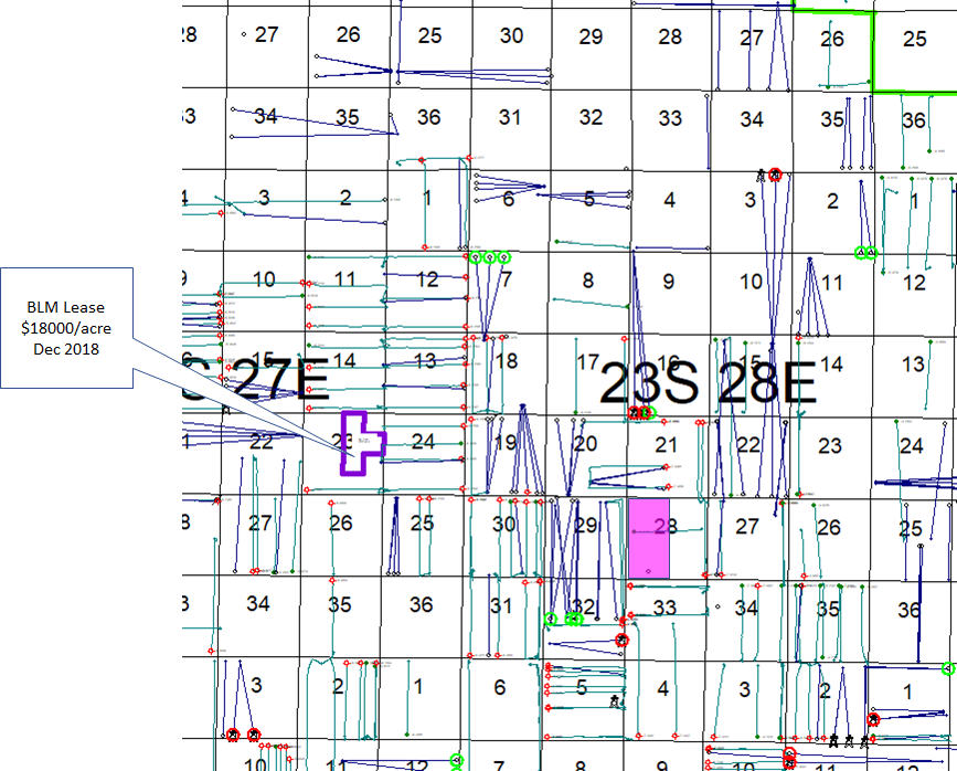
This may or may not be helpful, but the winning bid on a BLM lease a bit to the NW of you was $18,000 per acre in Dec 2018. See map.
That’s a 1/8th royalty lease with 10 year term. So a lot better terms for the lessee than you would be giving. Your area is a little bit better (i.e. to the SE). But based on that oranges to tangerines comparison, I’d say the bonus on a 3 year 25% royalty lease in W/2 of Section 28 would be less than half of that ($9k/acre) but more than $5k/acre.
Do you know where we can confirm who owns the mineral rights in this section? The lease offer was addressed to my grandfather who passed away in 2005. Thank you for the information on this section.
We use courthousedirect.com (a paid service) to search for deeds/leases etc. in New Mexico. I’m not sure how far back they go however. If you’d like to post a full name I can run a quick search in Eddy County records.
The mineral interest is likely owned of record in your grandfather’s name. When a real property owner passes away, his interest passes to his heirs (intestate) or devisees (testate), subject to the decedent’s estate being probated and distributed. When leasing, most landmen (or their companies) are willing to simply take leases from the apparent heirs with minor confirmation that you are the heirs, such as obtaining and recording an affidavit of heirship. Typically, before paying proceeds from production, the operator will require a probate and distribution. So you will want to start gathering information to show who the current owners are (i.e., the heirs or devisees of your grandfather).
Where can I find maps like this, please? I am in 22S, Range 27E and I am very new to reading these maps… Thanks for any help. Getting offers!
Hi Pam, unfortunately that map was from a fairly expensive subscription service called IHS. Here is another one from DrillingInfo, which also costs what is probably too much for an individual.
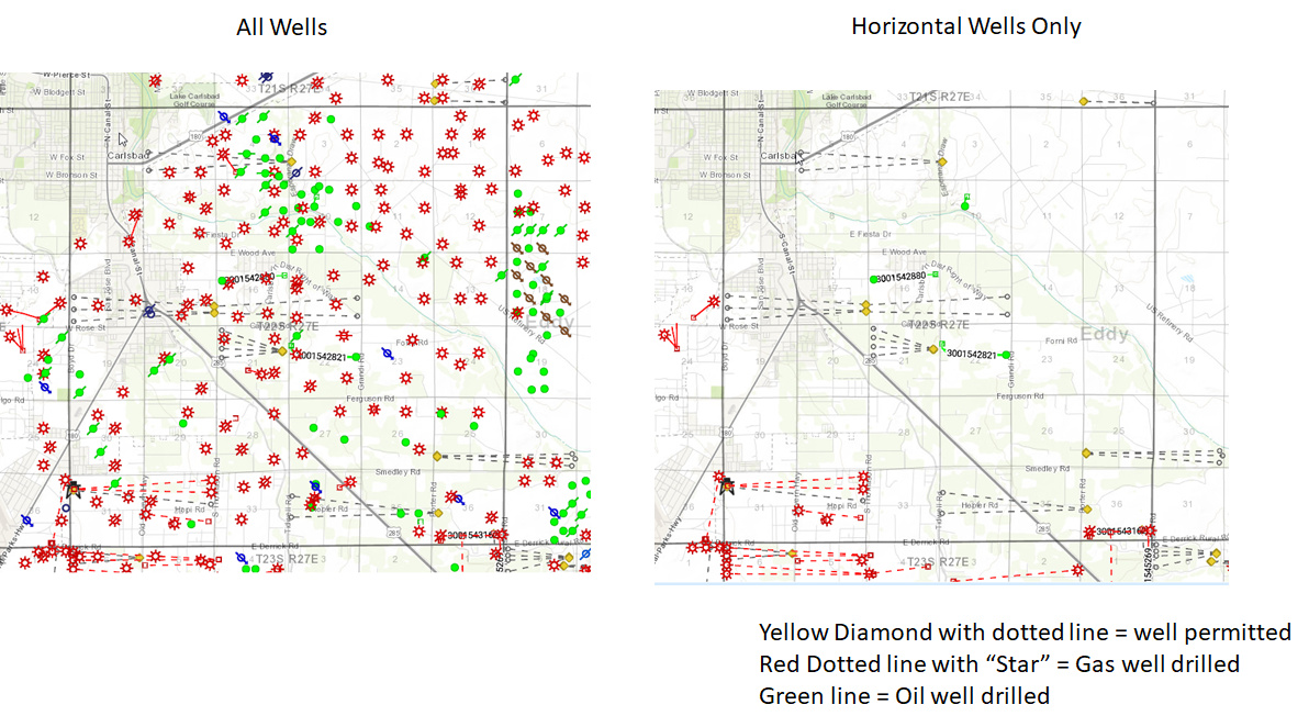
For public use maps, best thing is probably the NMOCD GIS. Just google that. Click on maps link. Zoom in near Carlsbad to find 22S27E. Can zoom further to see well numbers, etc.