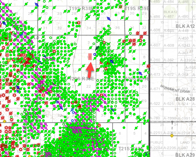
NW/4 SE/4 and SW/4 NE/4 Sec. 10, Township 20 South, Range 38 East, N.M.P.M.
My uncle did not respond to lease offers a couple of years back. I assume they would move forward without his permission or paying anything. Just curious about that, but where do I find out about this land? I don’t even know how many net acres. Where can I access a map that shows the location based on the provided coordinates?
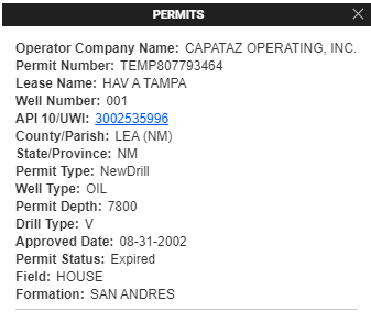
There are some good free resources out there like Oil & Gas GIS Maps by State listed out here, but it looks like the acreage is still mostly undeveloped. There was a permit in 2002 by Capataz Operating that’s now expired and was never drilled.
I am in that same Section 10 with you. I have an active lease that will expire in Aug. 2020. No drilling yet. (Deerwood Exploration) NE/4 NW/4, NW/4 (40 net mineral acres)