My company owns mineral rights in the NE4, the W2 of the SW4 & the N2 of the SE4 Section 30, 23N Township, 12W Range. There is a horizontal well that is in SW4 of Section 30 of the same Township & Range with a spacing of 640 and Section 31 with the same Township & Range with a spacing 640. I was told that the surface location is in Section 30 & the bottom hole is in 31 & The Oklahoma Corporation Commission ordered that the well is a single unit of 640 acres. In this case, the oil company is telling me that only surface owners in Section 30 are being paid royalties. Is this correct?
This is some of the info within the cause:
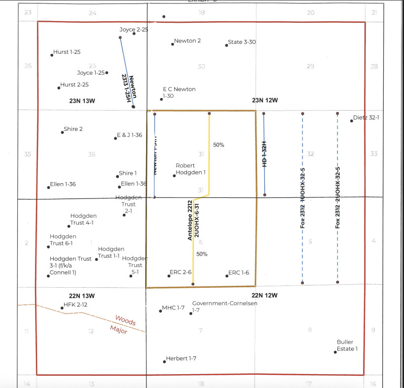
5. Relief Requested: Applicant requests that it or some other party be permitted to drill an additional Mississippi Lime well for the 640-acre unit comprising Section 31, Township 23 North, Range 12 West, Major County, Oklahoma.
6. Relief Granted: The requested relief is granted; the well will be for the common source of supply described below underlying the 640-acre unit described in the caption hereof, as an exception to the following order:
Common Source Order of Supply No. Mississippi Lime 203959
7. Reason for Relief: Engineering — the subject unit is underlain with 796,869 barrels of recoverable oil in place in the Mississippi Lime common source of supply. The existing Robert Hodgen #1 Well and the inactive Robert Hodgen #2 Well will ultimately drain 89,266 barrels of oil from Section 31, leaving 707,598 barrels of recoverable oil in place. The drilling of the increased density well is necessary to effectively and efficiently drain a portion of the drilling and spacing unit and common source of supply not being drained by the existing well which is classified as an oil well.
8. Allowable: If completed as an oil well, a normal 80-acre allowable, plus the incentive allowable authorized for horizontal wells. If completed as a gas well, each well shall share a single unit gas allowable determined by the test results of the best gas well.
If you own acreage in section 3-23N-12W, then you should be getting paid on the E.C. Newton 1-20H well.
If you own acreage in section 31-23N-12W, then you should be getting paid on the Canvas Newton 1-31H well. The surface location is in 30 but the perforations are in 31. You only get paid on the acreage with perforations. Robert Hodgden 1 is inactive. Hodgden 2 is Plugged and Abandoned. Cornelson 1-31 is still active, so maybe that one as well.
Are you getting the new cases for section 31? Canvas has a new well planned for 6-22N-12W and 31-23N-12W. It is called the Antelope 2212 2UOHX-6-31. The increased density case is 2024-002832
Please excuse my ignorance, I knew nothing about oil & gas until about a year ago and everything I’ve learned has been on my own. With that being said, how do I find information about the perforations? Also, how would I go about getting notifications for new cases?
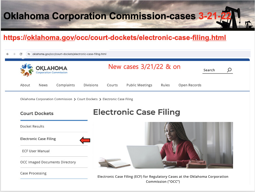
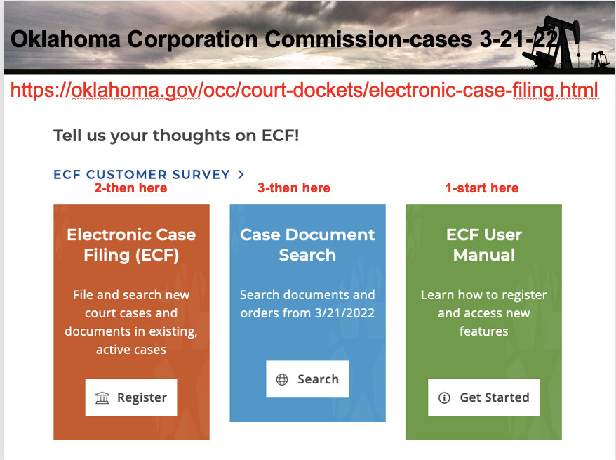
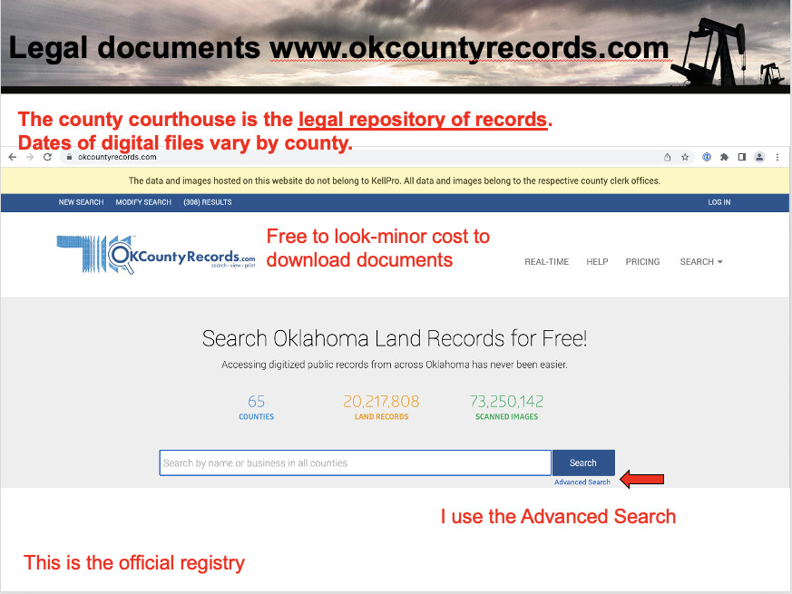
No problem. All of us started at ground zero and had to learn. Make sure that your name and address are properly filed in the county courthouse where your minerals are located. File title info such as probates, deeds, affidavits of heirship, etc. that describe the minerals. That is where the landmen go to find the mineral owners. That is how you will get sent the OCC documents that pertain to court cases.
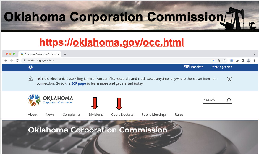
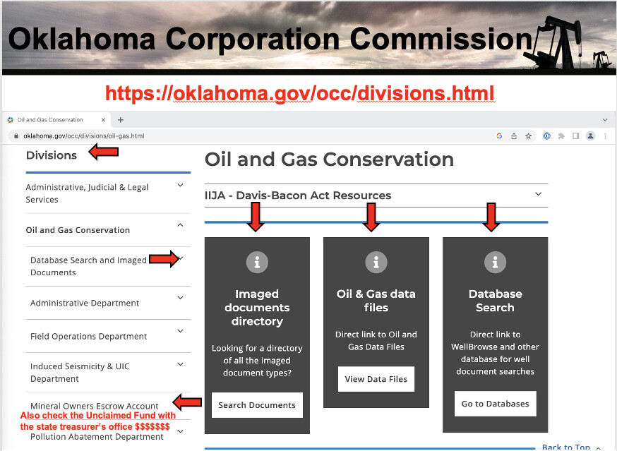
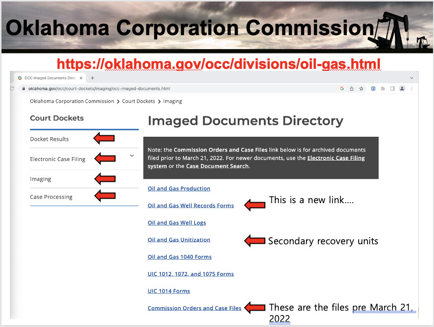
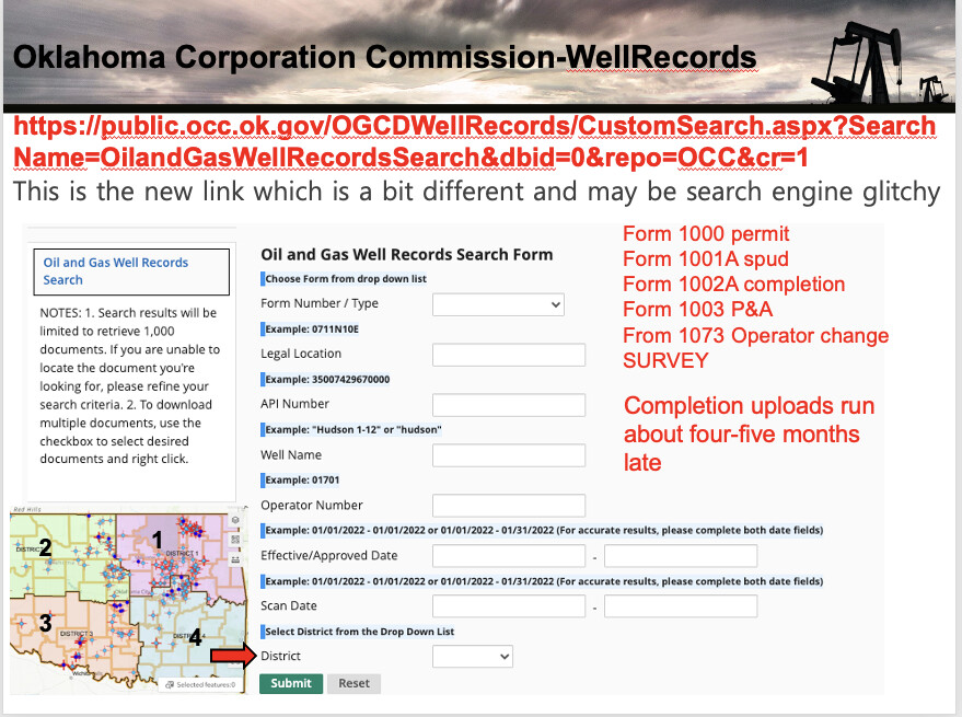
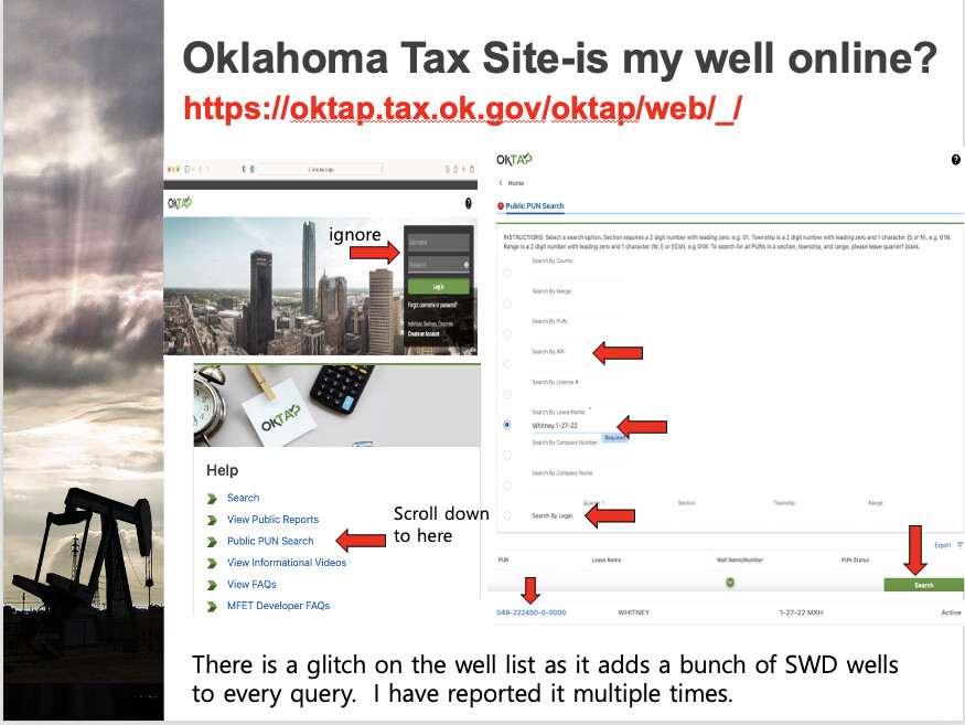
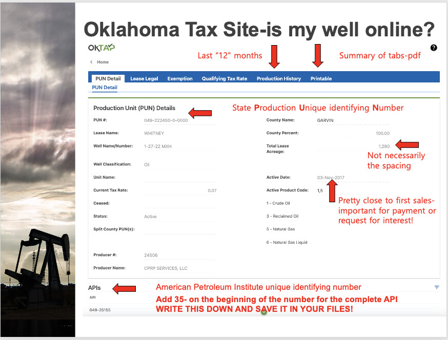
The perforations are listed on the Oklahoma Corporation completion documents. Get very familiar with the OCC website. You will also need to learn the OK tax site.
KKeith, based on the information you’ve shared, your company’s interest lies in Section 30-23N-12W. While the Newton 1-31H well (API #3508325107) has its surface location in the SW/4 of Section 30, all of its producing lateral perforations are located entirely within Section 31-23N-12W. In other words, although the well begins in Section 30, it turns and produces solely from Section 31.
Because your rights are in Section 30, you do not have a claim to production from the Newton 1-31H, as there is no production occurring within the section in which you own interest.
If you are a record title owner with a valid and current address on file, you should receive notice any time an application or spacing, pooling, or location exception order affects the section(s) in which you own rights. However, the recent orders for Sections 31 and 6 do not include or affect your tracts in Section 30, so you would not be entitled to notice in connection with those filings.
Hope this helps.