The family LLP has producing minerals in Carter County in Sections 6, 7 Township 3 South Range 2 East. But the individual leases are described as Lots, which seem to be 40 acre parcels (instead of NW/NE/NW nomenclature). Then there are different spacing designations. These may be within city limits of Ardmore.
I can’t resolve which wells participate in which parcels. Would appreciate any insight into this (maybe) outdated system.
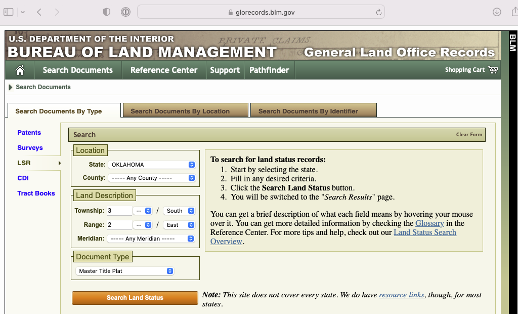
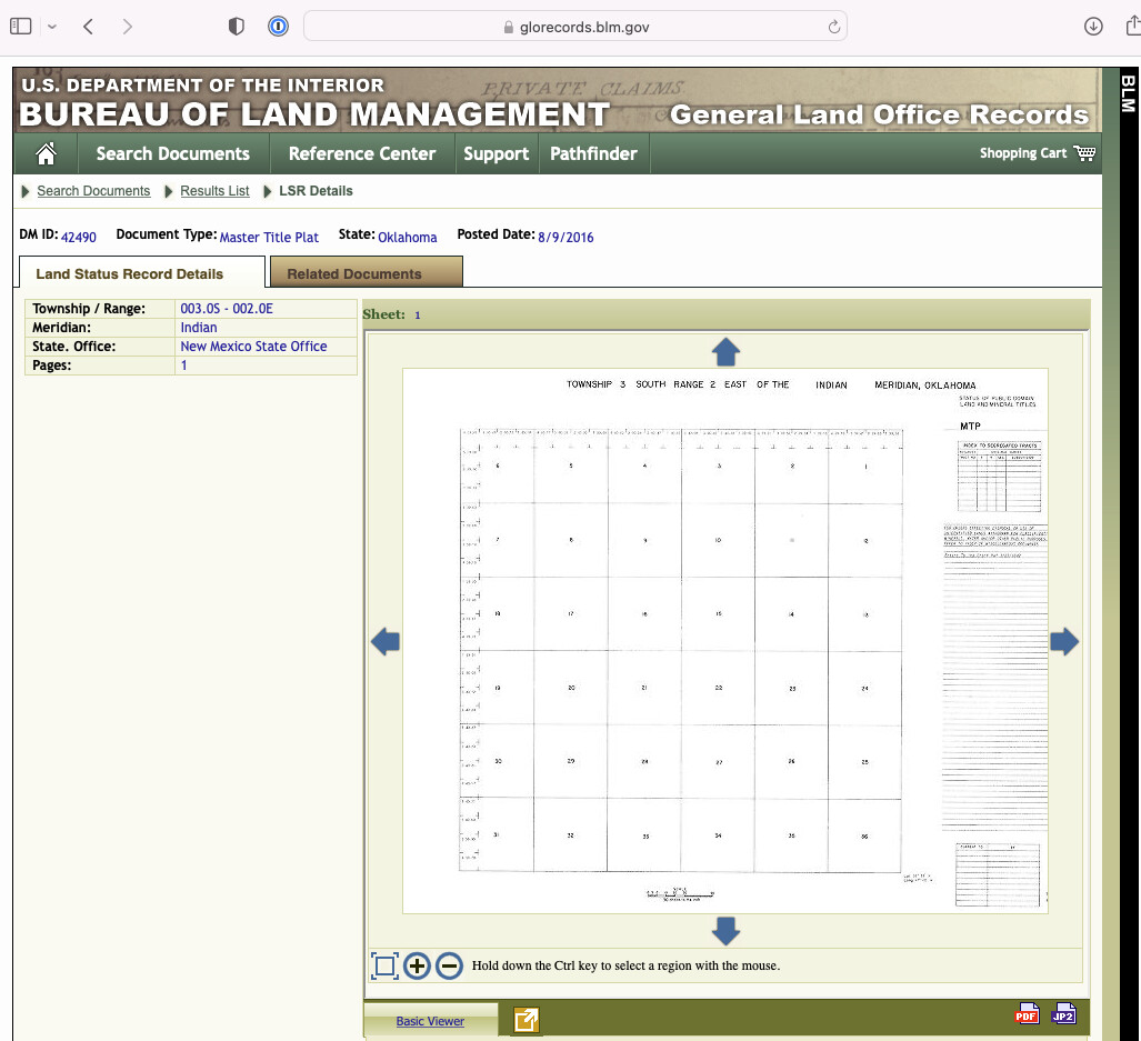
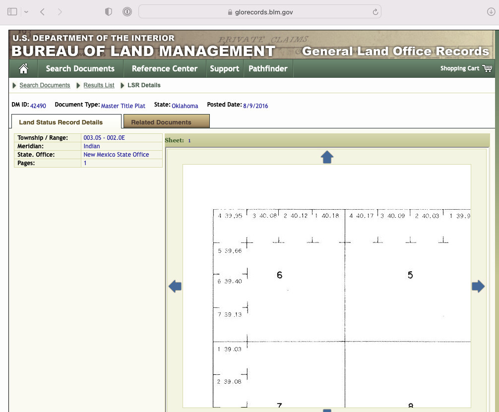
The lots are due to irregular tract sizes. When the land was surveyed, the northern tiers and western tiers of each section are corrected for the curvature of the earth. The quarter quarter sections are not exactly 40 acres each-they are call Lots instead. The Bureau of Land Managment has the original surveys. Here is how you figure out the exact gross acres of each of those lots. You probably have a proportion of them and not the full gross acres.
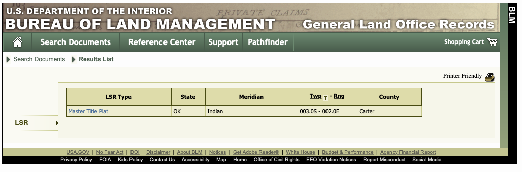
www.glorecords.glm.gov. Then Search Documents. Pick the LSR option and OK, then Master Title Plat and Search Land Status
Now you can find the wells.
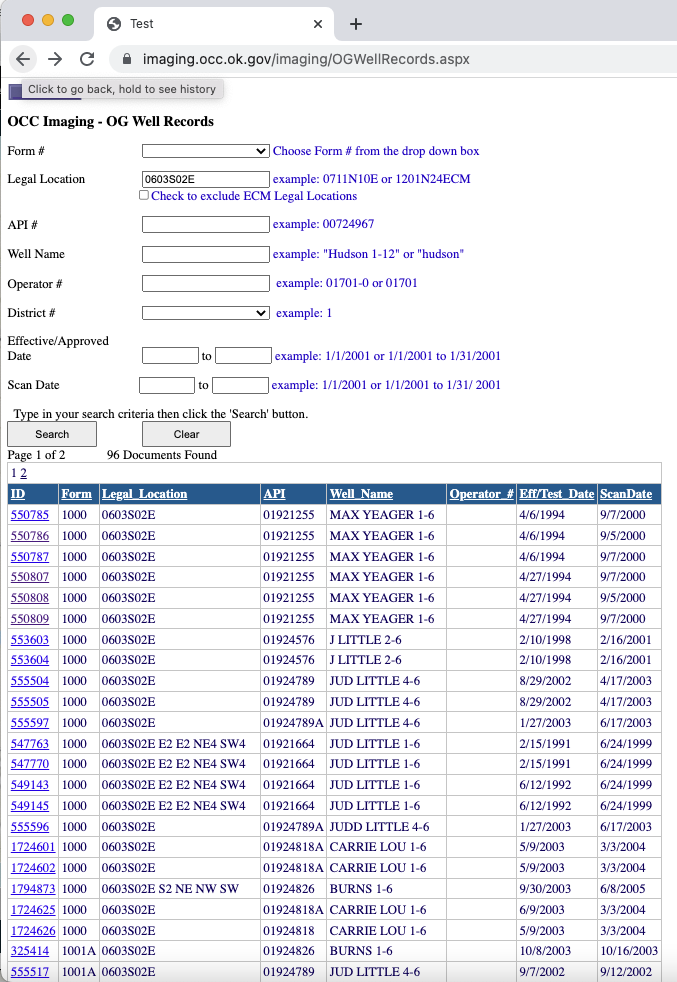
Go to the OCC wellrecords site. Form 1000 is the permit. You can search for the locations and spacings for each well. 1002A is the completion. Some of them have maps, so you can locate which wells are relevant for you.
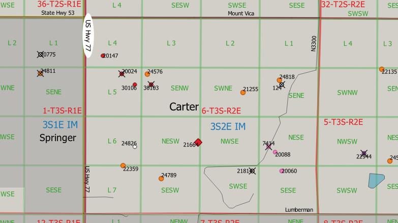
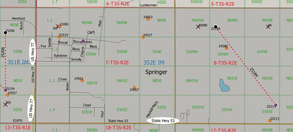
@M_Barnes gave a very thorough answer and here are a couple of maps showing the lots (L1, L2, etc.) and the well locations (dots with API number) for those two sections.
Section 6
This situation is further complicated as follows:
Lot 2 is 320-acre spaced.
Lots 3 and 4 have 160-acre and 640-acre spacing allocations.
And… Lot 4 has an additional 40-acre spaced unit.
I presume there are formation-specific details I have yet to understand.
Yes, the spacings are determined by depth and recovery drainages by product. Gas wells tend to be the larger spacings for the same equivalent depth. Even in the same tract you can have different spacings for a shallow oil well in one horizon with a gas well in a deeper horizon. The deeper the well, the larger the spacings (generally).