Back in April 2024, I posted that Key Exploration had been leasing acreage in the Ramon De La Garza Survey A-33 in Houston County. I continue to believe that Key has been leasing for Expand in Cherokee County, and I wondered if this Houston County leasing might also be for Expand.
At the time of my original post, I didn’t think to check for any deep vertical wells in the area that might be data sources for possible deep horizontal wells. However, I recently took a look.
It turns out that Chesapeake (now named Expand) permitted two vertical wells to a TVD of 22,000 feet in the De La Garza Survey: McFaddin 1 and McFaddin 2. McFaddin 2 was only drilled to 7,270 feet and was completed in the Woodbine Sands. However, McFaddin 1 was drilled to 17,340 feet, with log data available to 16,200 feet. I was told that the log data showed the well was in Bossier Sands at that depth. Maximus later acquired the wellbore and made a completion in the Woodbine Sands at 7,000 feet.
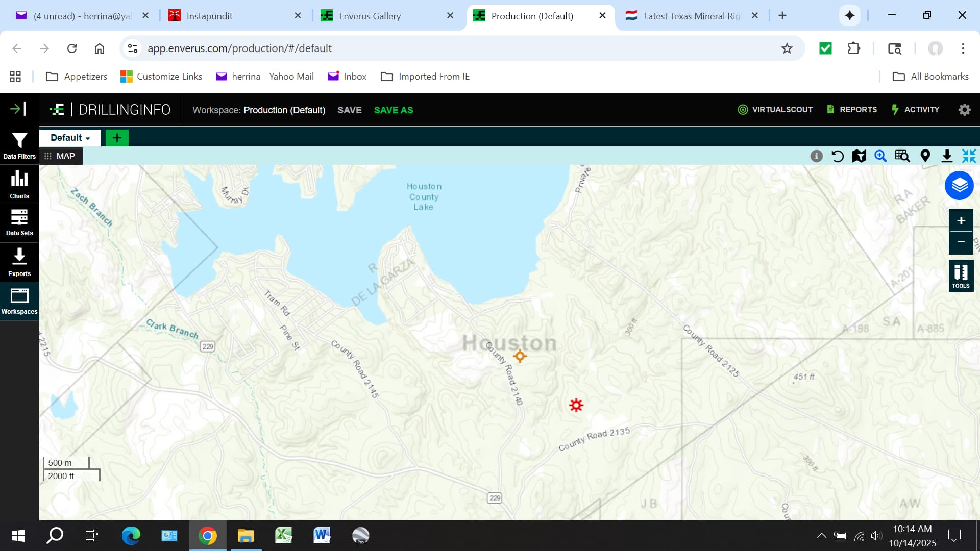
Here’s a screenshot showing the location of the two McFaddin wells. McFaddin 1 is the one just above County Road 2135.
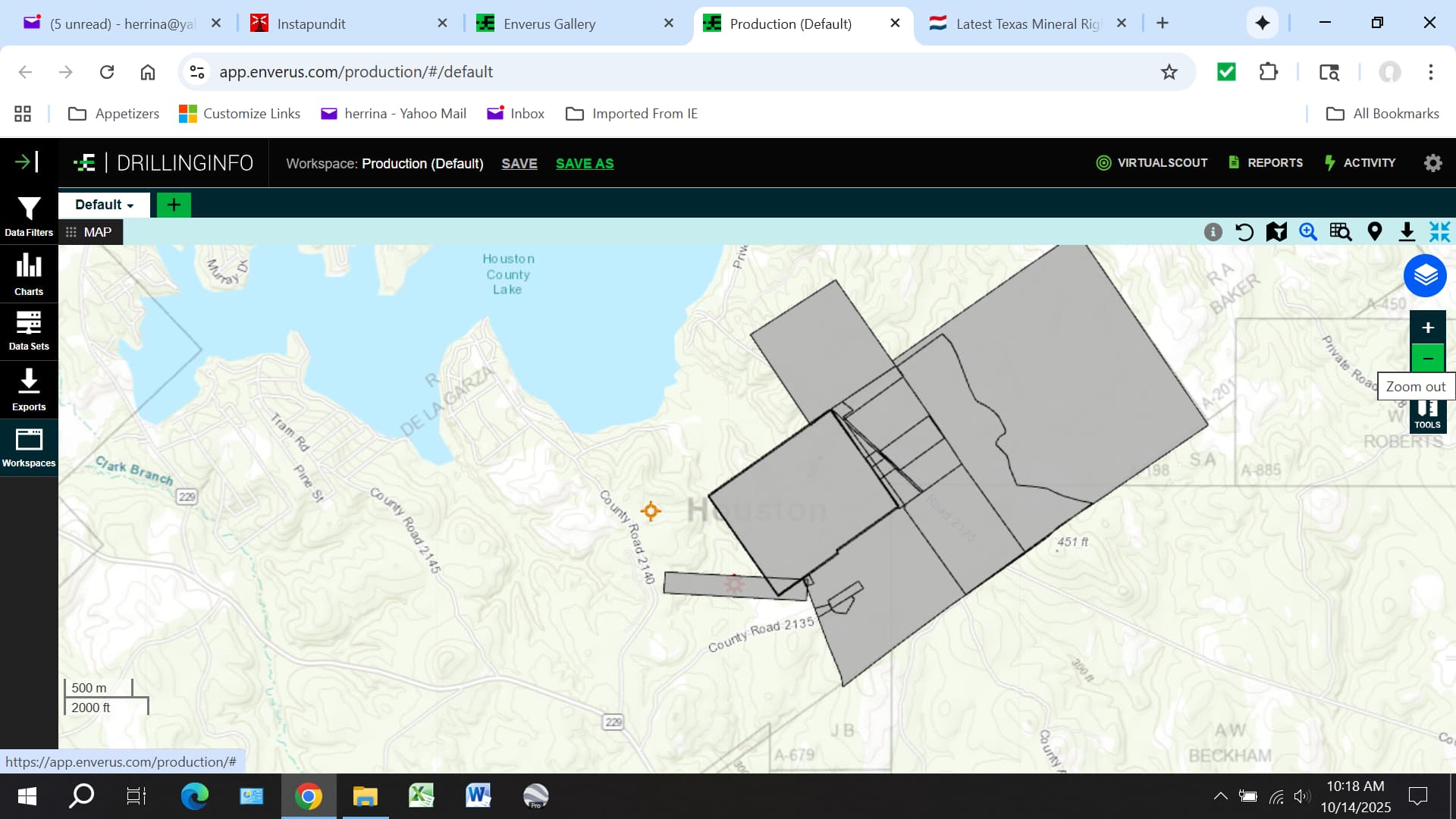
In this next screenshot, I’ve added Key Exploration’s lease area. As you can see, Key has leased what appears to be a ready-made horizontal well unit with the McFaddin 1 surface location right in the middle of it.
This suggests to me that the Key Exploration leasing is connected to Expand. Time will tell…