I inherited mineral rights and signed one 3-year lease 10 years ago. Never heard anything from the company at the end of the lease. How can I find more information about the physical location of my mineral rights and if there is any activity? Thank you.
We may be able to help you if you give the section, township and range.
Here is a map for the county with the township and ranges along the edges, you can see the sections if you zoom in a bit. It will help you get located.
Pottawatomie County Map.pdf (422.7 KB)
Hi Rocker, you can find well data at the Oklahoma Corporation Commission website OCC Well Data Finder
Alternatively, if you provide the Section, Township, and Range (available on your lease), I’m sure someone will get back with the activity.
Hello, thank you for the response. Trying to find any information on SW/4 NE/4 and N/2 NW/4 and SE/4 NW/4
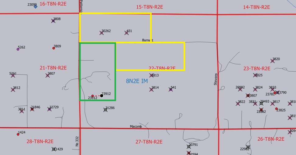
Section 22, Township 8N, Range 2E, I.M. Thank you.
Thank you, I will look there as well and posted location information above.
Rocker1969, attached a map of that section. There is one active well that appears to be just outside your areas. The other wells are plugged and abandoned.
This topic was automatically closed after 90 days. New replies are no longer allowed.