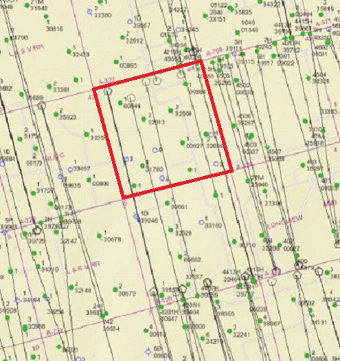
Below is the current Railroad Commission map of the area you described with Section 44 outlined in red. The RRC’s website is where to go for more details.
You didn’t mention if your wife has been receiving royalties. Considering the amount of production going on there it seems like she should be. It definitely doesn’t look like those parcels, depending on their size, would be worthless.
The Greathouse and Welch Leases you mentioned appear to be in the north half of Section 44 rather than the SW/4 you showed in the description. Endeavor Energy has been the operator of the Greathouse lease since 2000 and is still showing a little production from a well drilled there 30+ years ago.
The potentially bigger deal are four horizontal wells with laterals extending North-South from the north end of Section 44 through Section 5 that joins 44 on the south. They were drilled by Parsley Energy between 2015 and 2019 and are now operated by Pioneer Natural Resources who acquired Parsley in 2021.
“1/16 of 6/8 working interest in oil and gas lease, known as B.R. Greathouse, described as SW/4, Section 44, Block “C” L & S V Ry. Co. Survey, Reagan County, Texas”
The other one is:
“1/16 of 6/8 working interest in oil and gas lease, known as Welch Lease, described as SE/4 of Section 44, Block “C” L & S V Ry. Co. Survey, containing 160 acres, more or less, Reagan County, Texas.”
Looks like I had a typo, I wrote SW/4 where I should have written SE/4.
Greathouse is SW/4 and Welch is SE/4. Not that I know what any of this means.
Cakemeister, each section contains 640 +/- acres, so each quarter (4) section would have 160 acres +/-… it could be a few more acres or a few less acres.
You originally said your wife inherited “mineral rights” but that later description refers to working interests. That changes things. Unlike a mineral interest that she would still own unless she had sold or otherwise transferred title, a working interest would only last as long as the mineral leases the working interest held were still valid.
If you’ve had no communication with the operator of those units it’s possible your wife’s working interest didn’t participate in some past cash calls (went non-consent) and the other working interest owners absorbed her interest.
It looks like the only well related to those original working interests that may still be producing is called the Welch (Union) #2 that was drilled by Cass Oil in 1983 and is in the SE/4 of Section 44. Later two other companies were shown as the operator of that well before 2000 when it was taken over by Endeavor Energy who is the current operator. If you want to try contacting Endeavor, their Owner Relations Dept is at
I just sold what I had left of my mineral rights in Reagan County to Endeavor. So they could be interested depending on where they are in relation to where they are drilling I suppose.
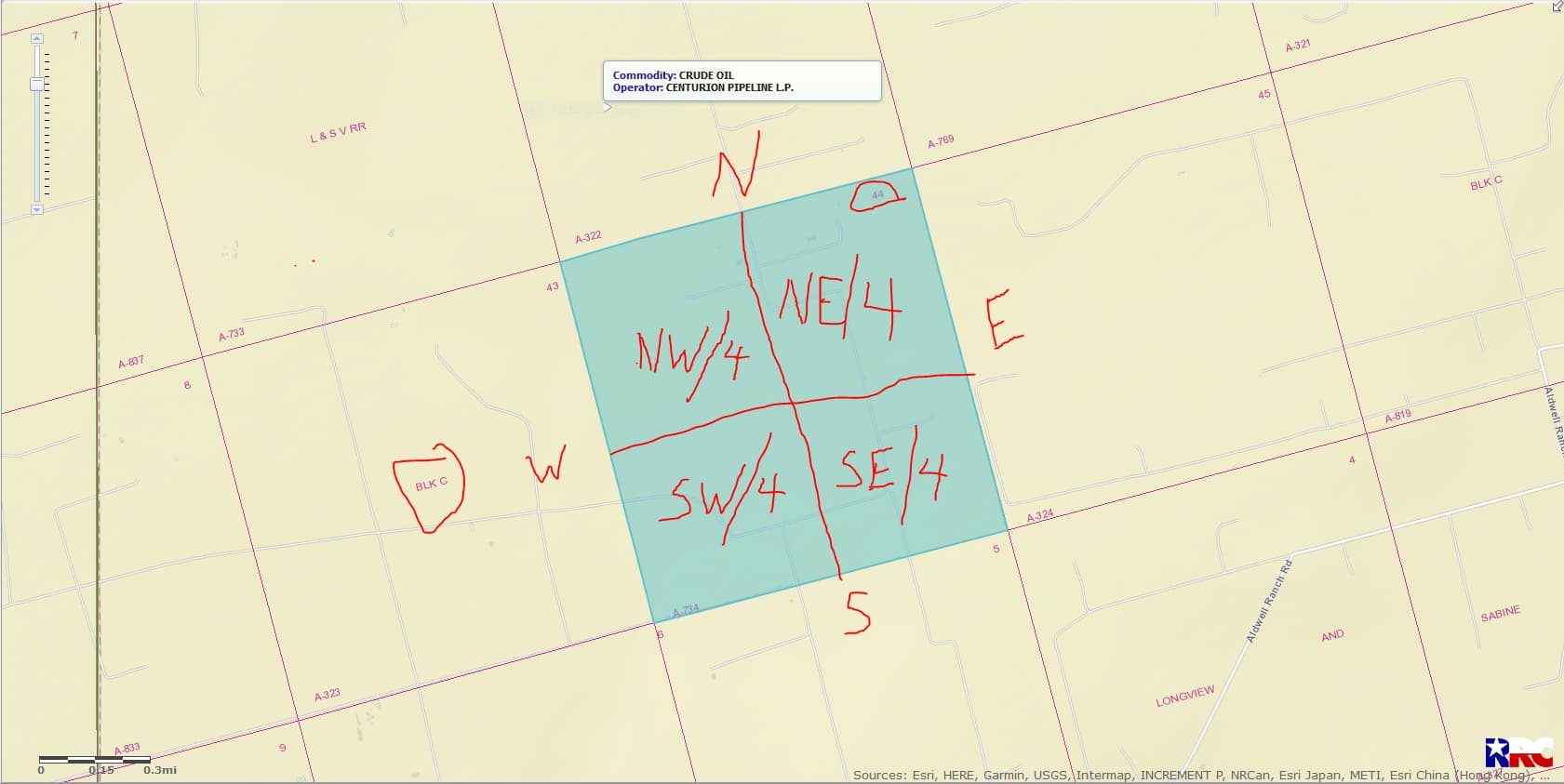
Thank you for the information. I looked up that section on the Texas Railroad Commission Public GIS Viewer, and I got something like this:
[image]
I don’t understand the pentagons on the north side of Section 44, or the lines connecting them. Is that “four horizontal wells with laterals extending North-South from the north end of Section 44 through Section 5 that joins 44 on the south” that you mentioned?
There is one well I see that looks like it is in the southeast quarter of Section 44, and that is a well with API 38332606.
How do I tell if that well is indeed in the Welch lease, and if it is producing?