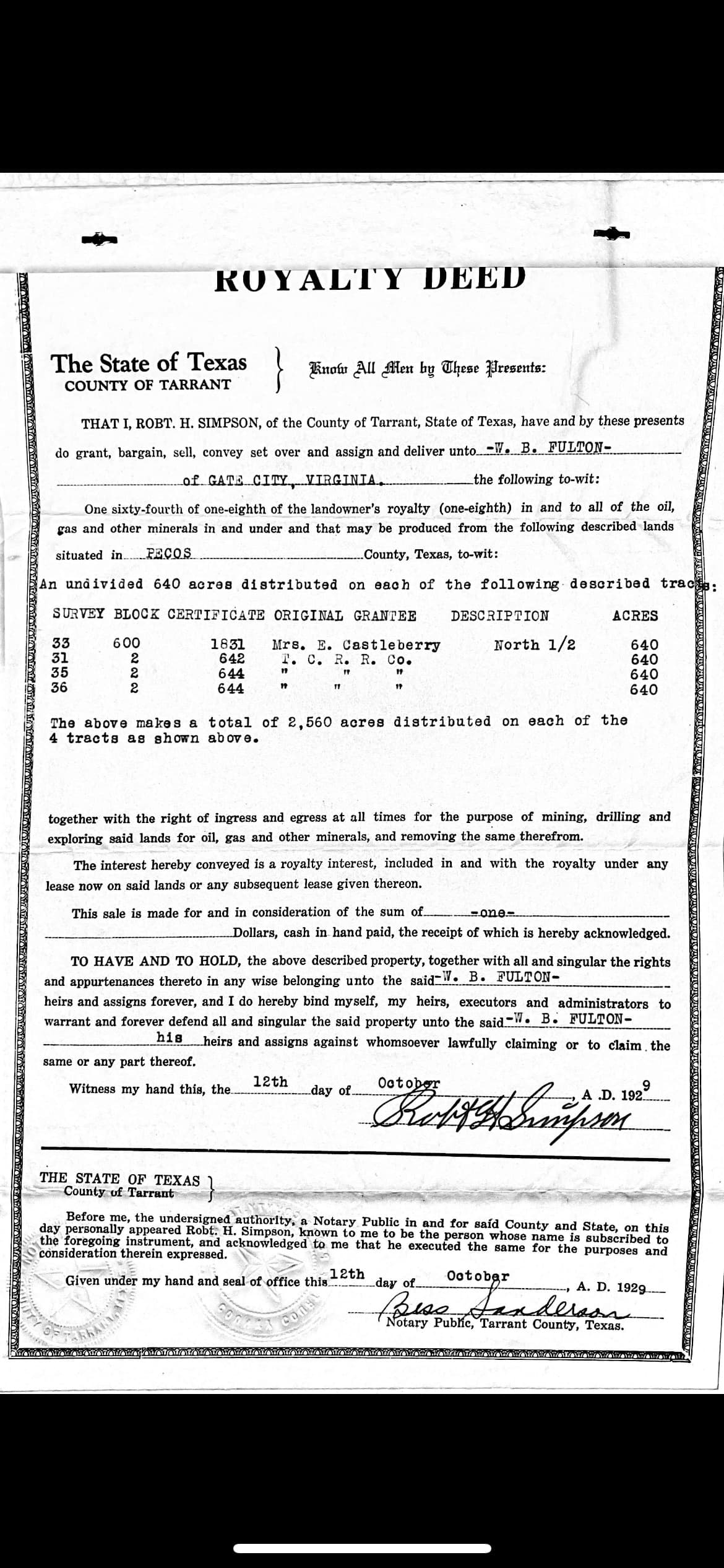
I have a deed that says Pecos County:
SURV 33, BLOCK 600, CERTIFICATE 1831, N 1/2; AND
SURV 31, BLOCK 2, CERT 642; AND
SURV 35, BLOCK 2 CERT 644; AND
SURVEY 36, BLOCK 2, CERT 644.
I’m trying to find this using the RRC mapping but the “Search” isn’t helping me. I’m not very familiar at all with Texas survey descriptions. I thought it was County, Abstract if it had one. Otherwise County, Section, Block, Range. Clearly, I don’t know what I’m doing! But I’m trying and learning more every day!!
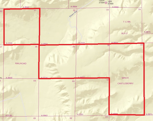
It looks like what the deed description called “SURV” were actually Section numbers. Outlined in red below is what RRC shows as the location of those Sections of Block 600 & Block 2. Since they join I’m guessing that’s the location the deed is describing.
With the abstract numbers shown on those Sections you can pull the area up on RRC’s map. Apparently there were several different types of land certificates issued by Mexico and the State of Texas.