I’m trying to find out if there’s been any activity on 14, 23 + 24 Township 20 South, Range 31 East, Eddy County. Also trying to find out where can I locate a grid map of the section.
In terms of a map, the EMNRD GIS map is not terrible. Just make sure you turn on the Public Land Survey System layer. I assume the link below will work. Otherwise just google NMOCD ArcGIS.
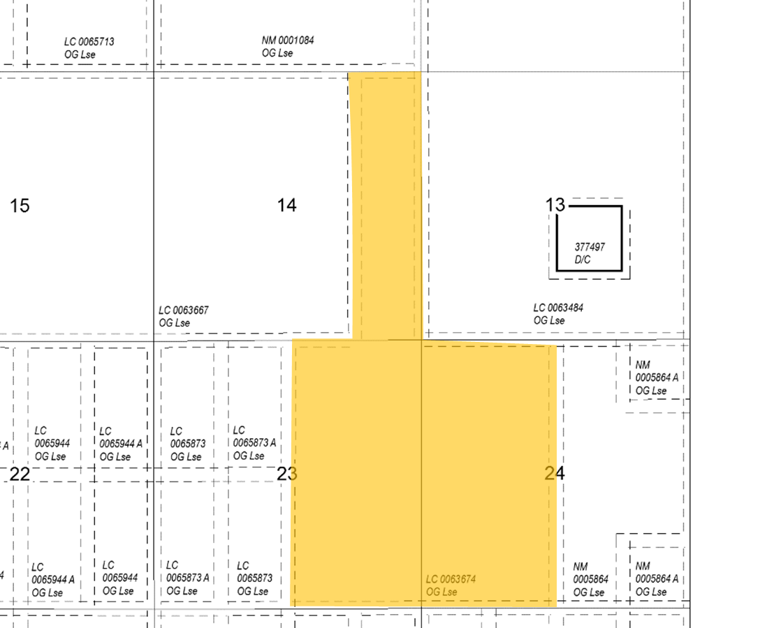
Assume you own an ORRI in NMLC-0063674 shown below in yellow. If it’s not that lease, then you probably have issues as that lease is 70 years old.
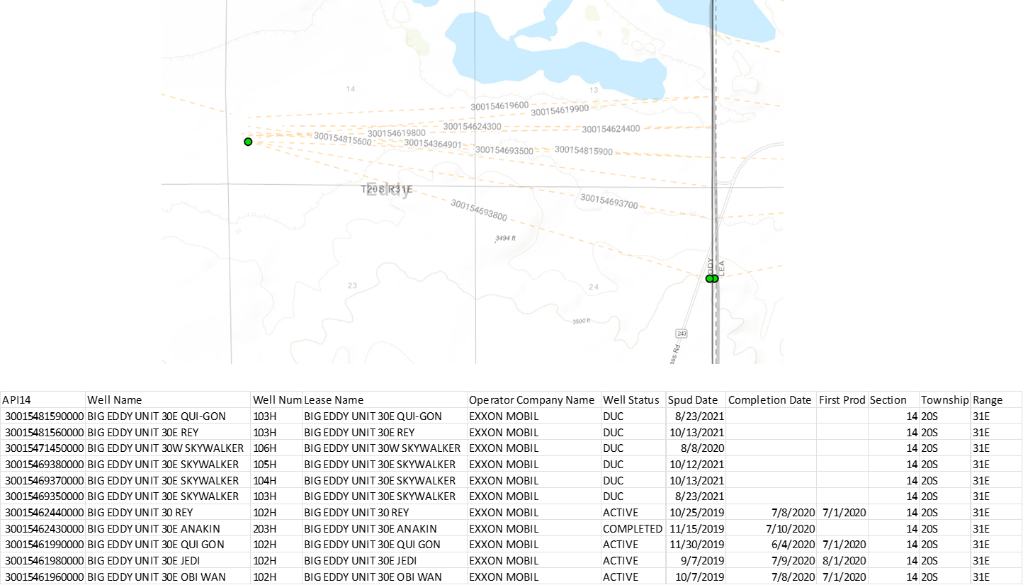
ExxonMobil/XTO has drilled it looks like 11 wells in that tract with four online and seven others awaiting production. Something like that. These wells below according to DrillingInfo.
This topic was automatically closed after 90 days. New replies are no longer allowed.