Howard county deed lookup

Hello, wondering if someone can help me out with understanding a deed/location. And how exactly you find this?

What can you tell me about: NE/4 of Section 9, Block 34, Township 1 South, T&P RR Co. Survey, A-1521.

and SE/4 of Section 2, Block 32, T-2-N

Thank you!

looks to me like permitted wells crossing that abstract with origination on other tracts.

Iofar, I also have interests in those two tracts. If I am correct, NE/4 of Section 9, Block 34, Township 1 South, should contain Bosque #6 well.
Are you a descendant of George Long?
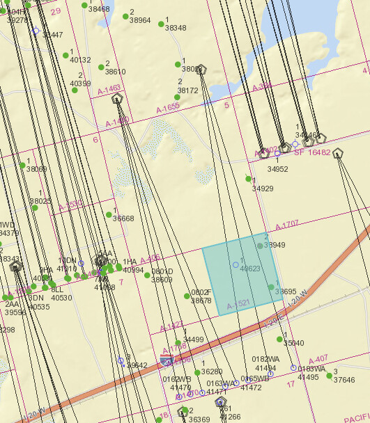
Hi lofar, the usual link to find these locations is: https://gis.rrc.texas.gov/GISViewer/

A-1521 is actually section 8 of Block 34 T1S, but as noted it is traversed by some recently permitted wells. This location is about 7 miles west of Big Lake, TX just north of I-20.

Section 2 Block 32, T2N is A-1734 and is also crossed by some recently permitted wells and some existing wells. Intersection of County Rd 48 and County Rd 33 is the SE corner of this section.

Another useful link is the Texas GLO land viewer https://gisweb.glo.texas.gov/glomapjs/index.html

This topic was automatically closed after 90 days. New replies are no longer allowed.