The legal description is:
160.00 acres Southwest Quarter (SW/4) of Section 145, Block 13, H&GN RR Survey, Abstract 283, Reeves County, Texas
The legal description is:
160.00 acres Southwest Quarter (SW/4) of Section 145, Block 13, H&GN RR Survey, Abstract 283, Reeves County, Texas
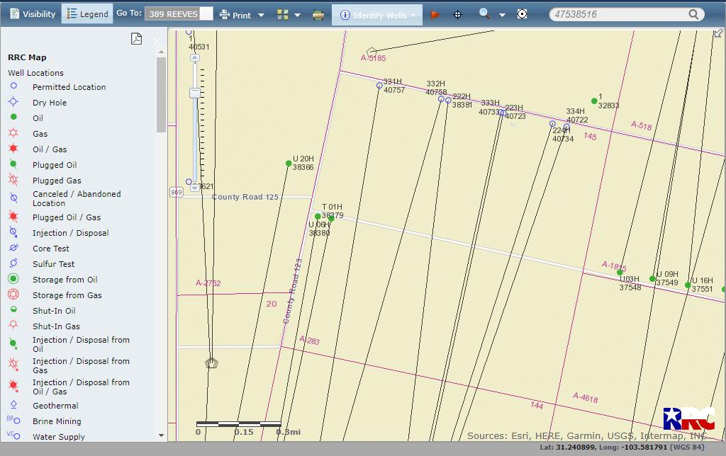
@Iacubus, the best place to look is usually the RRC Public GIS viewer, https://gis.rrc.texas.gov/gisviewer/ View of Reeves A-283 below shows several newly permitted wells.
This topic was automatically closed after 90 days. New replies are no longer allowed.