Hello,
How would I obtain a map of horizontal well permits and/or production numbers for the plots surrounding mine?
Do I need to pay a subscription service?
Hello,
How would I obtain a map of horizontal well permits and/or production numbers for the plots surrounding mine?
Do I need to pay a subscription service?
Further, is there a way to project yearly production for a given number of horizontal wells?
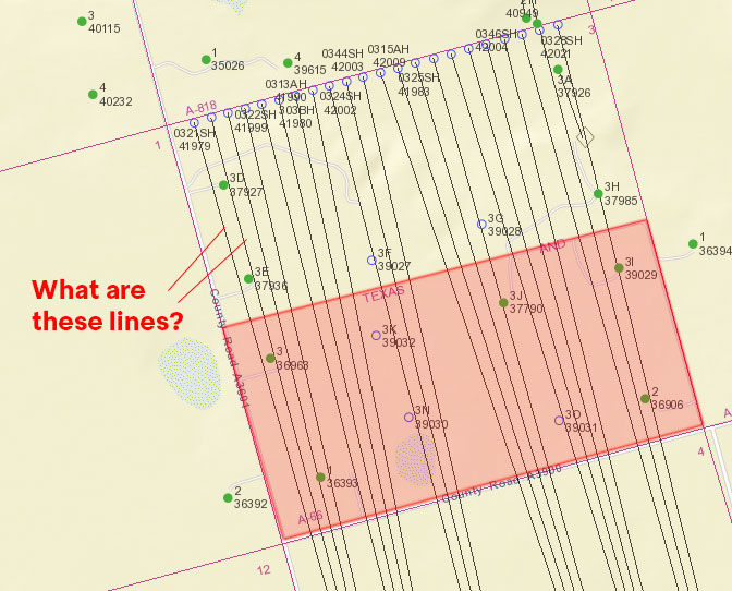
So I’ve discovered http://wwwgisp.rrc.texas.gov/GISViewer2/ and I have located my area.
I own rights in the area marked in red. However, the area just north of mine has about twenty permits for horizontal wells. Why are there lines running under my property, originating from their permit points?
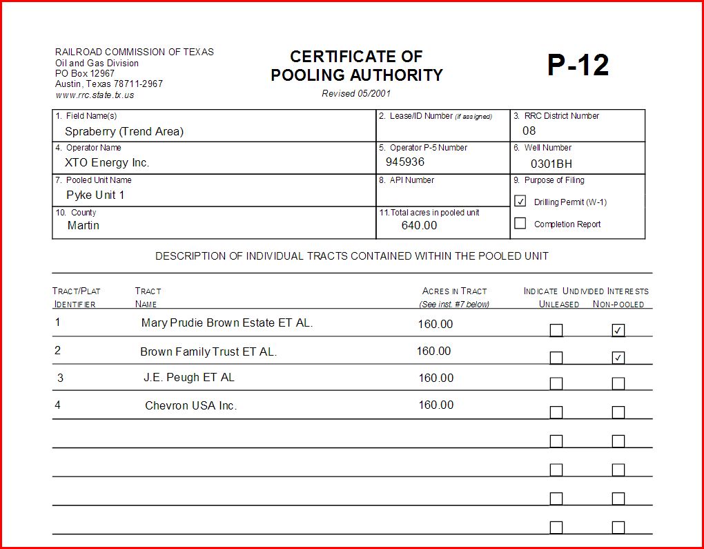
Those lines are the horizontal leg/lateral of horizontal wells. On the pooling authority (P12) are the names of Mary Prudice Brown Estate, Brown Family Trust, J. E. Peush, and Chevron USA. Do any of these names make sense to you? This info is at the bottom of one of the approved drilling permits.
Are you sure you own the minerals or do you just own the surface of this 160 acres?
DOUBLE LEFT CLICK ON DOCUMENT TO ENLARGE
Extremely helpful, thank you!
Yes, one of the tract names matches the name of our lease. I guess this means we are included in this. I will call the operator tomorrow.
Would we receive royalties from these wells, perhaps proportional to the length of the portion of the leg that traverses our mineral property area?
Yes, you should.
Clint